Grude elevation
Grude (Federation of B&H), Bosnia and Herzegovina elevation is 277 meters and Grude elevation in feet is 909 ft above sea level [src 1]. Grude is a seat of a third-order administrative division (feature code) with elevation that is 86 meters (282 ft) smaller than average city elevation in Bosnia and Herzegovina.
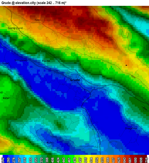
Below is the Elevation map of Grude, which displays elevation range with different colors. Scale of the first map is from 242 to 716 m (794 to 2349 ft) with average elevation of 407.3 meters (=1336 ft) [note 1]
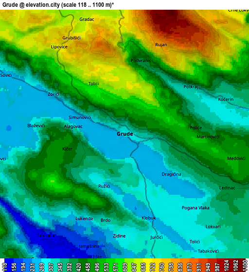
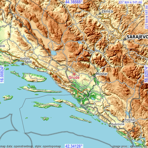
These maps also provides idea of topography and contour of this city, they are displayed at different zoom levels. More info about maps, scale and edge coordinates you can find below images.
| \ | Map #1 | Map #2 | Topo.Map |
| Scale [m] | 242..716 m | 118..1100 m | × |
| Scale [ft] | 794..2349 ft | 387..3609 ft | × |
| Average | 407.3 m = 1336 ft | 445.8 m = 1463 ft | × |
| Width | 7.1 km = 4.4 mi | 14.21 km = 8.8 mi | 227.3 km = 141.2 mi |
| Height | 7.1 km = 4.4 mi | 14.21 km = 8.8 mi | 227.3 km = 141.2 mi |
| ↑Max Latitude | 43.404016° | 43.435935° | 44.38568° |
| Latitude at center | 43.37208° | 43.37208° | 43.37208° |
| ↓Min Latitude | 43.340127° | 43.308158° | 42.34126° |
| ← Min Longitude | 17.370545° | 17.326599° | 16.00824° |
| Longitude center | 17.41449° | 17.41449° | 17.41449° |
| →Max Longitude | 17.458435° | 17.502381° | 18.82074° |
Nearby cities:
Cities around Grude sort by population:
• Ljubuški elevation 95 m
22.2 km,  151°
151°
• Široki Brijeg 281 m
14.6 km,  85°
85°
• Čitluk 225 m
28.1 km,  124°
124°
• Vitina 84 m
16 km,  159°
159°
• Radišići 182 m
19.5 km, 148°
• Cim 142 m
29.7 km, 93°
• Drežnica 841 m
20.5 km,  328°
328°
• Drinovci 308 m
7.5 km,  254°
254°
• Ilići 98 m
28.7 km,  95°
95°
• Kočerin 322 m
6.1 km,  70°
70°
• Gorica 274 m
11.7 km,  296°
296°
• Posušje 667 m
13.3 km, 327°
Multilingual:
 En español:
Grude elevación 277 m.
 En France:
Grude élévation 277 m.


Sources and notes:
- [note 1] Map square and city borders are not equal. Map elevation data is calculated only from area inside that square.
- [src 1] Elevation data from geonames database provided with same terms of usage.
- [src 2] The elevation map of Grude is generated using elevation data from NASA's 3 arcsec (90m) resolution SRTM data.
- [src 3] Base (background) map © OpenStreetMap contributors tiles are generated by Geofabrik and OpenTopoMap.
Copyright & License:
This Grude Elevation Map is licensed under CC BY-SA. You may reuse any part from this page, if you give a proper credit by linking to this URL:
 More info on terms of use page.