Janja elevation
Janja (Srpska), Bosnia and Herzegovina elevation is 105 meters and Janja elevation in feet is 344 ft above sea level [src 1]. Janja is a populated place (feature code) with elevation that is 258 meters (846 ft) smaller than average city elevation in Bosnia and Herzegovina.
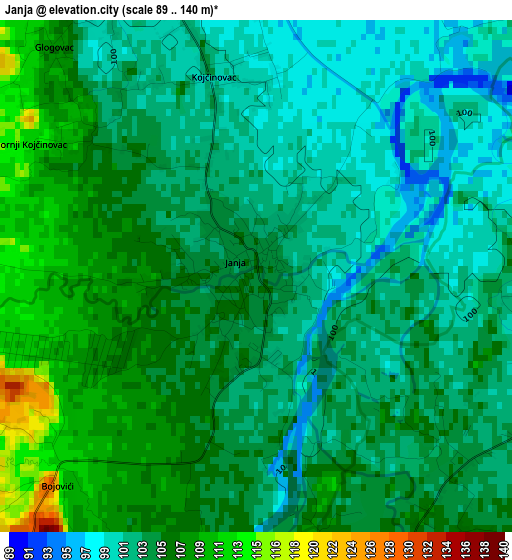
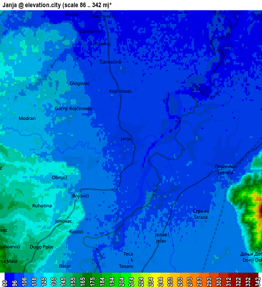
Below is the Elevation map of Janja, which displays elevation range with different colors. Scale of the first map is from 89 to 140 m (292 to 459 ft) with average elevation of 103.7 meters (=340 ft) [note 1]
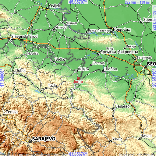
These maps also provides idea of topography and contour of this city, they are displayed at different zoom levels. More info about maps, scale and edge coordinates you can find below images.
| \ | Map #1 | Map #2 | Topo.Map |
| Scale [m] | 89..140 m | 86..342 m | × |
| Scale [ft] | 292..459 ft | 282..1122 ft | × |
| Average | 103.7 m = 340 ft | 110.7 m = 363 ft | × |
| Width | 6.95 km = 4.3 mi | 13.9 km = 8.6 mi | 222.4 km = 138.2 mi |
| Height | 6.95 km = 4.3 mi | 13.9 km = 8.6 mi | 222.4 km = 138.2 mi |
| ↑Max Latitude | 44.696786° | 44.728016° | 45.65707° |
| Latitude at center | 44.66554° | 44.66554° | 44.66554° |
| ↓Min Latitude | 44.634277° | 44.602997° | 43.65676° |
| ← Min Longitude | 19.202965° | 19.159019° | 17.84066° |
| Longitude center | 19.24691° | 19.24691° | 19.24691° |
| →Max Longitude | 19.290855° | 19.334801° | 20.65316° |
Nearby cities:
Cities around Janja sort by population:
• Bijeljina elevation 91 m
10.7 km,  346°
346°
• Zvornik 163 m
33.1 km,  200°
200°
• Velika Obarska 84 m
16.9 km,  336°
336°
• Priboj 251 m
25.9 km,  254°
254°
• Lopare 231 m
32.1 km,  263°
263°
• Ugljevik 299 m
17.9 km,  269°
269°
• Petkovci 257 m
25.8 km,  211°
211°
• Dvorovi 85 m
15.8 km,  3°
3°
• Balatun 81 m
23.2 km,  18°
18°
• Popovi 91 m
11.5 km, 15°
• Sapna 288 m
26.7 km,  227°
227°
• Teočak 459 m
22.3 km, 251°
Multilingual:
 En español:
Janja elevación 105 m.
 En France:
Janja élévation 105 m.


Sources and notes:
- [note 1] Map square and city borders are not equal. Map elevation data is calculated only from area inside that square.
- [src 1] Elevation data from geonames database provided with same terms of usage.
- [src 2] The elevation map of Janja is generated using elevation data from NASA's 3 arcsec (90m) resolution SRTM data.
- [src 3] Base (background) map © OpenStreetMap contributors tiles are generated by Geofabrik and OpenTopoMap.
Copyright & License:
This Janja Elevation Map is licensed under CC BY-SA. You may reuse any part from this page, if you give a proper credit by linking to this URL:
 More info on terms of use page.