Killarney Vale elevation
Killarney Vale (New South Wales, Central Coast), Australia elevation is 23 meters and Killarney Vale elevation in feet is 75 ft above sea level [src 1]. Killarney Vale is a section of populated place (feature code) with elevation that is 90 meters (295 ft) smaller than average city elevation in Australia.
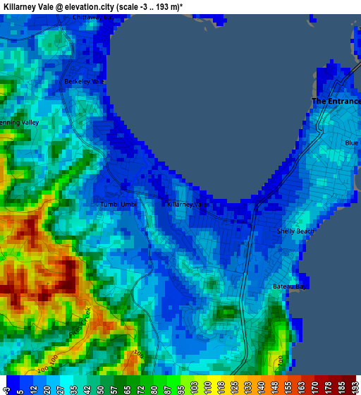
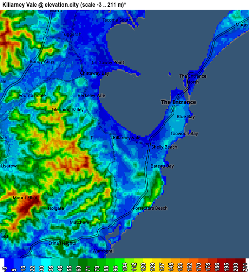
Below is the Elevation map of Killarney Vale, which displays elevation range with different colors. Scale of the first map is from -3 to 193 m (-10 to 633 ft) with average elevation of 42.2 meters (=138 ft) [note 1]
These maps also provides idea of topography and contour of this city, they are displayed at different zoom levels. More info about maps, scale and edge coordinates you can find below images.
| \ | Map #1 | Map #2 | Topo.Map |
| Scale [m] | -3..193 m | -3..211 m | × |
| Scale [ft] | -10..633 ft | -10..692 ft | × |
| Average | 42.2 m = 138 ft | 47.7 m = 156 ft | × |
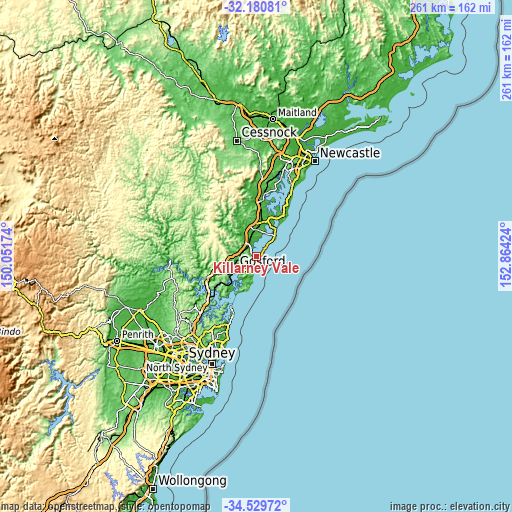
| Width | 8.16 km = 5.1 mi | 16.32 km = 10.1 mi | 261.2 km = 162.3 mi |
| Height | 8.16 km = 5.1 mi | 16.32 km = 10.1 mi | 261.2 km = 162.3 mi |
| ↑Max Latitude | -33.326479° | -33.289753° | -32.18081° |
| Latitude at center | -33.36319° | -33.36319° | -33.36319° |
| ↓Min Latitude | -33.399885° | -33.436565° | -34.52972° |
| ← Min Longitude | 151.414045° | 151.370099° | 150.05174° |
| Longitude center | 151.45799° | 151.45799° | 151.45799° |
| →Max Longitude | 151.501935° | 151.545881° | 152.86424° |
Nearby cities:
Cities around Killarney Vale sort by population:
• Bateau Bay elevation 35 m
2.4 km,  160°
160°
• Berkeley Vale 39 m
2.7 km,  302°
302°
• Long Jetty 1 m
2.9 km,  80°
80°
• Wamberal 45 m
5.9 km,  191°
191°
• Tumbi Vmbi 33 m
0.8 km,  242°
242°
• The Entrance 4 m
4.6 km,  53°
53°
• Forresters Beach 49 m
5.2 km, 161°
• Chittaway Bay 6 m
4.7 km,  326°
326°
• Glenning Valley 36 m
3.1 km,  289°
289°
• The Entrance North 2 m
5.2 km, 54°
• Shelly Beach 28 m
2.6 km,  106°
106°
• Blue Bay 18 m
4.1 km, 75°
Multilingual:
 En español:
Killarney Vale elevación 23 m.
 En France:
Killarney Vale élévation 23 m.
 Auf Deutsch:
Killarney Vale höhe über dem Meeresspiegel ist 23 m.

Sources and notes:
- [note 1] Map square and city borders are not equal. Map elevation data is calculated only from area inside that square.
- [src 1] Elevation data from geonames database provided with same terms of usage.
- [src 2] The elevation map of Killarney Vale is generated using elevation data from NASA's 3 arcsec (90m) resolution SRTM data.
- [src 3] Base (background) map © OpenStreetMap contributors tiles are generated by Geofabrik and OpenTopoMap.
Copyright & License:
This Killarney Vale Elevation Map is licensed under CC BY-SA. You may reuse any part from this page, if you give a proper credit by linking to this URL:
 More info on terms of use page.