Werrington County elevation
Werrington County (New South Wales, Penrith Municipality), Australia elevation is 42 meters and Werrington County elevation in feet is 138 ft above sea level [src 1]. Werrington County is a section of populated place (feature code) with elevation that is 71 meters (233 ft) smaller than average city elevation in Australia.
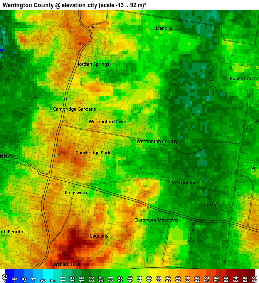
Below is the Elevation map of Werrington County, which displays elevation range with different colors. Scale of the first map is from -13 to 92 m (-43 to 302 ft) with average elevation of 40 meters (=131 ft) [note 1]
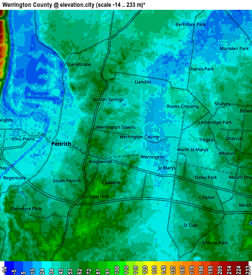
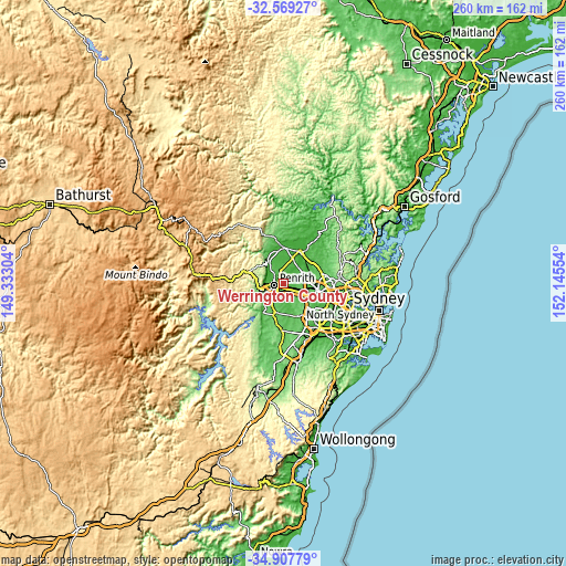
These maps also provides idea of topography and contour of this city, they are displayed at different zoom levels. More info about maps, scale and edge coordinates you can find below images.
| \ | Map #1 | Map #2 | Topo.Map |
| Scale [m] | -13..92 m | -14..233 m | × |
| Scale [ft] | -43..302 ft | -46..764 ft | × |
| Average | 40 m = 131 ft | 41.5 m = 136 ft | × |
| Width | 8.13 km = 5.1 mi | 16.25 km = 10.1 mi | 260 km = 161.6 mi |
| Height | 8.13 km = 5.1 mi | 16.25 km = 10.1 mi | 260 km = 161.6 mi |
| ↑Max Latitude | -33.709952° | -33.673388° | -32.56927° |
| Latitude at center | -33.7465° | -33.7465° | -33.7465° |
| ↓Min Latitude | -33.783033° | -33.81955° | -34.90779° |
| ← Min Longitude | 150.695345° | 150.651399° | 149.33304° |
| Longitude center | 150.73929° | 150.73929° | 150.73929° |
| →Max Longitude | 150.783235° | 150.827181° | 152.14554° |
Nearby cities:
Cities around Werrington County sort by population:
• Penrith elevation 31 m
3.7 km,  263°
263°
• Kingswood Park 54 m
3.2 km,  225°
225°
• Cambridge Park 55 m
1.6 km, 264°
• Jordan Springs 45 m
3 km,  340°
340°
• Claremont Meadows 42 m
3.5 km,  160°
160°
• Werrington 32 m
1.9 km,  138°
138°
• North St Marys 35 m
4.3 km,  102°
102°
• Werrington Downs 52 m
1.2 km,  294°
294°
• Cambridge Gardens 52 m
2 km,  298°
298°
• Orchard Hills 73 m
4.8 km,  213°
213°
• Llandilo 32 m
3.8 km,  10°
10°
• Caddens 50 m
3.1 km,  176°
176°
Multilingual:
 En español:
Werrington County elevación 42 m.
 En France:
Werrington County élévation 42 m.
 Auf Deutsch:
Werrington County höhe über dem Meeresspiegel ist 42 m.

Sources and notes:
- [note 1] Map square and city borders are not equal. Map elevation data is calculated only from area inside that square.
- [src 1] Elevation data from geonames database provided with same terms of usage.
- [src 2] The elevation map of Werrington County is generated using elevation data from NASA's 3 arcsec (90m) resolution SRTM data.
- [src 3] Base (background) map © OpenStreetMap contributors tiles are generated by Geofabrik and OpenTopoMap.
Copyright & License:
This Werrington County Elevation Map is licensed under CC BY-SA. You may reuse any part from this page, if you give a proper credit by linking to this URL:
 More info on terms of use page.