Picnic Point elevation
Picnic Point (New South Wales, Canterbury-Bankstown), Australia elevation is 7 meters and Picnic Point elevation in feet is 23 ft above sea level [src 1]. Picnic Point is a section of populated place (feature code) with elevation that is 106 meters (348 ft) smaller than average city elevation in Australia.
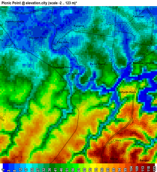
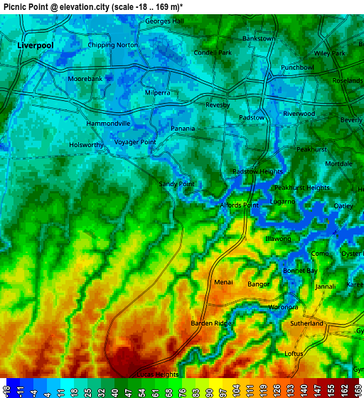
Below is the Elevation map of Picnic Point, which displays elevation range with different colors. Scale of the first map is from -2 to 123 m (-7 to 404 ft) with average elevation of 43.9 meters (=144 ft) [note 1]
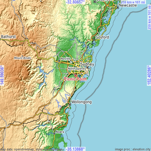
These maps also provides idea of topography and contour of this city, they are displayed at different zoom levels. More info about maps, scale and edge coordinates you can find below images.
| \ | Map #1 | Map #2 | Topo.Map |
| Scale [m] | -2..123 m | -18..169 m | × |
| Scale [ft] | -7..404 ft | -59..554 ft | × |
| Average | 43.9 m = 144 ft | 51 m = 167 ft | × |
| Width | 8.1 km = 5 mi | 16.21 km = 10.1 mi | 259.3 km = 161.1 mi |
| Height | 8.1 km = 5 mi | 16.21 km = 10.1 mi | 259.3 km = 161.1 mi |
| ↑Max Latitude | -33.944172° | -33.907708° | -32.80657° |
| Latitude at center | -33.98062° | -33.98062° | -33.98062° |
| ↓Min Latitude | -34.017053° | -34.05347° | -35.13868° |
| ← Min Longitude | 150.952665° | 150.908719° | 149.59036° |
| Longitude center | 150.99661° | 150.99661° | 150.99661° |
| →Max Longitude | 151.040555° | 151.084501° | 152.40286° |
Nearby cities:
Cities around Picnic Point sort by population:
• Revesby elevation 12 m
3.9 km,  28°
28°
• Padstow 23 m
4.2 km,  50°
50°
• Panania 17 m
3 km,  1°
1°
• Menai 122 m
4.4 km,  155°
155°
• Illawong 100 m
4 km,  122°
122°
• Holsworthy 59 m
2.8 km,  263°
263°
• Lugarno 55 m
4.2 km,  93°
93°
• Padstow Heights 38 m
4.3 km,  69°
69°
• East Hills 13 m
2.3 km,  340°
340°
• Alfords Point 58 m
2.7 km,  106°
106°
• Revesby Heights 31 m
2.5 km, 53°
• Voyager Point 5 m
3.2 km,  319°
319°
Multilingual:
 En español:
Picnic Point elevación 7 m.
 En France:
Picnic Point élévation 7 m.
 Auf Deutsch:
Picnic Point höhe über dem Meeresspiegel ist 7 m.

Sources and notes:
- [note 1] Map square and city borders are not equal. Map elevation data is calculated only from area inside that square.
- [src 1] Elevation data from geonames database provided with same terms of usage.
- [src 2] The elevation map of Picnic Point is generated using elevation data from NASA's 3 arcsec (90m) resolution SRTM data.
- [src 3] Base (background) map © OpenStreetMap contributors tiles are generated by Geofabrik and OpenTopoMap.
Copyright & License:
This Picnic Point Elevation Map is licensed under CC BY-SA. You may reuse any part from this page, if you give a proper credit by linking to this URL:
 More info on terms of use page.