St Clair elevation
St Clair (New South Wales, Penrith Municipality), Australia elevation is 49 meters and St Clair elevation in feet is 161 ft above sea level [src 1]. St Clair is a section of populated place (feature code) with elevation that is 64 meters (210 ft) smaller than average city elevation in Australia.
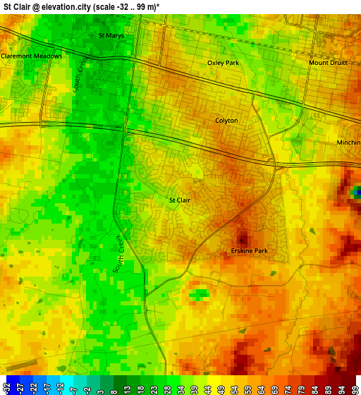
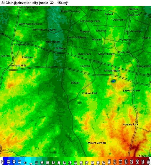
Below is the Elevation map of St Clair, which displays elevation range with different colors. Scale of the first map is from -32 to 99 m (-105 to 325 ft) with average elevation of 46.9 meters (=154 ft) [note 1]
These maps also provides idea of topography and contour of this city, they are displayed at different zoom levels. More info about maps, scale and edge coordinates you can find below images.
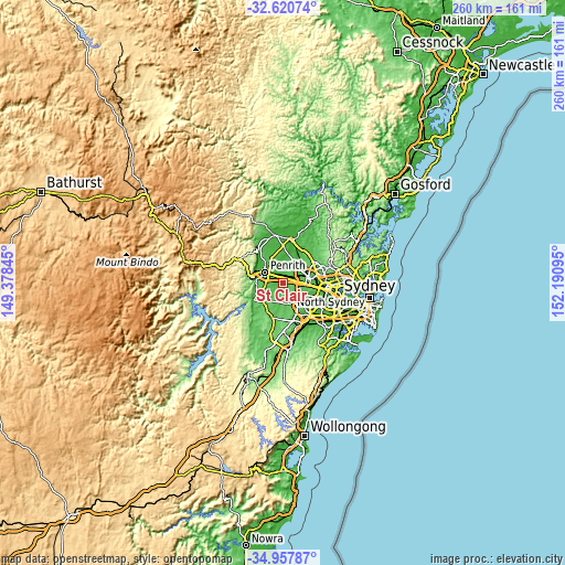
| \ | Map #1 | Map #2 | Topo.Map |
| Scale [m] | -32..99 m | -32..154 m | × |
| Scale [ft] | -105..325 ft | -105..505 ft | × |
| Average | 46.9 m = 154 ft | 54.3 m = 178 ft | × |
| Width | 8.12 km = 5 mi | 16.24 km = 10.1 mi | 259.9 km = 161.5 mi |
| Height | 8.12 km = 5 mi | 16.24 km = 10.1 mi | 259.9 km = 161.5 mi |
| ↑Max Latitude | -33.760753° | -33.724211° | -32.62074° |
| Latitude at center | -33.79728° | -33.79728° | -33.79728° |
| ↓Min Latitude | -33.833791° | -33.870287° | -34.95787° |
| ← Min Longitude | 150.740755° | 150.696809° | 149.37845° |
| Longitude center | 150.7847° | 150.7847° | 150.7847° |
| →Max Longitude | 150.828645° | 150.872591° | 152.19095° |
Nearby cities:
Cities around St Clair sort by population:
• Mount Druitt elevation 47 m
4.5 km,  40°
40°
• Rooty Hill 65 m
5.6 km,  52°
52°
• Colyton 52 m
2 km,  34°
34°
• Erskine Park 60 m
2.1 km,  145°
145°
• Whalan 40 m
4.8 km,  21°
21°
• Minchinbury 73 m
4.3 km,  74°
74°
• Claremont Meadows 42 m
3.9 km,  308°
308°
• Werrington 32 m
5.2 km,  325°
325°
• Tregear 52 m
5.8 km,  7°
7°
• North St Marys 35 m
4.7 km,  359°
359°
• Oxley Park 43 m
3.1 km, 17°
• Caddens 50 m
4.8 km,  302°
302°
Multilingual:
 En español:
St Clair elevación 49 m.
 En France:
St Clair élévation 49 m.


Sources and notes:
- [note 1] Map square and city borders are not equal. Map elevation data is calculated only from area inside that square.
- [src 1] Elevation data from geonames database provided with same terms of usage.
- [src 2] The elevation map of St Clair is generated using elevation data from NASA's 3 arcsec (90m) resolution SRTM data.
- [src 3] Base (background) map © OpenStreetMap contributors tiles are generated by Geofabrik and OpenTopoMap.
Copyright & License:
This St Clair Elevation Map is licensed under CC BY-SA. You may reuse any part from this page, if you give a proper credit by linking to this URL:
 More info on terms of use page.