Curtin elevation
Curtin (ACT), Australia elevation is 581 meters and Curtin elevation in feet is 1906 ft above sea level [src 1]. Curtin is a section of populated place (feature code) with elevation that is 468 meters (1535 ft) bigger than average city elevation in Australia.
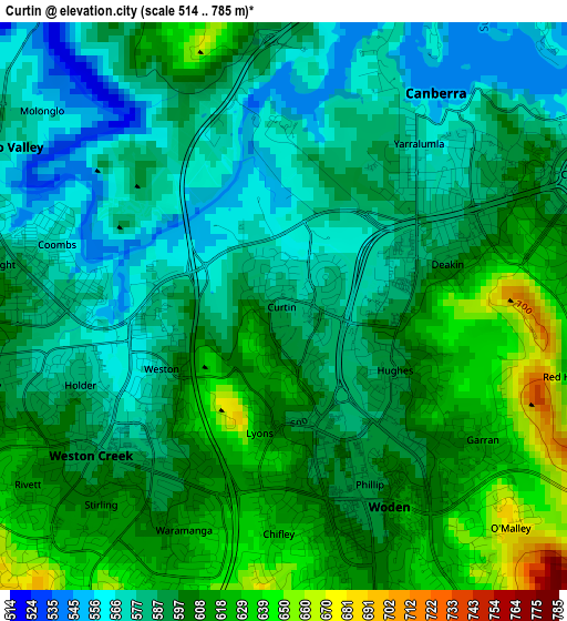
Below is the Elevation map of Curtin, which displays elevation range with different colors. Scale of the first map is from 514 to 785 m (1686 to 2575 ft) with average elevation of 595.7 meters (=1954 ft) [note 1]
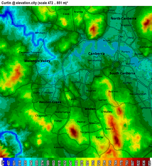
These maps also provides idea of topography and contour of this city, they are displayed at different zoom levels. More info about maps, scale and edge coordinates you can find below images.
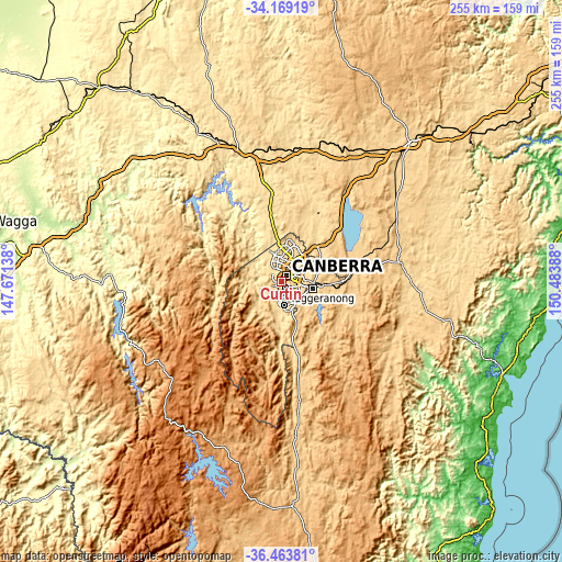
| \ | Map #1 | Map #2 | Topo.Map |
| Scale [m] | 514..785 m | 472..851 m | × |
| Scale [ft] | 1686..2575 ft | 1549..2792 ft | × |
| Average | 595.7 m = 1954 ft | 611.3 m = 2006 ft | × |
| Width | 7.97 km = 5 mi | 15.95 km = 9.9 mi | 255.1 km = 158.5 mi |
| Height | 7.97 km = 5 mi | 15.95 km = 9.9 mi | 255.1 km = 158.5 mi |
| ↑Max Latitude | -35.288778° | -35.252899° | -34.16919° |
| Latitude at center | -35.32464° | -35.32464° | -35.32464° |
| ↓Min Latitude | -35.360487° | -35.396317° | -36.46381° |
| ← Min Longitude | 149.033685° | 148.989739° | 147.67138° |
| Longitude center | 149.07763° | 149.07763° | 149.07763° |
| →Max Longitude | 149.121575° | 149.165521° | 150.48388° |
Nearby cities:
Cities around Curtin sort by population:
• Garran elevation 623 m
3.4 km,  124°
124°
• Weston 594 m
2.1 km,  233°
233°
• Red Hill 638 m
3.8 km,  92°
92°
• Phillip 596 m
3.1 km,  156°
156°
• Lyons 611 m
1.8 km,  190°
190°
• Deakin 597 m
2.4 km,  75°
75°
• Yarralumla 570 m
3.8 km,  42°
42°
• Hughes 596 m
1.8 km, 119°
• Holder 582 m
3.1 km,  249°
249°
• Waramanga 620 m
3.4 km,  204°
204°
• Chifley 621 m
3.2 km,  181°
181°
• Coombs 568 m
3.6 km,  284°
284°
Multilingual:
 En español:
Curtin elevación 581 m.
 En France:
Curtin élévation 581 m.


Sources and notes:
- [note 1] Map square and city borders are not equal. Map elevation data is calculated only from area inside that square.
- [src 1] Elevation data from geonames database provided with same terms of usage.
- [src 2] The elevation map of Curtin is generated using elevation data from NASA's 3 arcsec (90m) resolution SRTM data.
- [src 3] Base (background) map © OpenStreetMap contributors tiles are generated by Geofabrik and OpenTopoMap.
Copyright & License:
This Curtin Elevation Map is licensed under CC BY-SA. You may reuse any part from this page, if you give a proper credit by linking to this URL:
 More info on terms of use page.