Morley elevation
Morley (Western Australia, Bayswater), Australia elevation is 31 meters and Morley elevation in feet is 102 ft above sea level [src 1]. Morley is a section of populated place (feature code) with elevation that is 82 meters (269 ft) smaller than average city elevation in Australia.
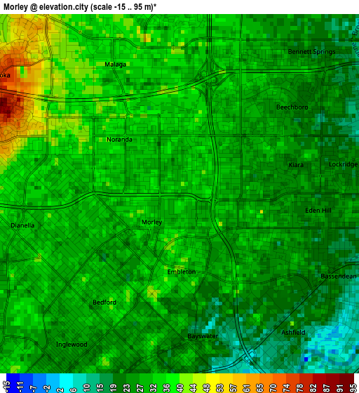
Below is the Elevation map of Morley, which displays elevation range with different colors. Scale of the first map is from -15 to 95 m (-49 to 312 ft) with average elevation of 29.8 meters (=98 ft) [note 1]
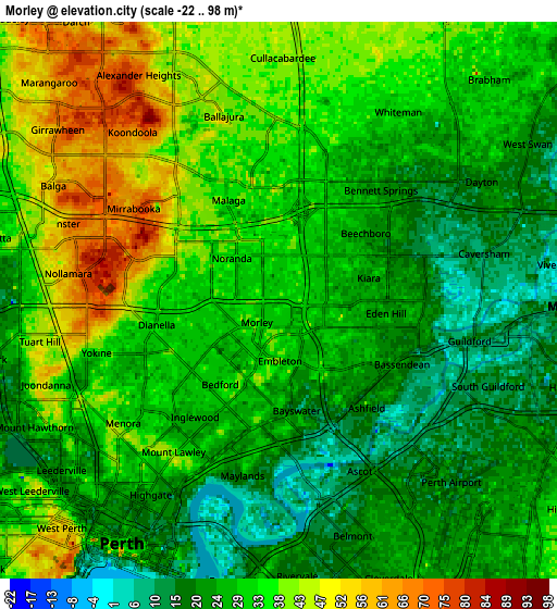
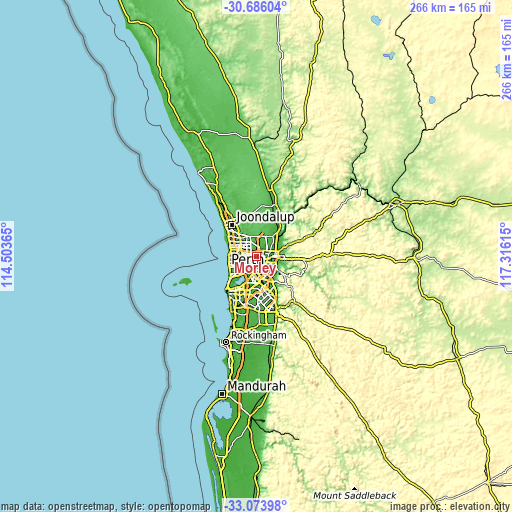
These maps also provides idea of topography and contour of this city, they are displayed at different zoom levels. More info about maps, scale and edge coordinates you can find below images.
| \ | Map #1 | Map #2 | Topo.Map |
| Scale [m] | -15..95 m | -22..98 m | × |
| Scale [ft] | -49..312 ft | -72..322 ft | × |
| Average | 29.8 m = 98 ft | 30.7 m = 101 ft | × |
| Width | 8.3 km = 5.2 mi | 16.6 km = 10.3 mi | 265.5 km = 165 mi |
| Height | 8.3 km = 5.2 mi | 16.6 km = 10.3 mi | 265.5 km = 165 mi |
| ↑Max Latitude | -31.850429° | -31.813093° | -30.68604° |
| Latitude at center | -31.88775° | -31.88775° | -31.88775° |
| ↓Min Latitude | -31.925056° | -31.962346° | -33.07398° |
| ← Min Longitude | 115.865955° | 115.822009° | 114.50365° |
| Longitude center | 115.9099° | 115.9099° | 115.9099° |
| →Max Longitude | 115.953845° | 115.997791° | 117.31615° |
Nearby cities:
Cities around Morley sort by population:
• Dianella elevation 30 m
3.6 km,  269°
269°
• Bayswater 13 m
3.3 km,  167°
167°
• Bassendean 19 m
4 km,  126°
126°
• Beechboro 25 m
3.6 km,  45°
45°
• Noranda 36 m
1.9 km,  327°
327°
• Inglewood 27 m
4.3 km,  221°
221°
• Bedford 30 m
3.3 km, 216°
• Lockridge 26 m
3.9 km,  79°
79°
• Eden Hill 25 m
3.5 km,  92°
92°
• Embleton 35 m
1.8 km,  182°
182°
• Kiara 26 m
2.8 km, 75°
• Ashfield 17 m
4.2 km,  141°
141°
Multilingual:
 En español:
Morley elevación 31 m.
 En France:
Morley élévation 31 m.


Sources and notes:
- [note 1] Map square and city borders are not equal. Map elevation data is calculated only from area inside that square.
- [src 1] Elevation data from geonames database provided with same terms of usage.
- [src 2] The elevation map of Morley is generated using elevation data from NASA's 3 arcsec (90m) resolution SRTM data.
- [src 3] Base (background) map © OpenStreetMap contributors tiles are generated by Geofabrik and OpenTopoMap.
Copyright & License:
This Morley Elevation Map is licensed under CC BY-SA. You may reuse any part from this page, if you give a proper credit by linking to this URL:
 More info on terms of use page.