Branyan elevation
Branyan (Queensland, Bundaberg), Australia elevation is 30 meters and Branyan elevation in feet is 98 ft above sea level [src 1]. Branyan is a section of populated place (feature code) with elevation that is 83 meters (272 ft) smaller than average city elevation in Australia.
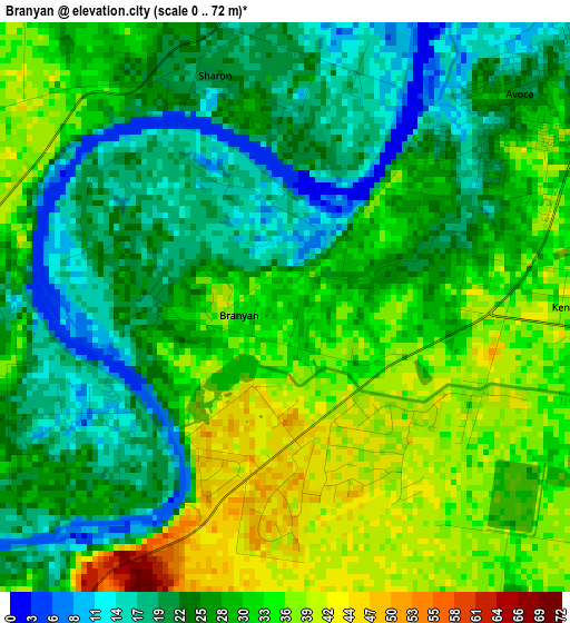
Below is the Elevation map of Branyan, which displays elevation range with different colors. Scale of the first map is from 0 to 72 m (0 to 236 ft) with average elevation of 28.1 meters (=92 ft) [note 1]
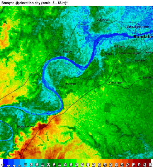
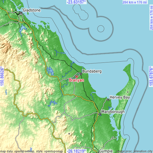
These maps also provides idea of topography and contour of this city, they are displayed at different zoom levels. More info about maps, scale and edge coordinates you can find below images.
| \ | Map #1 | Map #2 | Topo.Map |
| Scale [m] | 0..72 m | -3..86 m | × |
| Scale [ft] | 0..236 ft | -10..282 ft | × |
| Average | 28.1 m = 92 ft | 30.9 m = 101 ft | × |
| Width | 8.86 km = 5.5 mi | 17.73 km = 11 mi | 283.6 km = 176.2 mi |
| Height | 8.86 km = 5.5 mi | 17.73 km = 11 mi | 283.6 km = 176.2 mi |
| ↑Max Latitude | -24.873608° | -24.833732° | -23.63157° |
| Latitude at center | -24.91347° | -24.91347° | -24.91347° |
| ↓Min Latitude | -24.95332° | -24.993156° | -26.18219° |
| ← Min Longitude | 152.228565° | 152.184619° | 150.86626° |
| Longitude center | 152.27251° | 152.27251° | 152.27251° |
| →Max Longitude | 152.316455° | 152.360401° | 153.67876° |
Nearby cities:
Cities around Branyan sort by population:
• Bundaberg elevation 17 m
9.2 km,  55°
55°
• Bundaberg North 11 m
10.3 km,  46°
46°
• Avoca 18 m
5.3 km,  42°
42°
• Avenell Heights 21 m
10 km,  74°
74°
• Bundaberg South 18 m
9.9 km, 62°
• Svensson Heights 32 m
6.7 km, 62°
• Thabeban 39 m
8 km,  79°
79°
• Bundaberg West 18 m
7.9 km, 54°
• Walkervale 22 m
9.4 km, 68°
• Millbank 21 m
6.6 km, 49°
• Norville 28 m
7.3 km, 71°
• Sharon 19 m
4.2 km,  356°
356°
Multilingual:
 En español:
Branyan elevación 30 m.
 En France:
Branyan élévation 30 m.


Sources and notes:
- [note 1] Map square and city borders are not equal. Map elevation data is calculated only from area inside that square.
- [src 1] Elevation data from geonames database provided with same terms of usage.
- [src 2] The elevation map of Branyan is generated using elevation data from NASA's 3 arcsec (90m) resolution SRTM data.
- [src 3] Base (background) map © OpenStreetMap contributors tiles are generated by Geofabrik and OpenTopoMap.
Copyright & License:
This Branyan Elevation Map is licensed under CC BY-SA. You may reuse any part from this page, if you give a proper credit by linking to this URL:
 More info on terms of use page.