Berrinba elevation
Berrinba (Queensland, Logan), Australia elevation is 29 meters and Berrinba elevation in feet is 95 ft above sea level [src 1]. Berrinba is a section of populated place (feature code) with elevation that is 84 meters (276 ft) smaller than average city elevation in Australia.
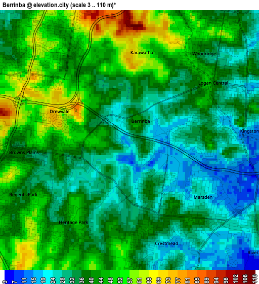
Below is the Elevation map of Berrinba, which displays elevation range with different colors. Scale of the first map is from 3 to 110 m (10 to 361 ft) with average elevation of 39 meters (=128 ft) [note 1]
These maps also provides idea of topography and contour of this city, they are displayed at different zoom levels. More info about maps, scale and edge coordinates you can find below images.
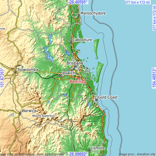
| \ | Map #1 | Topo.Map |
| Scale [m] | 3..110 m | × |
| Scale [ft] | 10..361 ft | × |
| Average | 39 m = 128 ft | × |
| Width | 8.66 km = 5.4 mi | 277 km = 172.1 mi |
| Height | 8.66 km = 5.4 mi | 277 km = 172.1 mi |
| ↑Max Latitude | -27.619599° | -26.40595° |
| Latitude at center | -27.65853° | -27.65853° |
| ↓Min Latitude | -27.697447° | -28.89692° |
| ← Min Longitude | 153.034935° | 151.67263° |
| Longitude center | 153.07888° | 153.07888° |
| →Max Longitude | 153.122825° | 154.48513° |
Nearby cities:
Cities around Berrinba sort by population:
• Logan City elevation 39 m
3.7 km,  54°
54°
• Calamvale 61 m
5 km,  322°
322°
• Marsden 16 m
2.5 km,  132°
132°
• Woodridge 40 m
3.5 km,  36°
36°
• Crestmead 41 m
3.3 km,  170°
170°
• Regents Park 35 m
4.2 km,  241°
241°
• Parkinson 42 m
5.1 km,  289°
289°
• Kingston 11 m
3.8 km,  103°
103°
• Logan Central 37 m
3.2 km,  59°
59°
• Heritage Park 49 m
3.2 km,  213°
213°
• Drewvale 73 m
2.7 km,  296°
296°
• Stretton 98 m
4.2 km,  342°
342°
Multilingual:
 En español:
Berrinba elevación 29 m.
 En France:
Berrinba élévation 29 m.


Sources and notes:
- [note 1] Map square and city borders are not equal. Map elevation data is calculated only from area inside that square.
- [src 1] Elevation data from geonames database provided with same terms of usage.
- [src 2] The elevation map of Berrinba is generated using elevation data from NASA's 3 arcsec (90m) resolution SRTM data.
- [src 3] Base (background) map © OpenStreetMap contributors tiles are generated by Geofabrik and OpenTopoMap.
Copyright & License:
This Berrinba Elevation Map is licensed under CC BY-SA. You may reuse any part from this page, if you give a proper credit by linking to this URL:
 More info on terms of use page.