Castlereagh elevation
Castlereagh (New South Wales, Penrith Municipality), Australia elevation is 20 meters and Castlereagh elevation in feet is 66 ft above sea level [src 1]. Castlereagh is a section of populated place (feature code) with elevation that is 93 meters (305 ft) smaller than average city elevation in Australia.
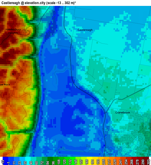
Below is the Elevation map of Castlereagh, which displays elevation range with different colors. Scale of the first map is from -13 to 302 m (-43 to 991 ft) with average elevation of 72.4 meters (=238 ft) [note 1]
These maps also provides idea of topography and contour of this city, they are displayed at different zoom levels. More info about maps, scale and edge coordinates you can find below images.
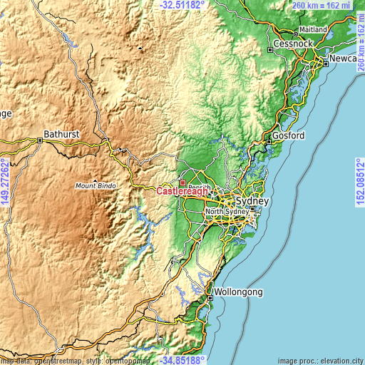
| \ | Map #1 | Topo.Map |
| Scale [m] | -13..302 m | × |
| Scale [ft] | -43..991 ft | × |
| Average | 72.4 m = 238 ft | × |
| Width | 8.13 km = 5.1 mi | 260.2 km = 161.7 mi |
| Height | 8.13 km = 5.1 mi | 260.2 km = 161.7 mi |
| ↑Max Latitude | -33.653237° | -32.51182° |
| Latitude at center | -33.68981° | -33.68981° |
| ↓Min Latitude | -33.726367° | -34.85188° |
| ← Min Longitude | 150.634925° | 149.27262° |
| Longitude center | 150.67887° | 150.67887° |
| →Max Longitude | 150.722815° | 152.08512° |
Nearby cities:
Cities around Castlereagh sort by population:
• Cranebrook elevation 51 m
3.4 km,  122°
122°
• Penrith 31 m
7 km,  163°
163°
• Emu Plains 27 m
6.8 km,  189°
189°
• Cambridge Park 55 m
7.6 km,  148°
148°
• Winmalee 272 m
6.3 km,  281°
281°
• Jordan Springs 45 m
5.8 km,  127°
127°
• Londonderry 23 m
7.1 km,  47°
47°
• Emu Heights 46 m
5.7 km,  209°
209°
• Werrington Downs 52 m
7.4 km,  142°
142°
• Mount Riverview 244 m
6.1 km,  221°
221°
• Cambridge Gardens 52 m
6.6 km, 144°
• Llandilo 32 m
6.8 km,  112°
112°
Multilingual:
 En español:
Castlereagh elevación 20 m.
 En France:
Castlereagh élévation 20 m.
 Auf Deutsch:
Castlereagh höhe über dem Meeresspiegel ist 20 m.

Sources and notes:
- [note 1] Map square and city borders are not equal. Map elevation data is calculated only from area inside that square.
- [src 1] Elevation data from geonames database provided with same terms of usage.
- [src 2] The elevation map of Castlereagh is generated using elevation data from NASA's 3 arcsec (90m) resolution SRTM data.
- [src 3] Base (background) map © OpenStreetMap contributors tiles are generated by Geofabrik and OpenTopoMap.
Copyright & License:
This Castlereagh Elevation Map is licensed under CC BY-SA. You may reuse any part from this page, if you give a proper credit by linking to this URL:
 More info on terms of use page.