Geebung elevation
Geebung (Queensland, Brisbane), Australia elevation is 29 meters and Geebung elevation in feet is 95 ft above sea level [src 1]. Geebung is a section of populated place (feature code) with elevation that is 84 meters (276 ft) smaller than average city elevation in Australia.
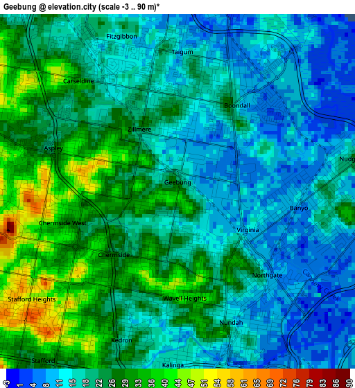
Below is the Elevation map of Geebung, which displays elevation range with different colors. Scale of the first map is from -3 to 90 m (-10 to 295 ft) with average elevation of 21 meters (=69 ft) [note 1]
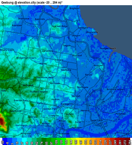
These maps also provides idea of topography and contour of this city, they are displayed at different zoom levels. More info about maps, scale and edge coordinates you can find below images.
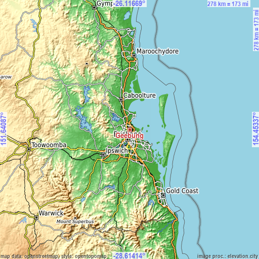
| \ | Map #1 | Map #2 | Topo.Map |
| Scale [m] | -3..90 m | -20..284 m | × |
| Scale [ft] | -10..295 ft | -66..932 ft | × |
| Average | 21 m = 69 ft | 22.8 m = 75 ft | × |
| Width | 8.68 km = 5.4 mi | 17.36 km = 10.8 mi | 277.7 km = 172.6 mi |
| Height | 8.68 km = 5.4 mi | 17.36 km = 10.8 mi | 277.7 km = 172.6 mi |
| ↑Max Latitude | -27.333428° | -27.294382° | -26.11669° |
| Latitude at center | -27.37246° | -27.37246° | -27.37246° |
| ↓Min Latitude | -27.411478° | -27.450483° | -28.61414° |
| ← Min Longitude | 153.003175° | 152.959229° | 151.64087° |
| Longitude center | 153.04712° | 153.04712° | 153.04712° |
| →Max Longitude | 153.091065° | 153.135011° | 154.45337° |
Nearby cities:
Cities around Geebung sort by population:
• Aspley elevation 28 m
3.1 km,  282°
282°
• Nundah 10 m
3.6 km,  156°
156°
• Chermside 25 m
2.1 km,  230°
230°
• Wavell Heights 41 m
2.4 km,  180°
180°
• Carseldine 25 m
3.7 km,  319°
319°
• Boondall 22 m
2.5 km,  32°
32°
• Zillmere 26 m
1.9 km,  352°
352°
• Taigum 21 m
3.3 km,  355°
355°
• Chermside West 44 m
3.3 km,  247°
247°
• Banyo 7 m
3.3 km,  109°
109°
• Nudgee 15 m
3.7 km,  84°
84°
• Virginia 8 m
2.3 km,  122°
122°
Multilingual:
 En español:
Geebung elevación 29 m.
 En France:
Geebung élévation 29 m.


Sources and notes:
- [note 1] Map square and city borders are not equal. Map elevation data is calculated only from area inside that square.
- [src 1] Elevation data from geonames database provided with same terms of usage.
- [src 2] The elevation map of Geebung is generated using elevation data from NASA's 3 arcsec (90m) resolution SRTM data.
- [src 3] Base (background) map © OpenStreetMap contributors tiles are generated by Geofabrik and OpenTopoMap.
Copyright & License:
This Geebung Elevation Map is licensed under CC BY-SA. You may reuse any part from this page, if you give a proper credit by linking to this URL:
 More info on terms of use page.