Calala elevation
Calala (New South Wales, Tamworth Municipality), Australia elevation is 428 meters and Calala elevation in feet is 1404 ft above sea level [src 1]. Calala is a section of populated place (feature code) with elevation that is 315 meters (1033 ft) bigger than average city elevation in Australia.
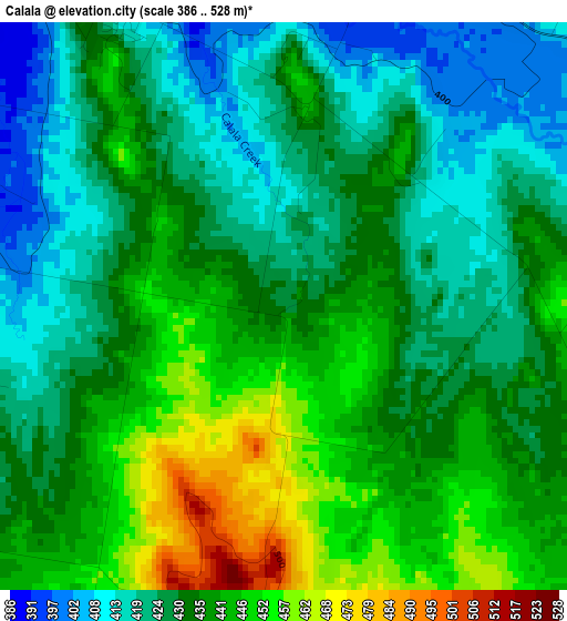
Below is the Elevation map of Calala, which displays elevation range with different colors. Scale of the first map is from 386 to 528 m (1266 to 1732 ft) with average elevation of 433.2 meters (=1421 ft) [note 1]
These maps also provides idea of topography and contour of this city, they are displayed at different zoom levels. More info about maps, scale and edge coordinates you can find below images.
| \ | Map #1 | Map #2 | Topo.Map |
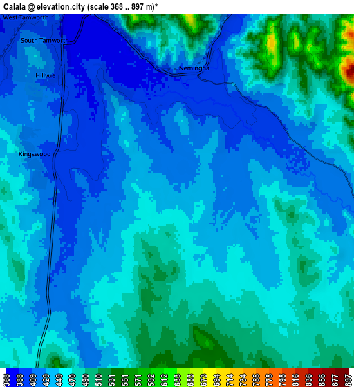
| Scale [m] | 386..528 m | 368..897 m | × |
| Scale [ft] | 1266..1732 ft | 1207..2943 ft | × |
| Average | 433.2 m = 1421 ft | 450.1 m = 1477 ft | × |
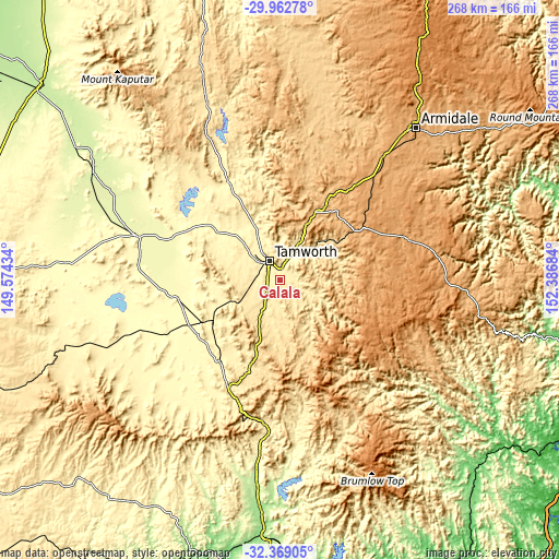
| Width | 8.36 km = 5.2 mi | 16.72 km = 10.4 mi | 267.6 km = 166.3 mi |
| Height | 8.36 km = 5.2 mi | 16.72 km = 10.4 mi | 267.6 km = 166.3 mi |
| ↑Max Latitude | -31.135953° | -31.098331° | -29.96278° |
| Latitude at center | -31.17356° | -31.17356° | -31.17356° |
| ↓Min Latitude | -31.211152° | -31.24873° | -32.36905° |
| ← Min Longitude | 150.936645° | 150.892699° | 149.57434° |
| Longitude center | 150.98059° | 150.98059° | 150.98059° |
| →Max Longitude | 151.024535° | 151.068481° | 152.38684° |
Nearby cities:
Cities around Calala sort by population:
• Tamworth elevation 565 m
10.5 km,  332°
332°
• South Tamworth 394 m
9 km,  321°
321°
• Hillvue 417 m
8.7 km,  306°
306°
• North Tamworth 391 m
11.9 km, 332°
• East Tamworth 419 m
10.6 km,  337°
337°
• West Tamworth 411 m
10.1 km, 321°
• Oxley Vale 396 m
14.4 km, 328°
• Westdale 403 m
15 km, 308°
• Kootingal 425 m
14.5 km,  28°
28°
• Phillip 415 m
13.2 km,  289°
289°
• Werris Creek 389 m
37.1 km,  238°
238°
• Moonbi 465 m
19.3 km, 26°
Multilingual:
 En español:
Calala elevación 428 m.
 En France:
Calala élévation 428 m.


Sources and notes:
- [note 1] Map square and city borders are not equal. Map elevation data is calculated only from area inside that square.
- [src 1] Elevation data from geonames database provided with same terms of usage.
- [src 2] The elevation map of Calala is generated using elevation data from NASA's 3 arcsec (90m) resolution SRTM data.
- [src 3] Base (background) map © OpenStreetMap contributors tiles are generated by Geofabrik and OpenTopoMap.
Copyright & License:
This Calala Elevation Map is licensed under CC BY-SA. You may reuse any part from this page, if you give a proper credit by linking to this URL:
 More info on terms of use page.