Salamander Bay elevation
Salamander Bay (New South Wales, Port Stephens Shire), Australia elevation is 35 meters and Salamander Bay elevation in feet is 115 ft above sea level [src 1]. Salamander Bay is a section of populated place (feature code) with elevation that is 78 meters (256 ft) smaller than average city elevation in Australia.
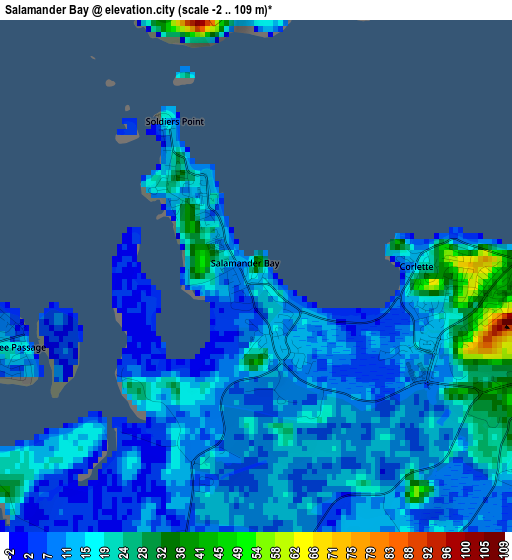
Below is the Elevation map of Salamander Bay, which displays elevation range with different colors. Scale of the first map is from -2 to 109 m (-7 to 358 ft) with average elevation of 13.8 meters (=45 ft) [note 1]
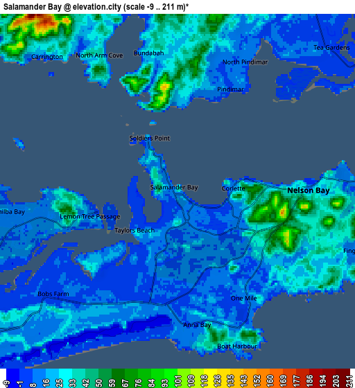
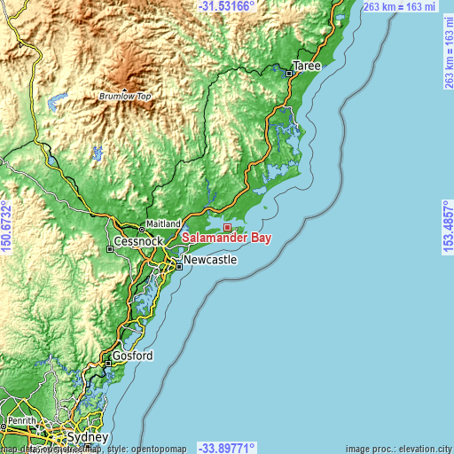
These maps also provides idea of topography and contour of this city, they are displayed at different zoom levels. More info about maps, scale and edge coordinates you can find below images.
| \ | Map #1 | Map #2 | Topo.Map |
| Scale [m] | -2..109 m | -9..211 m | × |
| Scale [ft] | -7..358 ft | -30..692 ft | × |
| Average | 13.8 m = 45 ft | 21.2 m = 70 ft | × |
| Width | 8.22 km = 5.1 mi | 16.44 km = 10.2 mi | 263.1 km = 163.5 mi |
| Height | 8.22 km = 5.1 mi | 16.44 km = 10.2 mi | 263.1 km = 163.5 mi |
| ↑Max Latitude | -32.685551° | -32.648557° | -31.53166° |
| Latitude at center | -32.72253° | -32.72253° | -32.72253° |
| ↓Min Latitude | -32.759493° | -32.796442° | -33.89771° |
| ← Min Longitude | 152.035505° | 151.991559° | 150.6732° |
| Longitude center | 152.07945° | 152.07945° | 152.07945° |
| →Max Longitude | 152.123395° | 152.167341° | 153.4857° |
Nearby cities:
Cities around Salamander Bay sort by population:
• Nelson Bay elevation 13 m
6 km,  87°
87°
• Corlette 16 m
2.7 km,  84°
84°
• Anna Bay 8 m
6.6 km,  174°
174°
• Tanilba Bay 8 m
8.2 km,  250°
250°
• Tea Gardens 11 m
9.6 km,  46°
46°
• Lemon Tree Passage 2 m
3.9 km,  256°
256°
• Shoal Bay 14 m
8.9 km, 89°
• Fingal Bay 17 m
9.1 km,  109°
109°
• Soldiers Point 11 m
1.6 km,  325°
325°
• Karuah 17 m
13.5 km,  304°
304°
• Hawks Nest 13 m
11.1 km,  56°
56°
• Salt Ash 8 m
16.7 km, 246°
Multilingual:
 En español:
Salamander Bay elevación 35 m.
 En France:
Salamander Bay élévation 35 m.
 Auf Deutsch:
Salamander Bay höhe über dem Meeresspiegel ist 35 m.

Sources and notes:
- [note 1] Map square and city borders are not equal. Map elevation data is calculated only from area inside that square.
- [src 1] Elevation data from geonames database provided with same terms of usage.
- [src 2] The elevation map of Salamander Bay is generated using elevation data from NASA's 3 arcsec (90m) resolution SRTM data.
- [src 3] Base (background) map © OpenStreetMap contributors tiles are generated by Geofabrik and OpenTopoMap.
Copyright & License:
This Salamander Bay Elevation Map is licensed under CC BY-SA. You may reuse any part from this page, if you give a proper credit by linking to this URL:
 More info on terms of use page.