Alfredton elevation
Alfredton (Victoria, Ballarat), Australia elevation is 448 meters and Alfredton elevation in feet is 1470 ft above sea level [src 1]. Alfredton is a section of populated place (feature code) with elevation that is 335 meters (1099 ft) bigger than average city elevation in Australia.
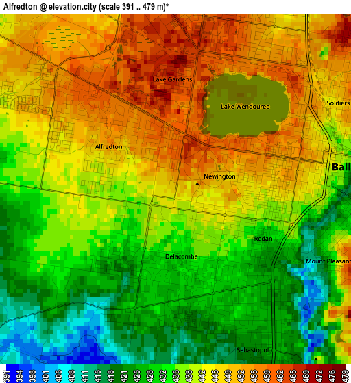
Below is the Elevation map of Alfredton, which displays elevation range with different colors. Scale of the first map is from 391 to 479 m (1283 to 1572 ft) with average elevation of 439.6 meters (=1442 ft) [note 1]
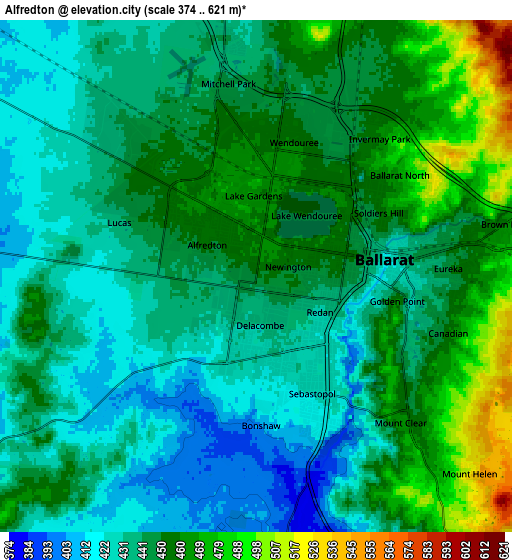
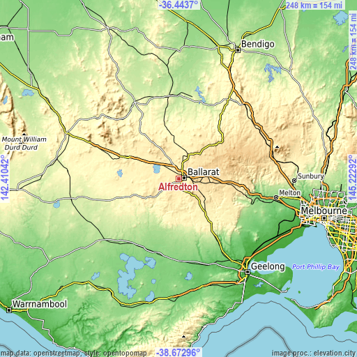
These maps also provides idea of topography and contour of this city, they are displayed at different zoom levels. More info about maps, scale and edge coordinates you can find below images.
| \ | Map #1 | Map #2 | Topo.Map |
| Scale [m] | 391..479 m | 374..621 m | × |
| Scale [ft] | 1283..1572 ft | 1227..2037 ft | × |
| Average | 439.6 m = 1442 ft | 444.8 m = 1459 ft | × |
| Width | 7.75 km = 4.8 mi | 15.49 km = 9.6 mi | 247.9 km = 154 mi |
| Height | 7.75 km = 4.8 mi | 15.49 km = 9.6 mi | 247.9 km = 154 mi |
| ↑Max Latitude | -37.531829° | -37.496971° | -36.4437° |
| Latitude at center | -37.56667° | -37.56667° | -37.56667° |
| ↓Min Latitude | -37.601495° | -37.636303° | -38.67296° |
| ← Min Longitude | 143.772725° | 143.728779° | 142.41042° |
| Longitude center | 143.81667° | 143.81667° | 143.81667° |
| →Max Longitude | 143.860615° | 143.904561° | 145.22292° |
Nearby cities:
Cities around Alfredton sort by population:
• Ballarat elevation 445 m
2.9 km,  89°
89°
• Wendouree 455 m
4.1 km,  14°
14°
• Sebastopol 425 m
2.9 km,  135°
135°
• Delacombe 429 m
2.5 km,  183°
183°
• Ballarat Central 450 m
3.1 km,  80°
80°
• Ballarat East 423 m
4.4 km, 90°
• Lake Wendouree 452 m
3.3 km,  55°
55°
• Redan 429 m
2.2 km,  119°
119°
• Soldiers Hill 449 m
4.2 km, 62°
• Golden Point 433 m
4.7 km,  101°
101°
• Newington 462 m
1.2 km,  38°
38°
• Lake Gardens 464 m
2.3 km,  359°
359°
Multilingual:
 En español:
Alfredton elevación 448 m.
 En France:
Alfredton élévation 448 m.
 Auf Deutsch:
Alfredton höhe über dem Meeresspiegel ist 448 m.

Sources and notes:
- [note 1] Map square and city borders are not equal. Map elevation data is calculated only from area inside that square.
- [src 1] Elevation data from geonames database provided with same terms of usage.
- [src 2] The elevation map of Alfredton is generated using elevation data from NASA's 3 arcsec (90m) resolution SRTM data.
- [src 3] Base (background) map © OpenStreetMap contributors tiles are generated by Geofabrik and OpenTopoMap.
Copyright & License:
This Alfredton Elevation Map is licensed under CC BY-SA. You may reuse any part from this page, if you give a proper credit by linking to this URL:
 More info on terms of use page.