Bass Hill elevation
Bass Hill (New South Wales, Canterbury-Bankstown), Australia elevation is 33 meters and Bass Hill elevation in feet is 108 ft above sea level [src 1]. Bass Hill is a section of populated place (feature code) with elevation that is 80 meters (262 ft) smaller than average city elevation in Australia.
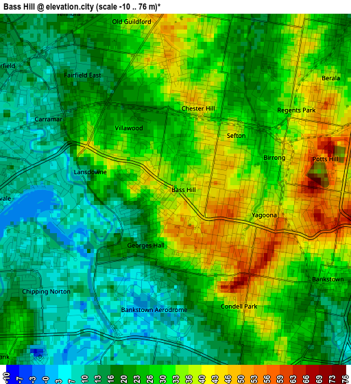
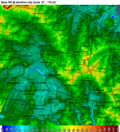
Below is the Elevation map of Bass Hill, which displays elevation range with different colors. Scale of the first map is from -10 to 76 m (-33 to 249 ft) with average elevation of 25.4 meters (=83 ft) [note 1]
These maps also provides idea of topography and contour of this city, they are displayed at different zoom levels. More info about maps, scale and edge coordinates you can find below images.
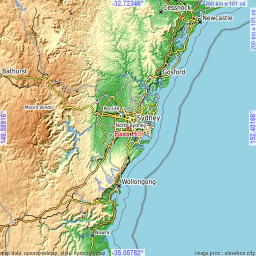
| \ | Map #1 | Map #2 | Topo.Map |
| Scale [m] | -10..76 m | -27..116 m | × |
| Scale [ft] | -33..249 ft | -89..381 ft | × |
| Average | 25.4 m = 83 ft | 25.2 m = 83 ft | × |
| Width | 8.11 km = 5 mi | 16.22 km = 10.1 mi | 259.6 km = 161.3 mi |
| Height | 8.11 km = 5 mi | 16.22 km = 10.1 mi | 259.6 km = 161.3 mi |
| ↑Max Latitude | -33.862146° | -33.825647° | -32.72346° |
| Latitude at center | -33.89863° | -33.89863° | -33.89863° |
| ↓Min Latitude | -33.935098° | -33.97155° | -35.05782° |
| ← Min Longitude | 150.951465° | 150.907519° | 149.58916° |
| Longitude center | 150.99541° | 150.99541° | 150.99541° |
| →Max Longitude | 151.039355° | 151.083301° | 152.40166° |
Nearby cities:
Cities around Bass Hill sort by population:
• Bankstown elevation 32 m
4 km,  119°
119°
• Yagoona 49 m
2.4 km,  107°
107°
• Chester Hill 46 m
2.2 km,  9°
9°
• Condell Park 41 m
3.2 km,  153°
153°
• Georges Hall 21 m
1.3 km,  209°
209°
• Chipping Norton 15 m
4 km,  237°
237°
• Villawood 12 m
2.1 km,  318°
318°
• Sefton 38 m
1.8 km,  49°
49°
• Fairfield East 17 m
3.9 km,  325°
325°
• Regents Park 23 m
2.6 km, 49°
• Carramar 13 m
3.5 km,  297°
297°
• Birrong 34 m
2.4 km,  73°
73°
Multilingual:
 En español:
Bass Hill elevación 33 m.
 En France:
Bass Hill élévation 33 m.
 Auf Deutsch:
Bass Hill höhe über dem Meeresspiegel ist 33 m.

Sources and notes:
- [note 1] Map square and city borders are not equal. Map elevation data is calculated only from area inside that square.
- [src 1] Elevation data from geonames database provided with same terms of usage.
- [src 2] The elevation map of Bass Hill is generated using elevation data from NASA's 3 arcsec (90m) resolution SRTM data.
- [src 3] Base (background) map © OpenStreetMap contributors tiles are generated by Geofabrik and OpenTopoMap.
Copyright & License:
This Bass Hill Elevation Map is licensed under CC BY-SA. You may reuse any part from this page, if you give a proper credit by linking to this URL:
 More info on terms of use page.