Colac elevation
Colac (Victoria, Colac Otway), Australia elevation is 139 meters and Colac elevation in feet is 456 ft above sea level [src 1]. Colac is a populated place (feature code) with elevation that is 26 meters (85 ft) bigger than average city elevation in Australia.
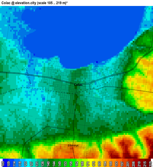
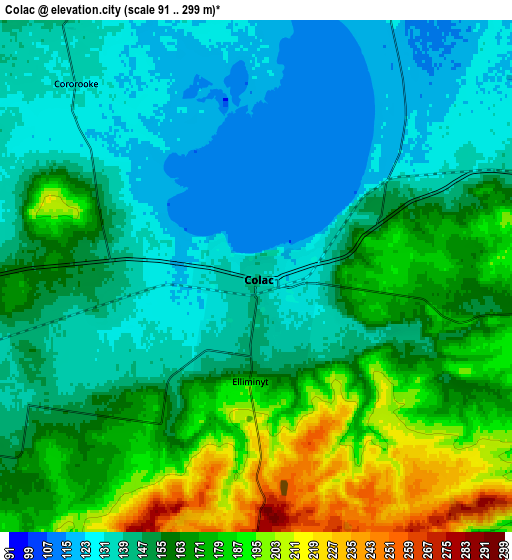
Below is the Elevation map of Colac, which displays elevation range with different colors. Scale of the first map is from 105 to 219 m (344 to 719 ft) with average elevation of 135.9 meters (=446 ft) [note 1]
These maps also provides idea of topography and contour of this city, they are displayed at different zoom levels. More info about maps, scale and edge coordinates you can find below images.
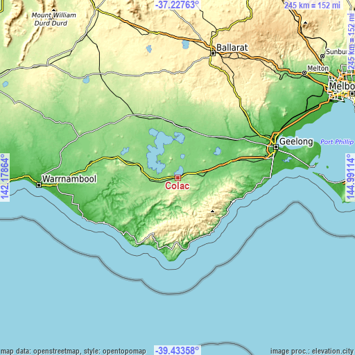
| \ | Map #1 | Map #2 | Topo.Map |
| Scale [m] | 105..219 m | 91..299 m | × |
| Scale [ft] | 344..719 ft | 299..981 ft | × |
| Average | 135.9 m = 446 ft | 155.4 m = 510 ft | × |
| Width | 7.67 km = 4.8 mi | 15.33 km = 9.5 mi | 245.3 km = 152.4 mi |
| Height | 7.67 km = 4.8 mi | 15.33 km = 9.5 mi | 245.3 km = 152.4 mi |
| ↑Max Latitude | -38.304523° | -38.27003° | -37.22763° |
| Latitude at center | -38.339° | -38.339° | -38.339° |
| ↓Min Latitude | -38.37346° | -38.407905° | -39.43358° |
| ← Min Longitude | 143.540945° | 143.496999° | 142.17864° |
| Longitude center | 143.58489° | 143.58489° | 143.58489° |
| →Max Longitude | 143.628835° | 143.672781° | 144.99114° |
Nearby cities:
Cities around Colac sort by population:
• Bannockburn elevation 116 m
60.4 km,  57°
57°
• Camperdown 171 m
39.7 km,  287°
287°
• Elliminyt 140 m
3.6 km,  186°
186°
• Anglesea 9 m
52.9 km,  98°
98°
• Terang 137 m
58.9 km,  280°
280°
• Winchelsea 93 m
36.3 km,  73°
73°
• Cobden 137 m
44.5 km,  271°
271°
• Teesdale 118 m
53 km,  50°
50°
• Apollo Bay 5 m
47.4 km,  170°
170°
• Inverleigh 70 m
48.5 km, 57°
• Lorne 60 m
40.8 km,  123°
123°
• Timboon 81 m
55.1 km,  252°
252°
Multilingual:
 En español:
Colac elevación 139 m.
 En France:
Colac élévation 139 m.


Sources and notes:
- [note 1] Map square and city borders are not equal. Map elevation data is calculated only from area inside that square.
- [src 1] Elevation data from geonames database provided with same terms of usage.
- [src 2] The elevation map of Colac is generated using elevation data from NASA's 3 arcsec (90m) resolution SRTM data.
- [src 3] Base (background) map © OpenStreetMap contributors tiles are generated by Geofabrik and OpenTopoMap.
Copyright & License:
This Colac Elevation Map is licensed under CC BY-SA. You may reuse any part from this page, if you give a proper credit by linking to this URL:
 More info on terms of use page.