Kanwal elevation
Kanwal (New South Wales, Central Coast), Australia elevation is 36 meters and Kanwal elevation in feet is 118 ft above sea level [src 1]. Kanwal is a section of populated place (feature code) with elevation that is 77 meters (253 ft) smaller than average city elevation in Australia.
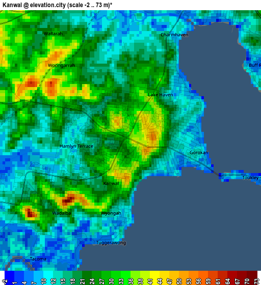
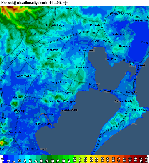
Below is the Elevation map of Kanwal, which displays elevation range with different colors. Scale of the first map is from -2 to 73 m (-7 to 240 ft) with average elevation of 20.5 meters (=67 ft) [note 1]
These maps also provides idea of topography and contour of this city, they are displayed at different zoom levels. More info about maps, scale and edge coordinates you can find below images.
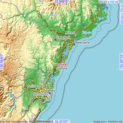
| \ | Map #1 | Map #2 | Topo.Map |
| Scale [m] | -2..73 m | -11..216 m | × |
| Scale [ft] | -7..240 ft | -36..709 ft | × |
| Average | 20.5 m = 67 ft | 22.9 m = 75 ft | × |
| Width | 8.17 km = 5.1 mi | 16.34 km = 10.2 mi | 261.5 km = 162.5 mi |
| Height | 8.17 km = 5.1 mi | 16.34 km = 10.2 mi | 261.5 km = 162.5 mi |
| ↑Max Latitude | -33.216243° | -33.17947° | -32.06915° |
| Latitude at center | -33.253° | -33.253° | -33.253° |
| ↓Min Latitude | -33.289742° | -33.326468° | -34.42103° |
| ← Min Longitude | 151.447155° | 151.403209° | 150.08485° |
| Longitude center | 151.4911° | 151.4911° | 151.4911° |
| →Max Longitude | 151.535045° | 151.578991° | 152.89735° |
Nearby cities:
Cities around Kanwal sort by population:
• Gorokan elevation 11 m
1.8 km,  106°
106°
• Blue Haven 14 m
4.8 km,  13°
13°
• Hamlyn Terrace 24 m
1.4 km,  278°
278°
• Woongarrah 30 m
1.9 km,  312°
312°
• Toukley 9 m
4.6 km, 105°
• San Remo 12 m
5.1 km,  33°
33°
• Lake Haven 20 m
1.7 km,  47°
47°
• Buff Point 13 m
5 km, 48°
• Wadalba 22 m
3.2 km,  228°
228°
• Charmhaven 21 m
3.1 km,  20°
20°
• Wyongah 9 m
2.4 km,  184°
184°
• Tuggerawong 4 m
3.2 km,  198°
198°
Multilingual:
 En español:
Kanwal elevación 36 m.
 En France:
Kanwal élévation 36 m.


Sources and notes:
- [note 1] Map square and city borders are not equal. Map elevation data is calculated only from area inside that square.
- [src 1] Elevation data from geonames database provided with same terms of usage.
- [src 2] The elevation map of Kanwal is generated using elevation data from NASA's 3 arcsec (90m) resolution SRTM data.
- [src 3] Base (background) map © OpenStreetMap contributors tiles are generated by Geofabrik and OpenTopoMap.
Copyright & License:
This Kanwal Elevation Map is licensed under CC BY-SA. You may reuse any part from this page, if you give a proper credit by linking to this URL:
 More info on terms of use page.