Leumeah elevation
Leumeah (New South Wales, Campbelltown Municipality), Australia elevation is 59 meters and Leumeah elevation in feet is 194 ft above sea level [src 1]. Leumeah is a section of populated place (feature code) with elevation that is 54 meters (177 ft) smaller than average city elevation in Australia.
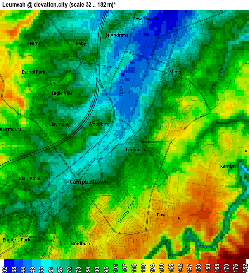
Below is the Elevation map of Leumeah, which displays elevation range with different colors. Scale of the first map is from 32 to 182 m (105 to 597 ft) with average elevation of 92 meters (=302 ft) [note 1]
These maps also provides idea of topography and contour of this city, they are displayed at different zoom levels. More info about maps, scale and edge coordinates you can find below images.
| \ | Map #1 | Map #2 | Topo.Map |
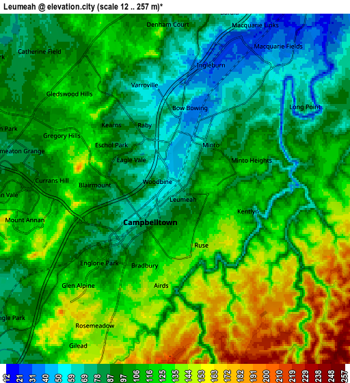
| Scale [m] | 32..182 m | 12..257 m | × |
| Scale [ft] | 105..597 ft | 39..843 ft | × |
| Average | 92 m = 302 ft | 107.8 m = 354 ft | × |
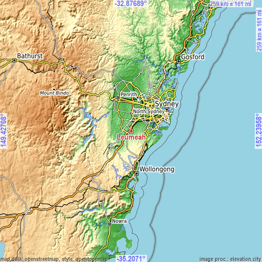
| Width | 8.1 km = 5 mi | 16.19 km = 10.1 mi | 259.1 km = 161 mi |
| Height | 8.1 km = 5 mi | 16.19 km = 10.1 mi | 259.1 km = 161 mi |
| ↑Max Latitude | -34.013581° | -33.977147° | -32.87689° |
| Latitude at center | -34.05° | -34.05° | -34.05° |
| ↓Min Latitude | -34.086403° | -34.12279° | -35.2071° |
| ← Min Longitude | 150.789385° | 150.745439° | 149.42708° |
| Longitude center | 150.83333° | 150.83333° | 150.83333° |
| →Max Longitude | 150.877275° | 150.921221° | 152.23958° |
Nearby cities:
Cities around Leumeah sort by population:
• Campbelltown elevation 84 m
2.4 km,  219°
219°
• Minto 74 m
2.4 km,  39°
39°
• Raby 53 m
3.8 km,  337°
337°
• Eagle Vale 84 m
2.3 km,  307°
307°
• St Andrews 55 m
3.1 km,  353°
353°
• Ruse 122 m
2.3 km,  160°
160°
• Airds 141 m
4 km,  180°
180°
• Blair Athol 94 m
3.2 km,  245°
245°
• Woodbine 81 m
1.2 km,  292°
292°
• Claymore 87 m
2.1 km,  280°
280°
• Eschol Park 76 m
3.1 km,  315°
315°
• Bow Bowing 45 m
3.8 km,  9°
9°
Multilingual:
 En español:
Leumeah elevación 59 m.
 En France:
Leumeah élévation 59 m.


Sources and notes:
- [note 1] Map square and city borders are not equal. Map elevation data is calculated only from area inside that square.
- [src 1] Elevation data from geonames database provided with same terms of usage.
- [src 2] The elevation map of Leumeah is generated using elevation data from NASA's 3 arcsec (90m) resolution SRTM data.
- [src 3] Base (background) map © OpenStreetMap contributors tiles are generated by Geofabrik and OpenTopoMap.
Copyright & License:
This Leumeah Elevation Map is licensed under CC BY-SA. You may reuse any part from this page, if you give a proper credit by linking to this URL:
 More info on terms of use page.