Tatura elevation
Tatura (Victoria, Greater Shepparton), Australia elevation is 115 meters and Tatura elevation in feet is 377 ft above sea level [src 1]. Tatura is a populated place (feature code) with elevation that is 2 meters (7 ft) bigger than average city elevation in Australia.
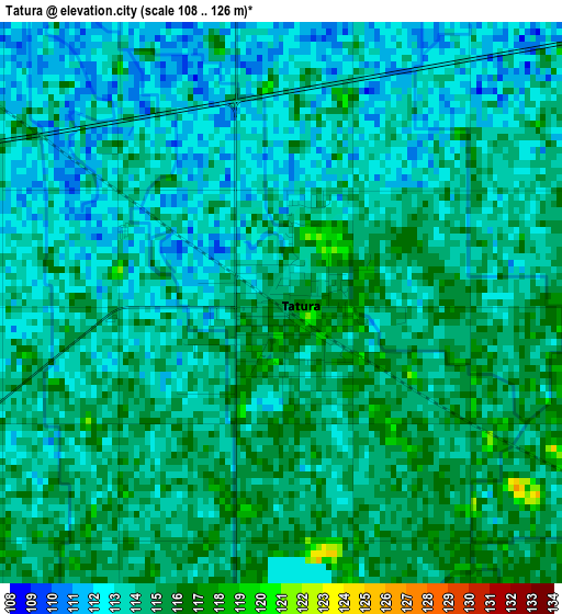
Below is the Elevation map of Tatura, which displays elevation range with different colors. Scale of the first map is from 108 to 126 m (354 to 413 ft) with average elevation of 113.7 meters (=373 ft) [note 1]
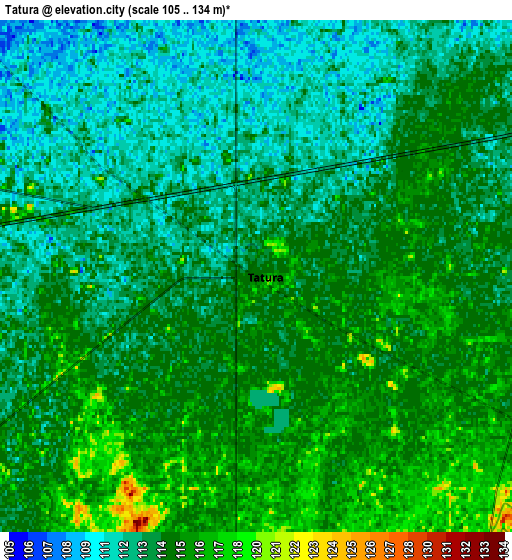
These maps also provides idea of topography and contour of this city, they are displayed at different zoom levels. More info about maps, scale and edge coordinates you can find below images.
| \ | Map #1 | Map #2 | Topo.Map |
| Scale [m] | 108..126 m | 105..134 m | × |
| Scale [ft] | 354..413 ft | 344..440 ft | × |
| Average | 113.7 m = 373 ft | 113.9 m = 374 ft | × |
| Width | 7.86 km = 4.9 mi | 15.72 km = 9.8 mi | 251.6 km = 156.3 mi |
| Height | 7.86 km = 4.9 mi | 15.72 km = 9.8 mi | 251.6 km = 156.3 mi |
| ↑Max Latitude | -36.404259° | -36.368881° | -35.3001° |
| Latitude at center | -36.43962° | -36.43962° | -36.43962° |
| ↓Min Latitude | -36.474965° | -36.510294° | -37.56265° |
| ← Min Longitude | 145.185995° | 145.142049° | 143.82369° |
| Longitude center | 145.22994° | 145.22994° | 145.22994° |
| →Max Longitude | 145.273885° | 145.317831° | 146.63619° |
Nearby cities:
Cities around Tatura sort by population:
• Shepparton elevation 115 m
16.5 km,  66°
66°
• Mooroopna 113 m
11.6 km, 67°
• Kyabram 109 m
21.3 km,  311°
311°
• Kialla 117 m
16.5 km,  92°
92°
• Numurkah 110 m
43.4 km,  25°
25°
• Euroa 179 m
46.5 km,  139°
139°
• Rochester 118 m
48.1 km,  280°
280°
• Nagambie 132 m
39 km,  190°
190°
• Tongala 103 m
32 km, 309°
• Nathalia 105 m
42.5 km,  356°
356°
• Rushworth 148 m
25.1 km,  229°
229°
• Shepparton East 118 m
22.6 km,  79°
79°
Multilingual:
 En español:
Tatura elevación 115 m.
 En France:
Tatura élévation 115 m.


Sources and notes:
- [note 1] Map square and city borders are not equal. Map elevation data is calculated only from area inside that square.
- [src 1] Elevation data from geonames database provided with same terms of usage.
- [src 2] The elevation map of Tatura is generated using elevation data from NASA's 3 arcsec (90m) resolution SRTM data.
- [src 3] Base (background) map © OpenStreetMap contributors tiles are generated by Geofabrik and OpenTopoMap.
Copyright & License:
This Tatura Elevation Map is licensed under CC BY-SA. You may reuse any part from this page, if you give a proper credit by linking to this URL:
 More info on terms of use page.