Tenterfield elevation
Tenterfield (New South Wales, Tenterfield Municipality), Australia elevation is 849 meters and Tenterfield elevation in feet is 2785 ft above sea level [src 1]. Tenterfield is a populated place (feature code) with elevation that is 736 meters (2415 ft) bigger than average city elevation in Australia.
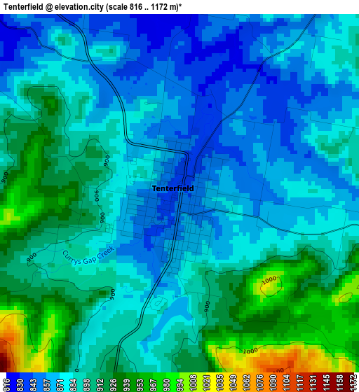
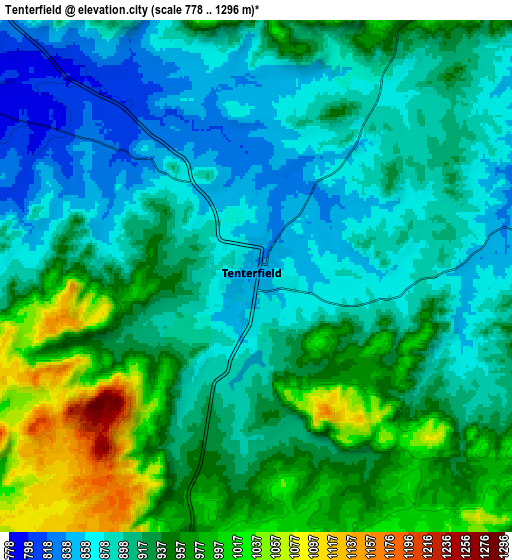
Below is the Elevation map of Tenterfield, which displays elevation range with different colors. Scale of the first map is from 816 to 1172 m (2677 to 3845 ft) with average elevation of 891 meters (=2923 ft) [note 1]
These maps also provides idea of topography and contour of this city, they are displayed at different zoom levels. More info about maps, scale and edge coordinates you can find below images.
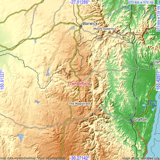
| \ | Map #1 | Map #2 | Topo.Map |
| Scale [m] | 816..1172 m | 778..1296 m | × |
| Scale [ft] | 2677..3845 ft | 2552..4252 ft | × |
| Average | 891 m = 2923 ft | 922.4 m = 3026 ft | × |
| Width | 8.54 km = 5.3 mi | 17.09 km = 10.6 mi | 273.4 km = 169.9 mi |
| Height | 8.54 km = 5.3 mi | 17.09 km = 10.6 mi | 273.4 km = 169.9 mi |
| ↑Max Latitude | -29.011036° | -28.972597° | -27.81286° |
| Latitude at center | -29.04946° | -29.04946° | -29.04946° |
| ↓Min Latitude | -29.08787° | -29.126265° | -30.27142° |
| ← Min Longitude | 151.975575° | 151.931629° | 150.61327° |
| Longitude center | 152.01952° | 152.01952° | 152.01952° |
| →Max Longitude | 152.063465° | 152.107411° | 153.42577° |
Nearby cities:
Cities around Tenterfield sort by population:
• Warwick elevation 462 m
92.3 km,  0°
0°
• Casino 25 m
102.2 km,  77°
77°
• Grafton 7 m
113.1 km,  128°
128°
• South Grafton 2 m
114.3 km, 129°
• Glen Innes 1071 m
80.9 km,  199°
199°
• Stanthorpe 796 m
44.7 km,  349°
349°
• Rosenthal Heights 492 m
90 km,  359°
359°
• Kyogle 225 m
106.4 km,  63°
63°
• Junction Hill 30 m
109.7 km, 126°
• Waterview Heights 50 m
107.3 km, 132°
• Allora 470 m
112.9 km, 358°
• Carrolls Creek 1006 m
26.5 km,  17°
17°
Multilingual:
 En español:
Tenterfield elevación 849 m.
 En France:
Tenterfield élévation 849 m.
 Auf Deutsch:
Tenterfield höhe über dem Meeresspiegel ist 849 m.

Sources and notes:
- [note 1] Map square and city borders are not equal. Map elevation data is calculated only from area inside that square.
- [src 1] Elevation data from geonames database provided with same terms of usage.
- [src 2] The elevation map of Tenterfield is generated using elevation data from NASA's 3 arcsec (90m) resolution SRTM data.
- [src 3] Base (background) map © OpenStreetMap contributors tiles are generated by Geofabrik and OpenTopoMap.
Copyright & License:
This Tenterfield Elevation Map is licensed under CC BY-SA. You may reuse any part from this page, if you give a proper credit by linking to this URL:
 More info on terms of use page.