Toongabbie elevation
Toongabbie (New South Wales, Parramatta), Australia elevation is 37 meters and Toongabbie elevation in feet is 121 ft above sea level [src 1]. Toongabbie is a section of populated place (feature code) with elevation that is 76 meters (249 ft) smaller than average city elevation in Australia.
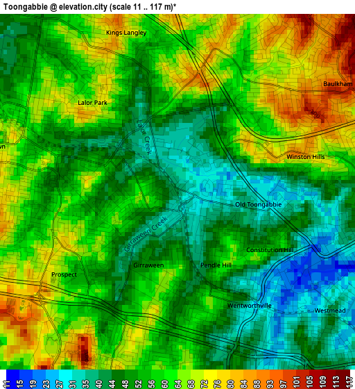
Below is the Elevation map of Toongabbie, which displays elevation range with different colors. Scale of the first map is from 11 to 117 m (36 to 384 ft) with average elevation of 56.3 meters (=185 ft) [note 1]
These maps also provides idea of topography and contour of this city, they are displayed at different zoom levels. More info about maps, scale and edge coordinates you can find below images.
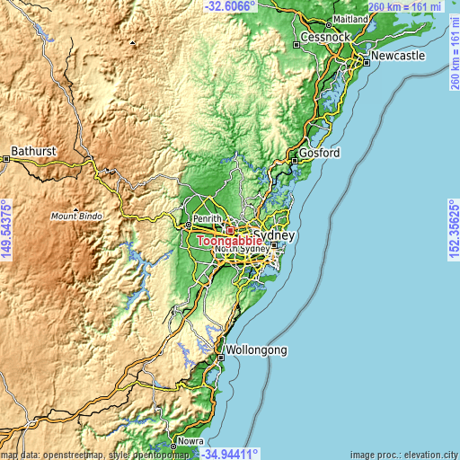
| \ | Map #1 | Map #2 | Topo.Map |
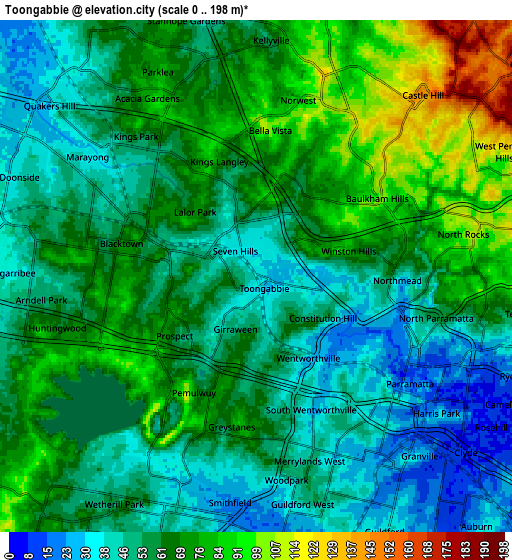
| Scale [m] | 11..117 m | 0..198 m | × |
| Scale [ft] | 36..384 ft | 0..650 ft | × |
| Average | 56.3 m = 185 ft | 60.9 m = 200 ft | × |
| Width | 8.12 km = 5 mi | 16.24 km = 10.1 mi | 259.9 km = 161.5 mi |
| Height | 8.12 km = 5 mi | 16.24 km = 10.1 mi | 259.9 km = 161.5 mi |
| ↑Max Latitude | -33.746797° | -33.710249° | -32.6066° |
| Latitude at center | -33.78333° | -33.78333° | -33.78333° |
| ↓Min Latitude | -33.819847° | -33.856349° | -34.94411° |
| ← Min Longitude | 150.906055° | 150.862109° | 149.54375° |
| Longitude center | 150.95° | 150.95° | 150.95° |
| →Max Longitude | 150.993945° | 151.037891° | 152.35625° |
Nearby cities:
Cities around Toongabbie sort by population:
• Blacktown elevation 67 m
3.6 km,  301°
301°
• Seven Hills 47 m
1.5 km,  270°
270°
• Winston Hills 85 m
2.9 km,  74°
74°
• Wentworthville 45 m
3.1 km,  147°
147°
• Kings Langley 82 m
3.9 km,  339°
339°
• Lalor Park 79 m
3 km,  325°
325°
• Pendle Hill 59 m
2.4 km,  167°
167°
• South Wentworthville 50 m
4.1 km,  162°
162°
• Girraween 54 m
1.9 km,  200°
200°
• Prospect 80 m
3.9 km,  238°
238°
• Constitution Hill 46 m
2.6 km,  112°
112°
• Old Toongabbie 30 m
1.8 km, 105°
Multilingual:
 En español:
Toongabbie elevación 37 m.
 En France:
Toongabbie élévation 37 m.
 Auf Deutsch:
Toongabbie höhe über dem Meeresspiegel ist 37 m.

Sources and notes:
- [note 1] Map square and city borders are not equal. Map elevation data is calculated only from area inside that square.
- [src 1] Elevation data from geonames database provided with same terms of usage.
- [src 2] The elevation map of Toongabbie is generated using elevation data from NASA's 3 arcsec (90m) resolution SRTM data.
- [src 3] Base (background) map © OpenStreetMap contributors tiles are generated by Geofabrik and OpenTopoMap.
Copyright & License:
This Toongabbie Elevation Map is licensed under CC BY-SA. You may reuse any part from this page, if you give a proper credit by linking to this URL:
 More info on terms of use page.