Wacol elevation
Wacol (Queensland, Brisbane), Australia elevation is 38 meters and Wacol elevation in feet is 125 ft above sea level [src 1]. Wacol is a section of populated place (feature code) with elevation that is 75 meters (246 ft) smaller than average city elevation in Australia.
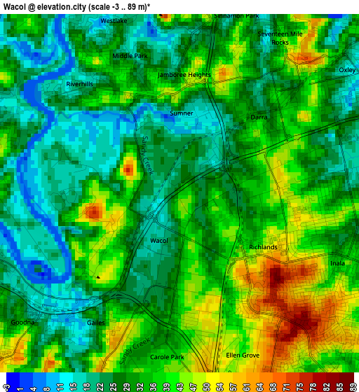
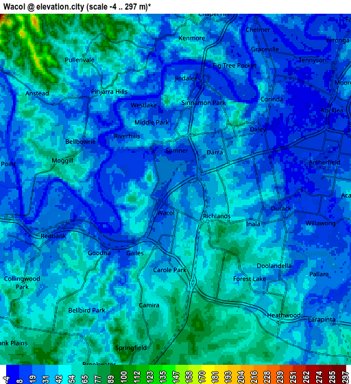
Below is the Elevation map of Wacol, which displays elevation range with different colors. Scale of the first map is from -3 to 89 m (-10 to 292 ft) with average elevation of 32.3 meters (=106 ft) [note 1]
These maps also provides idea of topography and contour of this city, they are displayed at different zoom levels. More info about maps, scale and edge coordinates you can find below images.
| \ | Map #1 | Map #2 | Topo.Map |
| Scale [m] | -3..89 m | -4..297 m | × |
| Scale [ft] | -10..292 ft | -13..974 ft | × |
| Average | 32.3 m = 106 ft | 38 m = 125 ft | × |
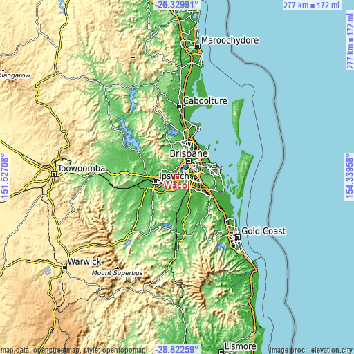
| Width | 8.66 km = 5.4 mi | 17.32 km = 10.8 mi | 277.2 km = 172.2 mi |
| Height | 8.66 km = 5.4 mi | 17.32 km = 10.8 mi | 277.2 km = 172.2 mi |
| ↑Max Latitude | -27.544373° | -27.505402° | -26.32991° |
| Latitude at center | -27.58333° | -27.58333° | -27.58333° |
| ↓Min Latitude | -27.622273° | -27.661203° | -28.82259° |
| ← Min Longitude | 152.889385° | 152.845439° | 151.52708° |
| Longitude center | 152.93333° | 152.93333° | 152.93333° |
| →Max Longitude | 152.977275° | 153.021221° | 154.33958° |
Nearby cities:
Cities around Wacol sort by population:
• Inala elevation 40 m
4.3 km,  110°
110°
• Goodna 22 m
4.5 km,  228°
228°
• Darra 34 m
2.7 km,  48°
48°
• Westlake 17 m
4.4 km,  332°
332°
• Riverhills 17 m
3.5 km,  320°
320°
• Middle Park 22 m
3.2 km,  340°
340°
• Richlands 51 m
2.4 km,  126°
126°
• Jamboree Heights 42 m
3 km,  1°
1°
• Ellen Grove 49 m
3.7 km,  163°
163°
• Seventeen Mile Rocks 46 m
4.4 km,  34°
34°
• Mount Ommaney 27 m
4.1 km,  358°
358°
• Gailes 26 m
3.7 km,  212°
212°
Multilingual:
 En español:
Wacol elevación 38 m.
 En France:
Wacol élévation 38 m.


Sources and notes:
- [note 1] Map square and city borders are not equal. Map elevation data is calculated only from area inside that square.
- [src 1] Elevation data from geonames database provided with same terms of usage.
- [src 2] The elevation map of Wacol is generated using elevation data from NASA's 3 arcsec (90m) resolution SRTM data.
- [src 3] Base (background) map © OpenStreetMap contributors tiles are generated by Geofabrik and OpenTopoMap.
Copyright & License:
This Wacol Elevation Map is licensed under CC BY-SA. You may reuse any part from this page, if you give a proper credit by linking to this URL:
 More info on terms of use page.