Wallacia elevation
Wallacia (New South Wales, Penrith Municipality), Australia elevation is 56 meters and Wallacia elevation in feet is 184 ft above sea level [src 1]. Wallacia is a section of populated place (feature code) with elevation that is 57 meters (187 ft) smaller than average city elevation in Australia.
Below is the Elevation map of Wallacia, which displays elevation range with different colors. Scale of the first map is from 21 to 225 m (69 to 738 ft) with average elevation of 98.1 meters (=322 ft) [note 1]
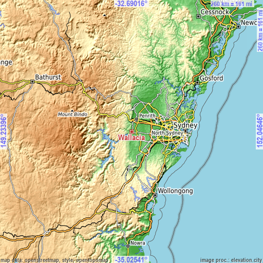
These maps also provides idea of topography and contour of this city, they are displayed at different zoom levels. More info about maps, scale and edge coordinates you can find below images.
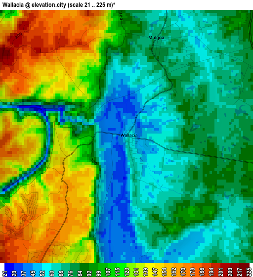
| \ | Map #1 | Topo.Map |
| Scale [m] | 21..225 m | × |
| Scale [ft] | 69..738 ft | × |
| Average | 98.1 m = 322 ft | × |
| Width | 8.11 km = 5 mi | 259.7 km = 161.4 mi |
| Height | 8.11 km = 5 mi | 259.7 km = 161.4 mi |
| ↑Max Latitude | -33.829272° | -32.69016° |
| Latitude at center | -33.86577° | -33.86577° |
| ↓Min Latitude | -33.902252° | -35.02541° |
| ← Min Longitude | 150.596265° | 149.23396° |
| Longitude center | 150.64021° | 150.64021° |
| →Max Longitude | 150.684155° | 152.04646° |
Nearby cities:
Cities around Wallacia sort by population:
• Glenmore Park elevation 48 m
8.8 km,  17°
17°
• Kingswood Park 54 m
13 km,  31°
31°
• South Penrith 43 m
11.4 km, 26°
• Jamisontown 31 m
11.4 km, 17°
• Glenbrook 187 m
11.2 km,  348°
348°
• Silverdale 170 m
6.2 km,  207°
207°
• Bringelly 70 m
11.4 km,  131°
131°
• Leonay 47 m
11.2 km,  3°
3°
• Orchard Hills 73 m
11.3 km,  35°
35°
• Mulgoa 74 m
3.2 km, 15°
• Luddenham 101 m
4.7 km,  107°
107°
• Warragamba 181 m
4.4 km,  228°
228°
Multilingual:
 En español:
Wallacia elevación 56 m.
 En France:
Wallacia élévation 56 m.


Sources and notes:
- [note 1] Map square and city borders are not equal. Map elevation data is calculated only from area inside that square.
- [src 1] Elevation data from geonames database provided with same terms of usage.
- [src 2] The elevation map of Wallacia is generated using elevation data from NASA's 3 arcsec (90m) resolution SRTM data.
- [src 3] Base (background) map © OpenStreetMap contributors tiles are generated by Geofabrik and OpenTopoMap.
Copyright & License:
This Wallacia Elevation Map is licensed under CC BY-SA. You may reuse any part from this page, if you give a proper credit by linking to this URL:
 More info on terms of use page.