Woombye elevation
Woombye (Queensland, Sunshine Coast), Australia elevation is 26 meters and Woombye elevation in feet is 85 ft above sea level [src 1]. Woombye is a section of populated place (feature code) with elevation that is 87 meters (285 ft) smaller than average city elevation in Australia.
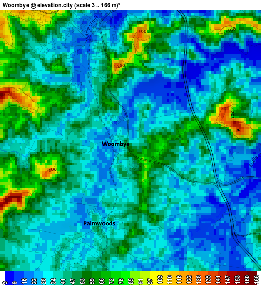
Below is the Elevation map of Woombye, which displays elevation range with different colors. Scale of the first map is from 3 to 166 m (10 to 545 ft) with average elevation of 41.9 meters (=137 ft) [note 1]
These maps also provides idea of topography and contour of this city, they are displayed at different zoom levels. More info about maps, scale and edge coordinates you can find below images.
| \ | Map #1 | Topo.Map |
| Scale [m] | 3..166 m | × |
| Scale [ft] | 10..545 ft | × |
| Average | 41.9 m = 137 ft | × |
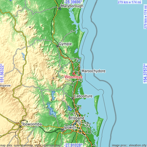
| Width | 8.73 km = 5.4 mi | 279.5 km = 173.7 mi |
| Height | 8.73 km = 5.4 mi | 279.5 km = 173.7 mi |
| ↑Max Latitude | -26.62126° | -25.39696° |
| Latitude at center | -26.66054° | -26.66054° |
| ↓Min Latitude | -26.699806° | -27.91028° |
| ← Min Longitude | 152.925525° | 151.56322° |
| Longitude center | 152.96947° | 152.96947° |
| →Max Longitude | 153.013415° | 154.37572° |
Nearby cities:
Cities around Woombye sort by population:
• Nambour elevation 19 m
4 km,  345°
345°
• Bli Bli 23 m
8.2 km,  54°
54°
• Palmwoods 34 m
2.9 km,  196°
196°
• Burnside 36 m
4.2 km,  317°
317°
• Kuluin 17 m
8.6 km,  87°
87°
• Rosemount 61 m
4.5 km,  41°
41°
• Diddillibah 3 m
8.2 km,  75°
75°
• Forest Glen 16 m
4.7 km,  131°
131°
• Coes Creek 46 m
2.5 km,  306°
306°
• Tanawha 69 m
8.9 km,  137°
137°
• Eudlo 29 m
7.8 km,  191°
191°
• West Woombye 60 m
4.4 km,  261°
261°
Multilingual:
 En español:
Woombye elevación 26 m.
 En France:
Woombye élévation 26 m.


Sources and notes:
- [note 1] Map square and city borders are not equal. Map elevation data is calculated only from area inside that square.
- [src 1] Elevation data from geonames database provided with same terms of usage.
- [src 2] The elevation map of Woombye is generated using elevation data from NASA's 3 arcsec (90m) resolution SRTM data.
- [src 3] Base (background) map © OpenStreetMap contributors tiles are generated by Geofabrik and OpenTopoMap.
Copyright & License:
This Woombye Elevation Map is licensed under CC BY-SA. You may reuse any part from this page, if you give a proper credit by linking to this URL:
 More info on terms of use page.