Albany elevation
Albany (Western Australia), Australia elevation is 90 meters and Albany elevation in feet is 295 ft above sea level [src 1]. Albany is a seat of a second-order administrative division (feature code) with elevation that is 23 meters (75 ft) smaller than average city elevation in Australia.
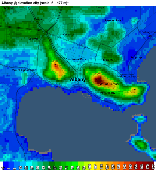
Below is the Elevation map of Albany, which displays elevation range with different colors. Scale of the first map is from -6 to 177 m (-20 to 581 ft) with average elevation of 31.2 meters (=102 ft) [note 1]
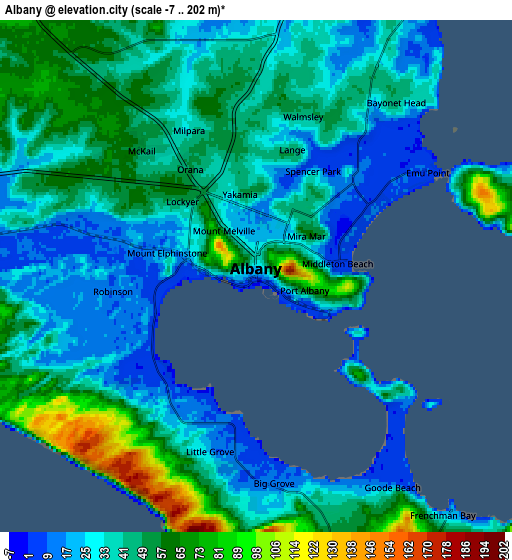
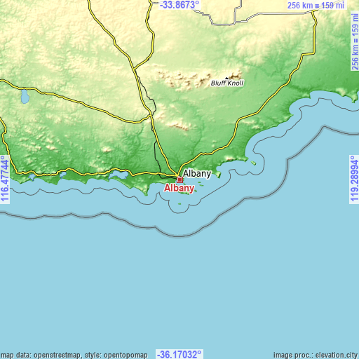
These maps also provides idea of topography and contour of this city, they are displayed at different zoom levels. More info about maps, scale and edge coordinates you can find below images.
| \ | Map #1 | Map #2 | Topo.Map |
| Scale [m] | -6..177 m | -7..202 m | × |
| Scale [ft] | -20..581 ft | -23..663 ft | × |
| Average | 31.2 m = 102 ft | 42.4 m = 139 ft | × |
| Width | 8 km = 5 mi | 16.01 km = 9.9 mi | 256.1 km = 159.1 mi |
| Height | 8 km = 5 mi | 16.01 km = 9.9 mi | 256.1 km = 159.1 mi |
| ↑Max Latitude | -34.990926° | -34.954916° | -33.8673° |
| Latitude at center | -35.02692° | -35.02692° | -35.02692° |
| ↓Min Latitude | -35.062898° | -35.09886° | -36.17032° |
| ← Min Longitude | 117.839745° | 117.795799° | 116.47744° |
| Longitude center | 117.88369° | 117.88369° | 117.88369° |
| →Max Longitude | 117.927635° | 117.971581° | 119.28994° |
Nearby cities:
Cities around Albany sort by population:
• Spencer Park elevation 46 m
2.8 km,  31°
31°
• McKail 69 m
6.7 km,  313°
313°
• Bayonet Head 44 m
7.6 km,  37°
37°
• Yakamia 47 m
2.6 km,  349°
349°
• Orana 46 m
4.1 km,  327°
327°
• Lower King 14 m
9.2 km, 32°
• Mira Mar 61 m
2 km,  50°
50°
• Grasmere 6 m
11.7 km,  274°
274°
• Albany city centre 90 m
0.3 km,  21°
21°
• Little Grove 14 m
4.7 km,  193°
193°
• Lockyer 48 m
3.3 km,  316°
316°
• Mount Melville 88 m
1.2 km,  295°
295°
Multilingual:
 En español:
Albany elevación 90 m.
 En France:
Albany élévation 90 m.


Sources and notes:
- [note 1] Map square and city borders are not equal. Map elevation data is calculated only from area inside that square.
- [src 1] Elevation data from geonames database provided with same terms of usage.
- [src 2] The elevation map of Albany is generated using elevation data from NASA's 3 arcsec (90m) resolution SRTM data.
- [src 3] Base (background) map © OpenStreetMap contributors tiles are generated by Geofabrik and OpenTopoMap.
Copyright & License:
This Albany Elevation Map is licensed under CC BY-SA. You may reuse any part from this page, if you give a proper credit by linking to this URL:
 More info on terms of use page.