Nöstlbach elevation
Nöstlbach (Upper Austria, Politischer Bezirk Linz-Land), Austria elevation is 285 meters and Nöstlbach elevation in feet is 935 ft above sea level [src 1]. Nöstlbach is a populated place (feature code) with elevation that is 224 meters (735 ft) smaller than average city elevation in Austria.
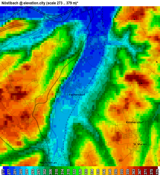
Below is the Elevation map of Nöstlbach, which displays elevation range with different colors. Scale of the first map is from 273 to 379 m (896 to 1243 ft) with average elevation of 320.1 meters (=1050 ft) [note 1]
These maps also provides idea of topography and contour of this city, they are displayed at different zoom levels. More info about maps, scale and edge coordinates you can find below images.
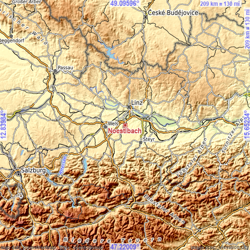
| \ | Map #1 | Topo.Map |
| Scale [m] | 273..379 m | × |
| Scale [ft] | 896..1243 ft | × |
| Average | 320.1 m = 1050 ft | × |
| Width | 6.52 km = 4.1 mi | 208.6 km = 129.6 mi |
| Height | 6.52 km = 4.1 mi | 208.6 km = 129.6 mi |
| ↑Max Latitude | 48.195902° | 49.09596° |
| Latitude at center | 48.1666° | 48.1666° |
| ↓Min Latitude | 48.137282° | 47.22009° |
| ← Min Longitude | 14.202145° | 12.83984° |
| Longitude center | 14.24609° | 14.24609° |
| →Max Longitude | 14.290035° | 15.65234° |
Nearby cities:
Cities around Nöstlbach sort by population:
• Traun elevation 271 m
6.7 km,  352°
352°
• Haid 277 m
4.3 km,  4°
4°
• Neuhofen an der Krems 302 m
3.4 km,  203°
203°
• Oedt 277 m
5.8 km,  332°
332°
• Sankt Dionysen 268 m
6.5 km,  5°
5°
• Ansfelden 278 m
5.8 km,  34°
34°
• Pucking 286 m
5 km,  299°
299°
• Sankt Marien 335 m
3.1 km,  131°
131°
• Kremsdorf 276 m
3.9 km,  17°
17°
• Audorf 265 m
6.2 km, 23°
• Sammersdorf 289 m
6.1 km,  285°
285°
• Allhaming 343 m
5.8 km,  254°
254°
Multilingual:
 En español:
Nöstlbach elevación 285 m.
 En France:
Nöstlbach élévation 285 m.
 Auf Deutsch:
Nöstlbach höhe über dem Meeresspiegel ist 285 m.

Sources and notes:
- [note 1] Map square and city borders are not equal. Map elevation data is calculated only from area inside that square.
- [src 1] Elevation data from geonames database provided with same terms of usage.
- [src 2] The elevation map of Nöstlbach is generated using elevation data from NASA's 3 arcsec (90m) resolution SRTM data.
- [src 3] Base (background) map © OpenStreetMap contributors tiles are generated by Geofabrik and OpenTopoMap.
Copyright & License:
This Nöstlbach Elevation Map is licensed under CC BY-SA. You may reuse any part from this page, if you give a proper credit by linking to this URL:
 More info on terms of use page.