Traun elevation
Traun (Upper Austria, Politischer Bezirk Linz-Land), Austria elevation is 271 meters and Traun elevation in feet is 889 ft above sea level [src 1]. Traun is a populated place (feature code) with elevation that is 238 meters (781 ft) smaller than average city elevation in Austria.
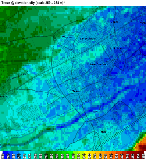
Below is the Elevation map of Traun, which displays elevation range with different colors. Scale of the first map is from 259 to 358 m (850 to 1175 ft) with average elevation of 276.6 meters (=907 ft) [note 1]
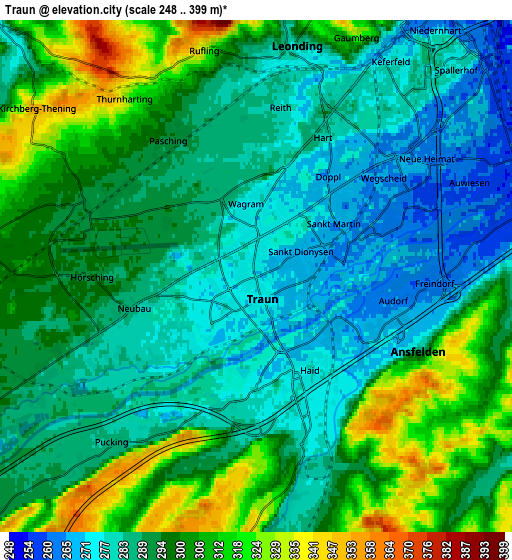
These maps also provides idea of topography and contour of this city, they are displayed at different zoom levels. More info about maps, scale and edge coordinates you can find below images.
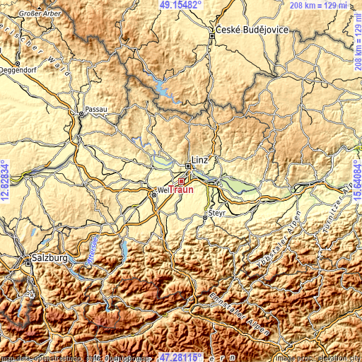
| \ | Map #1 | Map #2 | Topo.Map |
| Scale [m] | 259..358 m | 248..399 m | × |
| Scale [ft] | 850..1175 ft | 814..1309 ft | × |
| Average | 276.6 m = 907 ft | 293.6 m = 963 ft | × |
| Width | 6.51 km = 4 mi | 13.02 km = 8.1 mi | 208.3 km = 129.4 mi |
| Height | 6.51 km = 4 mi | 13.02 km = 8.1 mi | 208.3 km = 129.4 mi |
| ↑Max Latitude | 48.255827° | 48.285078° | 49.15482° |
| Latitude at center | 48.22656° | 48.22656° | 48.22656° |
| ↓Min Latitude | 48.197276° | 48.167975° | 47.28115° |
| ← Min Longitude | 14.190645° | 14.146699° | 12.82834° |
| Longitude center | 14.23459° | 14.23459° | 14.23459° |
| →Max Longitude | 14.278535° | 14.322481° | 15.64084° |
Nearby cities:
Cities around Traun sort by population:
• Haid elevation 277 m
2.7 km,  153°
153°
• Sankt Martin 263 m
2.5 km,  78°
78°
• Langholzfeld 272 m
2.1 km,  28°
28°
• Doppl 273 m
2.8 km, 31°
• Oedt 277 m
2.3 km,  230°
230°
• Sankt Dionysen 268 m
1.5 km,  99°
99°
• Pasching 294 m
4.3 km,  327°
327°
• Hörsching 291 m
4.2 km,  269°
269°
• Kremsdorf 276 m
3.6 km,  144°
144°
• Neubau 278 m
3.2 km,  254°
254°
• Audorf 265 m
3.4 km,  105°
105°
• Wagram 274 m
1.3 km,  345°
345°
Multilingual:
 En español:
Traun elevación 271 m.
 En France:
Traun élévation 271 m.


Sources and notes:
- [note 1] Map square and city borders are not equal. Map elevation data is calculated only from area inside that square.
- [src 1] Elevation data from geonames database provided with same terms of usage.
- [src 2] The elevation map of Traun is generated using elevation data from NASA's 3 arcsec (90m) resolution SRTM data.
- [src 3] Base (background) map © OpenStreetMap contributors tiles are generated by Geofabrik and OpenTopoMap.
Copyright & License:
This Traun Elevation Map is licensed under CC BY-SA. You may reuse any part from this page, if you give a proper credit by linking to this URL:
 More info on terms of use page.