Untertilliach elevation
Untertilliach (Tyrol, Politischer Bezirk Lienz), Austria elevation is 1237 meters and Untertilliach elevation in feet is 4058 ft above sea level [src 1]. Untertilliach is a seat of a third-order administrative division (feature code) with elevation that is 728 meters (2388 ft) bigger than average city elevation in Austria.
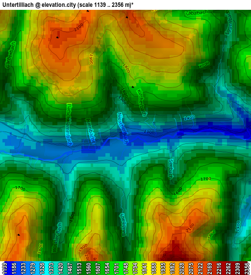
Below is the Elevation map of Untertilliach, which displays elevation range with different colors. Scale of the first map is from 1139 to 2356 m (3737 to 7730 ft) with average elevation of 1652.8 meters (=5423 ft) [note 1]
These maps also provides idea of topography and contour of this city, they are displayed at different zoom levels. More info about maps, scale and edge coordinates you can find below images.
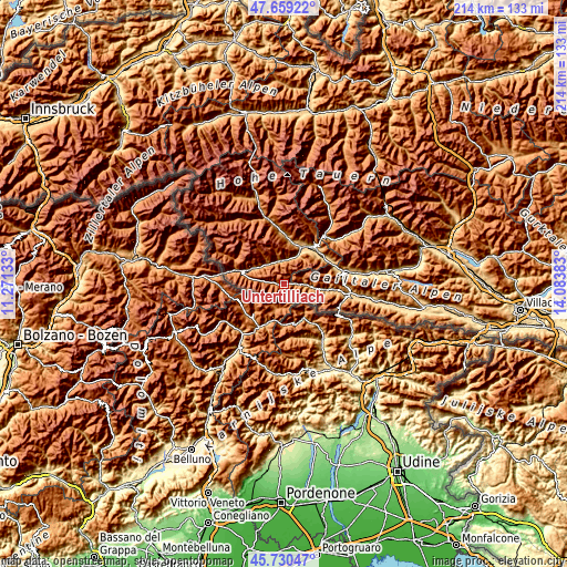
| \ | Map #1 | Topo.Map |
| Scale [m] | 1139..2356 m | × |
| Scale [ft] | 3737..7730 ft | × |
| Average | 1652.8 m = 5423 ft | × |
| Width | 6.7 km = 4.2 mi | 214.5 km = 133.3 mi |
| Height | 6.7 km = 4.2 mi | 214.4 km = 133.2 mi |
| ↑Max Latitude | 46.733588° | 47.65922° |
| Latitude at center | 46.70346° | 46.70346° |
| ↓Min Latitude | 46.673315° | 45.73047° |
| ← Min Longitude | 12.633635° | 11.27133° |
| Longitude center | 12.67758° | 12.67758° |
| →Max Longitude | 12.721525° | 14.08383° |
Nearby cities:
Cities around Untertilliach sort by population:
• Lienz elevation 681 m
15.6 km,  26°
26°
• Tristach 668 m
15.2 km, 34°
• Oberlienz 817 m
16.5 km,  14°
14°
• Strassen 1222 m
15.8 km,  290°
290°
• Kartitsch 1485 m
13.8 km,  281°
281°
• Abfaltersbach 989 m
12.8 km,  297°
297°
• Leisach 745 m
13.3 km,  24°
24°
• Amlach 685 m
14.2 km, 27°
• Obertilliach 1472 m
4.9 km, 279°
• Anras 1296 m
11.9 km,  311°
311°
• Lavant 656 m
16.2 km,  49°
49°
• Assling 1155 m
9.7 km,  342°
342°
Multilingual:
 En español:
Untertilliach elevación 1237 m.
 En France:
Untertilliach élévation 1237 m.
 Auf Deutsch:
Untertilliach höhe über dem Meeresspiegel ist 1237 m.

Sources and notes:
- [note 1] Map square and city borders are not equal. Map elevation data is calculated only from area inside that square.
- [src 1] Elevation data from geonames database provided with same terms of usage.
- [src 2] The elevation map of Untertilliach is generated using elevation data from NASA's 3 arcsec (90m) resolution SRTM data.
- [src 3] Base (background) map © OpenStreetMap contributors tiles are generated by Geofabrik and OpenTopoMap.
Copyright & License:
This Untertilliach Elevation Map is licensed under CC BY-SA. You may reuse any part from this page, if you give a proper credit by linking to this URL:
 More info on terms of use page.