Lienz elevation
Lienz (Tyrol, Politischer Bezirk Lienz), Austria elevation is 681 meters and Lienz elevation in feet is 2234 ft above sea level [src 1]. Lienz is a seat of a third-order administrative division (feature code) with elevation that is 172 meters (564 ft) bigger than average city elevation in Austria.
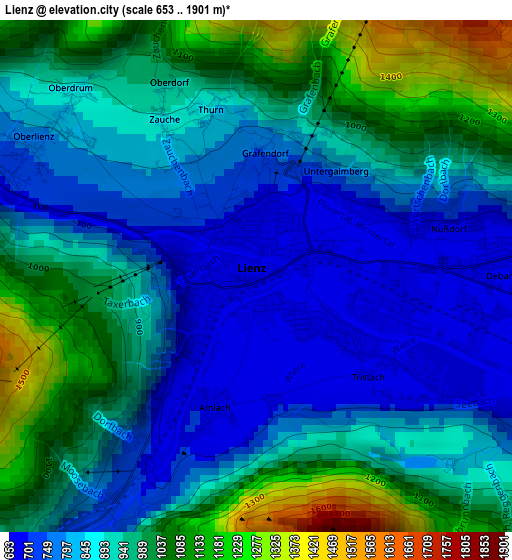
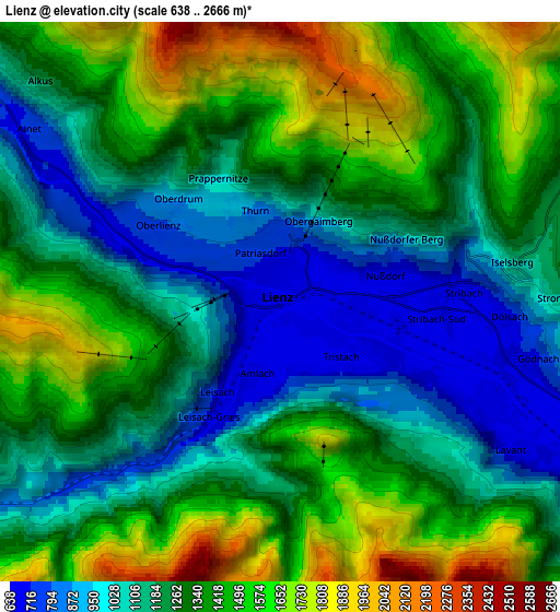
Below is the Elevation map of Lienz, which displays elevation range with different colors. Scale of the first map is from 653 to 1901 m (2142 to 6237 ft) with average elevation of 912.1 meters (=2992 ft) [note 1]
These maps also provides idea of topography and contour of this city, they are displayed at different zoom levels. More info about maps, scale and edge coordinates you can find below images.
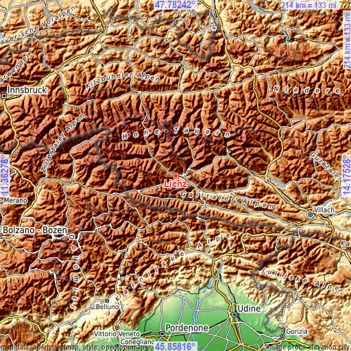
| \ | Map #1 | Map #2 | Topo.Map |
| Scale [m] | 653..1901 m | 638..2666 m | × |
| Scale [ft] | 2142..6237 ft | 2093..8747 ft | × |
| Average | 912.1 m = 2992 ft | 1289.8 m = 4232 ft | × |
| Width | 6.69 km = 4.2 mi | 13.37 km = 8.3 mi | 214 km = 133 mi |
| Height | 6.69 km = 4.2 mi | 13.37 km = 8.3 mi | 213.9 km = 132.9 mi |
| ↑Max Latitude | 46.858958° | 46.888999° | 47.78242° |
| Latitude at center | 46.8289° | 46.8289° | 46.8289° |
| ↓Min Latitude | 46.798825° | 46.768733° | 45.85816° |
| ← Min Longitude | 12.725085° | 12.681139° | 11.36278° |
| Longitude center | 12.76903° | 12.76903° | 12.76903° |
| →Max Longitude | 12.812975° | 12.856921° | 14.17528° |
Nearby cities:
Cities around Lienz sort by population:
• Debant elevation 674 m
3.7 km,  82°
82°
• Tristach 668 m
2.1 km,  132°
132°
• Dölsach 836 m
5.8 km,  90°
90°
• Oberlienz 817 m
3.5 km,  305°
305°
• Ainet 727 m
7.3 km,  304°
304°
• Winklern 977 m
9.5 km,  58°
58°
• Leisach 745 m
2.4 km,  220°
220°
• Amlach 685 m
1.5 km,  196°
196°
• Schlaiten 867 m
10.4 km, 302°
• Lavant 656 m
6.2 km,  122°
122°
• Thurn 985 m
2.4 km,  359°
359°
• Assling 1155 m
10.9 km,  244°
244°
Multilingual:
 En español:
Lienz elevación 681 m.
 En France:
Lienz élévation 681 m.


Sources and notes:
- [note 1] Map square and city borders are not equal. Map elevation data is calculated only from area inside that square.
- [src 1] Elevation data from geonames database provided with same terms of usage.
- [src 2] The elevation map of Lienz is generated using elevation data from NASA's 3 arcsec (90m) resolution SRTM data.
- [src 3] Base (background) map © OpenStreetMap contributors tiles are generated by Geofabrik and OpenTopoMap.
Copyright & License:
This Lienz Elevation Map is licensed under CC BY-SA. You may reuse any part from this page, if you give a proper credit by linking to this URL:
 More info on terms of use page.