Attersee elevation
Attersee (Upper Austria, Politischer Bezirk Vöcklabruck), Austria elevation is 490 meters and Attersee elevation in feet is 1608 ft above sea level [src 1]. Attersee is a seat of a third-order administrative division (feature code) with elevation that is 19 meters (62 ft) smaller than average city elevation in Austria.
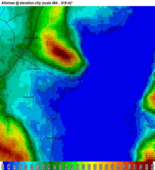
Below is the Elevation map of Attersee, which displays elevation range with different colors. Scale of the first map is from 464 to 818 m (1522 to 2684 ft) with average elevation of 523.5 meters (=1718 ft) [note 1]
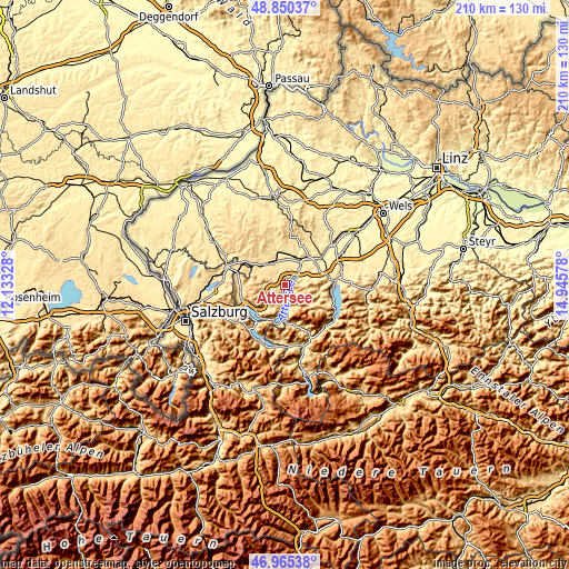
These maps also provides idea of topography and contour of this city, they are displayed at different zoom levels. More info about maps, scale and edge coordinates you can find below images.
| \ | Map #1 | Topo.Map |
| Scale [m] | 464..818 m | × |
| Scale [ft] | 1522..2684 ft | × |
| Average | 523.5 m = 1718 ft | × |
| Width | 6.55 km = 4.1 mi | 209.6 km = 130.2 mi |
| Height | 6.55 km = 4.1 mi | 209.6 km = 130.2 mi |
| ↑Max Latitude | 47.945904° | 48.85037° |
| Latitude at center | 47.91646° | 47.91646° |
| ↓Min Latitude | 47.886999° | 46.96538° |
| ← Min Longitude | 13.495585° | 12.13328° |
| Longitude center | 13.53953° | 13.53953° |
| →Max Longitude | 13.583475° | 14.94578° |
Nearby cities:
Cities around Attersee sort by population:
• Timelkam elevation 446 m
11 km,  27°
27°
• Sankt Georgen im Attergau 537 m
4.7 km,  297°
297°
• Lenzing 485 m
8.1 km,  39°
39°
• Seewalchen 493 m
5.2 km, 39°
• Vöcklamarkt 488 m
10.4 km,  336°
336°
• Schörfling 509 m
5.8 km,  56°
56°
• Weyregg 477 m
2.8 km,  121°
121°
• Gampern 507 m
8.1 km,  7°
7°
• Oberwang 573 m
9.7 km,  235°
235°
• Aurach am Hongar 492 m
10.7 km,  68°
68°
• Steinbach am Attersee 475 m
9.5 km,  177°
177°
• Weißenkirchen im Attergau 649 m
9.7 km,  292°
292°
Multilingual:
 En español:
Attersee elevación 490 m.
 En France:
Attersee élévation 490 m.
 Auf Deutsch:
Attersee höhe über dem Meeresspiegel ist 490 m.

Sources and notes:
- [note 1] Map square and city borders are not equal. Map elevation data is calculated only from area inside that square.
- [src 1] Elevation data from geonames database provided with same terms of usage.
- [src 2] The elevation map of Attersee is generated using elevation data from NASA's 3 arcsec (90m) resolution SRTM data.
- [src 3] Base (background) map © OpenStreetMap contributors tiles are generated by Geofabrik and OpenTopoMap.
Copyright & License:
This Attersee Elevation Map is licensed under CC BY-SA. You may reuse any part from this page, if you give a proper credit by linking to this URL:
 More info on terms of use page.