Ebbs elevation
Ebbs (Tyrol, Politischer Bezirk Kufstein), Austria elevation is 475 meters and Ebbs elevation in feet is 1558 ft above sea level [src 1]. Ebbs is a seat of a third-order administrative division (feature code) with elevation that is 34 meters (112 ft) smaller than average city elevation in Austria.
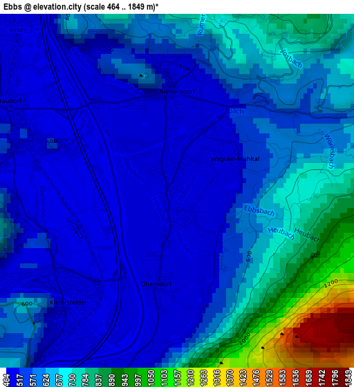
Below is the Elevation map of Ebbs, which displays elevation range with different colors. Scale of the first map is from 464 to 1849 m (1522 to 6066 ft) with average elevation of 621.4 meters (=2039 ft) [note 1]
These maps also provides idea of topography and contour of this city, they are displayed at different zoom levels. More info about maps, scale and edge coordinates you can find below images.
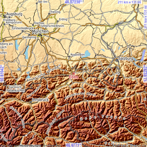
| \ | Map #1 | Topo.Map |
| Scale [m] | 464..1849 m | × |
| Scale [ft] | 1522..6066 ft | × |
| Average | 621.4 m = 2039 ft | × |
| Width | 6.59 km = 4.1 mi | 210.7 km = 130.9 mi |
| Height | 6.59 km = 4.1 mi | 210.7 km = 130.9 mi |
| ↑Max Latitude | 47.662935° | 48.57238° |
| Latitude at center | 47.63333° | 47.63333° |
| ↓Min Latitude | 47.603708° | 46.6771° |
| ← Min Longitude | 12.172725° | 10.81042° |
| Longitude center | 12.21667° | 12.21667° |
| →Max Longitude | 12.260615° | 13.62292° |
Nearby cities:
Cities around Ebbs sort by population:
• Kufstein elevation 483 m
6.7 km,  213°
213°
• Niederndorf 498 m
1.9 km,  0°
0°
• Zell 516 m
7.5 km,  221°
221°
• Schwoich 571 m
11.3 km, 210°
• Endach 492 m
8.6 km, 212°
• Weissach 499 m
8 km, 210°
• Mitterndorf 492 m
7.2 km, 209°
• Vorderthiersee 823 m
10.4 km,  237°
237°
• Walchsee 663 m
7.9 km,  75°
75°
• Erl 473 m
6.1 km,  335°
335°
• Rettenschöss 676 m
4.7 km,  55°
55°
• Thiersee 625 m
8.6 km, 239°
Multilingual:
 En español:
Ebbs elevación 475 m.
 En France:
Ebbs élévation 475 m.


Sources and notes:
- [note 1] Map square and city borders are not equal. Map elevation data is calculated only from area inside that square.
- [src 1] Elevation data from geonames database provided with same terms of usage.
- [src 2] The elevation map of Ebbs is generated using elevation data from NASA's 3 arcsec (90m) resolution SRTM data.
- [src 3] Base (background) map © OpenStreetMap contributors tiles are generated by Geofabrik and OpenTopoMap.
Copyright & License:
This Ebbs Elevation Map is licensed under CC BY-SA. You may reuse any part from this page, if you give a proper credit by linking to this URL:
 More info on terms of use page.