Elixhausen elevation
Elixhausen (Salzburg, Politischer Bezirk Salzburg-Umgebung), Austria elevation is 534 meters and Elixhausen elevation in feet is 1752 ft above sea level [src 1]. Elixhausen is a seat of a third-order administrative division (feature code) with elevation that is 25 meters (82 ft) bigger than average city elevation in Austria.
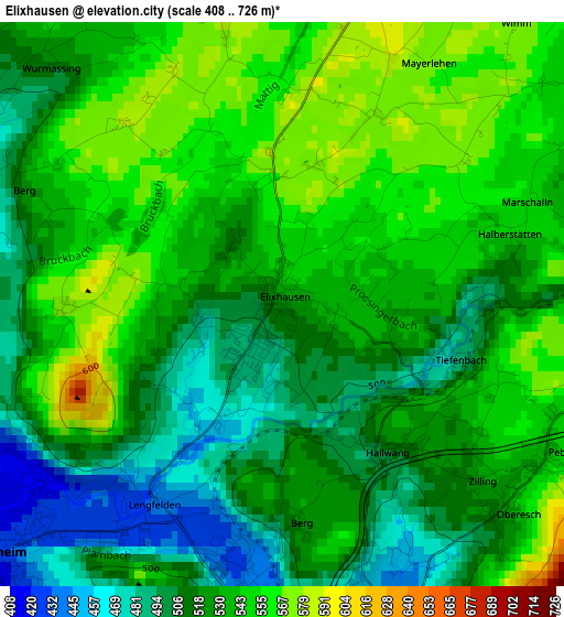
Below is the Elevation map of Elixhausen, which displays elevation range with different colors. Scale of the first map is from 408 to 726 m (1339 to 2382 ft) with average elevation of 528.7 meters (=1735 ft) [note 1]
These maps also provides idea of topography and contour of this city, they are displayed at different zoom levels. More info about maps, scale and edge coordinates you can find below images.
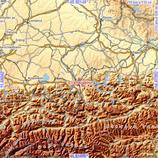
| \ | Map #1 | Topo.Map |
| Scale [m] | 408..726 m | × |
| Scale [ft] | 1339..2382 ft | × |
| Average | 528.7 m = 1735 ft | × |
| Width | 6.56 km = 4.1 mi | 209.8 km = 130.4 mi |
| Height | 6.56 km = 4.1 mi | 209.8 km = 130.4 mi |
| ↑Max Latitude | 47.896143° | 48.80149° |
| Latitude at center | 47.86667° | 47.86667° |
| ↓Min Latitude | 47.837181° | 46.91468° |
| ← Min Longitude | 13.022725° | 11.66042° |
| Longitude center | 13.06667° | 13.06667° |
| →Max Longitude | 13.110615° | 14.47292° |
Nearby cities:
Cities around Elixhausen sort by population:
• Salzburg elevation 435 m
7.7 km,  192°
192°
• Seekirchen am Wallersee 510 m
6.2 km,  53°
53°
• Bergheim 436 m
4.5 km,  213°
213°
• Eugendorf 551 m
4.4 km,  88°
88°
• Esch 468 m
3.5 km,  146°
146°
• Anthering 445 m
4.2 km,  296°
296°
• Waldprechting 530 m
5.3 km, 45°
• Lengfelden 442 m
2.2 km, 213°
• Hallwang 507 m
2.2 km, 146°
• Reitberg 622 m
6.9 km,  102°
102°
• Seewalchen 510 m
6.2 km, 53°
• Lehen 429 m
3.7 km,  277°
277°
Multilingual:
 En español:
Elixhausen elevación 534 m.
 En France:
Elixhausen élévation 534 m.
 Auf Deutsch:
Elixhausen höhe über dem Meeresspiegel ist 534 m.

Sources and notes:
- [note 1] Map square and city borders are not equal. Map elevation data is calculated only from area inside that square.
- [src 1] Elevation data from geonames database provided with same terms of usage.
- [src 2] The elevation map of Elixhausen is generated using elevation data from NASA's 3 arcsec (90m) resolution SRTM data.
- [src 3] Base (background) map © OpenStreetMap contributors tiles are generated by Geofabrik and OpenTopoMap.
Copyright & License:
This Elixhausen Elevation Map is licensed under CC BY-SA. You may reuse any part from this page, if you give a proper credit by linking to this URL:
 More info on terms of use page.