Erlauf elevation
Erlauf (Lower Austria, Politischer Bezirk Melk), Austria elevation is 223 meters and Erlauf elevation in feet is 732 ft above sea level [src 1]. Erlauf is a seat of a third-order administrative division (feature code) with elevation that is 286 meters (938 ft) smaller than average city elevation in Austria.
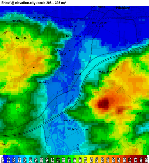
Below is the Elevation map of Erlauf, which displays elevation range with different colors. Scale of the first map is from 208 to 393 m (682 to 1289 ft) with average elevation of 266.7 meters (=875 ft) [note 1]
These maps also provides idea of topography and contour of this city, they are displayed at different zoom levels. More info about maps, scale and edge coordinates you can find below images.
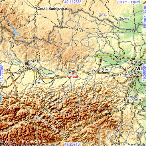
| \ | Map #1 | Topo.Map |
| Scale [m] | 208..393 m | × |
| Scale [ft] | 682..1289 ft | × |
| Average | 266.7 m = 875 ft | × |
| Width | 6.52 km = 4.1 mi | 208.5 km = 129.6 mi |
| Height | 6.52 km = 4.1 mi | 208.5 km = 129.6 mi |
| ↑Max Latitude | 48.212622° | 49.11238° |
| Latitude at center | 48.18333° | 48.18333° |
| ↓Min Latitude | 48.154021° | 47.23713° |
| ← Min Longitude | 15.139385° | 13.77708° |
| Longitude center | 15.18333° | 15.18333° |
| →Max Longitude | 15.227275° | 16.58958° |
Nearby cities:
Cities around Erlauf sort by population:
• Ybbs an der Donau elevation 218 m
7.6 km,  255°
255°
• Wieselburg 258 m
6.7 km,  213°
213°
• Pöchlarn 214 m
2.2 km,  33°
33°
• Bergland 256 m
3 km,  176°
176°
• Petzenkirchen 238 m
4.6 km, 207°
• Persenbeug 219 m
7.1 km,  273°
273°
• Krumnussbaum 215 m
3.2 km,  330°
330°
• Ruprechtshofen 241 m
8.7 km,  126°
126°
• Klein-Pöchlarn 209 m
4.5 km, 33°
• Hofamt Priel 271 m
8 km,  280°
280°
• Marbach an der Donau 256 m
4.5 km, 326°
• Maria Taferl 435 m
5.2 km,  340°
340°
Multilingual:
 En español:
Erlauf elevación 223 m.
 En France:
Erlauf élévation 223 m.


Sources and notes:
- [note 1] Map square and city borders are not equal. Map elevation data is calculated only from area inside that square.
- [src 1] Elevation data from geonames database provided with same terms of usage.
- [src 2] The elevation map of Erlauf is generated using elevation data from NASA's 3 arcsec (90m) resolution SRTM data.
- [src 3] Base (background) map © OpenStreetMap contributors tiles are generated by Geofabrik and OpenTopoMap.
Copyright & License:
This Erlauf Elevation Map is licensed under CC BY-SA. You may reuse any part from this page, if you give a proper credit by linking to this URL:
 More info on terms of use page.