Hötting elevation
Hötting (Tyrol, Innsbruck Stadt), Austria elevation is 636 meters and Hötting elevation in feet is 2087 ft above sea level [src 1]. Hötting is a section of populated place (feature code) with elevation that is 127 meters (417 ft) bigger than average city elevation in Austria.
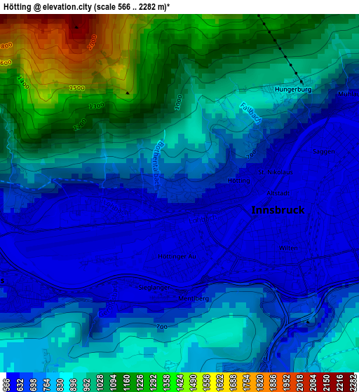
Below is the Elevation map of Hötting, which displays elevation range with different colors. Scale of the first map is from 566 to 2282 m (1857 to 7487 ft) with average elevation of 854.1 meters (=2802 ft) [note 1]
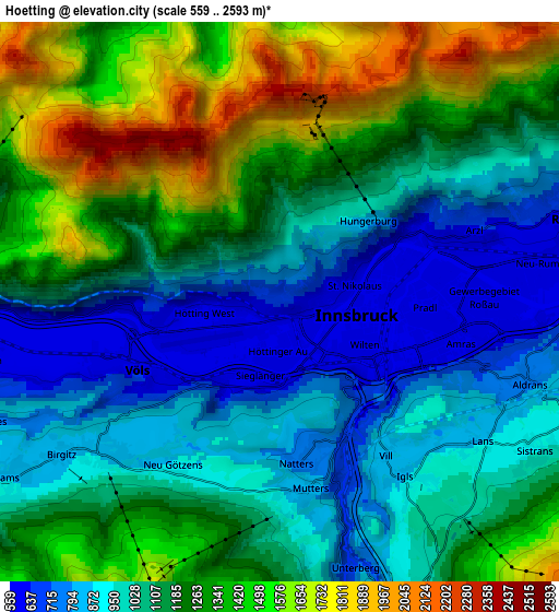
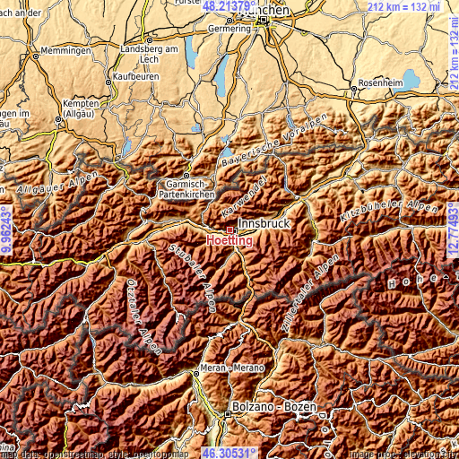
These maps also provides idea of topography and contour of this city, they are displayed at different zoom levels. More info about maps, scale and edge coordinates you can find below images.
| \ | Map #1 | Map #2 | Topo.Map |
| Scale [m] | 566..2282 m | 559..2593 m | × |
| Scale [ft] | 1857..7487 ft | 1834..8507 ft | × |
| Average | 854.1 m = 2802 ft | 1152.3 m = 3781 ft | × |
| Width | 6.63 km = 4.1 mi | 13.26 km = 8.2 mi | 212.2 km = 131.9 mi |
| Height | 6.63 km = 4.1 mi | 13.26 km = 8.2 mi | 212.2 km = 131.9 mi |
| ↑Max Latitude | 47.297961° | 47.327756° | 48.21379° |
| Latitude at center | 47.26815° | 47.26815° | 47.26815° |
| ↓Min Latitude | 47.238322° | 47.208477° | 46.30531° |
| ← Min Longitude | 11.324735° | 11.280789° | 9.96243° |
| Longitude center | 11.36868° | 11.36868° | 11.36868° |
| →Max Longitude | 11.412625° | 11.456571° | 12.77493° |
Nearby cities:
Cities around Hötting sort by population:
• Innsbruck elevation 587 m
2 km,  107°
107°
• Pradl 572 m
3.5 km,  94°
94°
• Wilten 588 m
1.8 km,  126°
126°
• Arzl 638 m
5.2 km,  70°
70°
• Völs 605 m
3.3 km,  232°
232°
• Amras 781 m
4.1 km,  119°
119°
• Mühlau 698 m
2.9 km,  54°
54°
• Götzens 868 m
5.6 km, 230°
• Igls 940 m
5.2 km,  142°
142°
• Natters 779 m
3.8 km,  174°
174°
• Mutters 776 m
4 km,  164°
164°
• Lans 863 m
5.8 km, 125°
Multilingual:
 En español:
Hötting elevación 636 m.
 En France:
Hötting élévation 636 m.


Sources and notes:
- [note 1] Map square and city borders are not equal. Map elevation data is calculated only from area inside that square.
- [src 1] Elevation data from geonames database provided with same terms of usage.
- [src 2] The elevation map of Hötting is generated using elevation data from NASA's 3 arcsec (90m) resolution SRTM data.
- [src 3] Base (background) map © OpenStreetMap contributors tiles are generated by Geofabrik and OpenTopoMap.
Copyright & License:
This Hötting Elevation Map is licensed under CC BY-SA. You may reuse any part from this page, if you give a proper credit by linking to this URL:
 More info on terms of use page.