Pitten elevation
Pitten (Lower Austria, Politischer Bezirk Neunkirchen), Austria elevation is 324 meters and Pitten elevation in feet is 1063 ft above sea level [src 1]. Pitten is a seat of a third-order administrative division (feature code) with elevation that is 185 meters (607 ft) smaller than average city elevation in Austria.
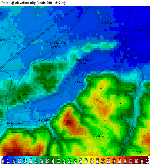
Below is the Elevation map of Pitten, which displays elevation range with different colors. Scale of the first map is from 299 to 612 m (981 to 2008 ft) with average elevation of 377.9 meters (=1240 ft) [note 1]
These maps also provides idea of topography and contour of this city, they are displayed at different zoom levels. More info about maps, scale and edge coordinates you can find below images.
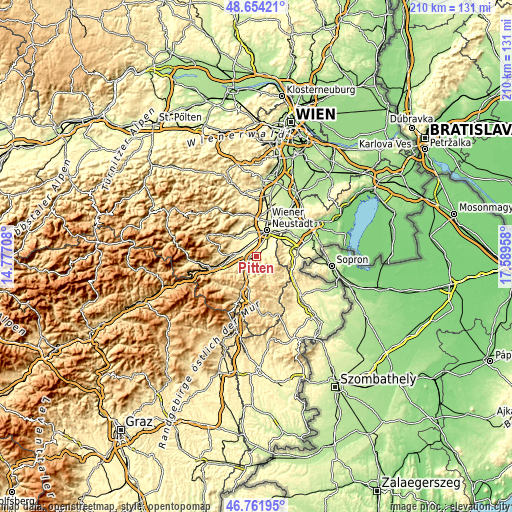
| \ | Map #1 | Topo.Map |
| Scale [m] | 299..612 m | × |
| Scale [ft] | 981..2008 ft | × |
| Average | 377.9 m = 1240 ft | × |
| Width | 6.57 km = 4.1 mi | 210.4 km = 130.7 mi |
| Height | 6.57 km = 4.1 mi | 210.4 km = 130.7 mi |
| ↑Max Latitude | 47.746228° | 48.65421° |
| Latitude at center | 47.71667° | 47.71667° |
| ↓Min Latitude | 47.687095° | 46.76195° |
| ← Min Longitude | 16.139385° | 14.77708° |
| Longitude center | 16.18333° | 16.18333° |
| →Max Longitude | 16.227275° | 17.58958° |
Nearby cities:
Cities around Pitten sort by population:
• Neunkirchen elevation 372 m
7.7 km,  273°
273°
• Bad Erlach 310 m
2.6 km,  63°
63°
• Breitenau 340 m
3.5 km,  302°
302°
• Schwarzau am Steinfeld 327 m
1.9 km,  331°
331°
• Frohsdorf 341 m
5.3 km,  69°
69°
• Seebenstein 345 m
3.5 km,  236°
236°
• Hochwolkersdorf 623 m
9.5 km,  130°
130°
• Lanzenkirchen 304 m
3.5 km,  51°
51°
• Walpersbach 375 m
3.7 km,  90°
90°
• Wartmannstetten 403 m
8.5 km,  252°
252°
• Warth 466 m
8.9 km,  213°
213°
• Bromberg 429 m
6 km,  160°
160°
Multilingual:
 En español:
Pitten elevación 324 m.
 En France:
Pitten élévation 324 m.


Sources and notes:
- [note 1] Map square and city borders are not equal. Map elevation data is calculated only from area inside that square.
- [src 1] Elevation data from geonames database provided with same terms of usage.
- [src 2] The elevation map of Pitten is generated using elevation data from NASA's 3 arcsec (90m) resolution SRTM data.
- [src 3] Base (background) map © OpenStreetMap contributors tiles are generated by Geofabrik and OpenTopoMap.
Copyright & License:
This Pitten Elevation Map is licensed under CC BY-SA. You may reuse any part from this page, if you give a proper credit by linking to this URL:
 More info on terms of use page.