Pottschach elevation
Pottschach (Lower Austria, Politischer Bezirk Neunkirchen), Austria elevation is 402 meters and Pottschach elevation in feet is 1319 ft above sea level [src 1]. Pottschach is a populated place (feature code) with elevation that is 107 meters (351 ft) smaller than average city elevation in Austria.
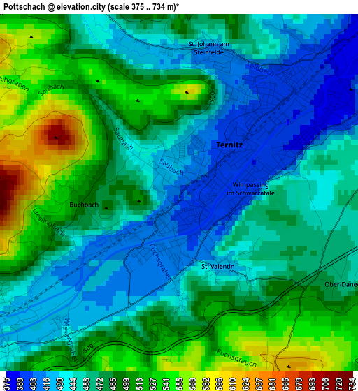
Below is the Elevation map of Pottschach, which displays elevation range with different colors. Scale of the first map is from 375 to 734 m (1230 to 2408 ft) with average elevation of 474.1 meters (=1555 ft) [note 1]
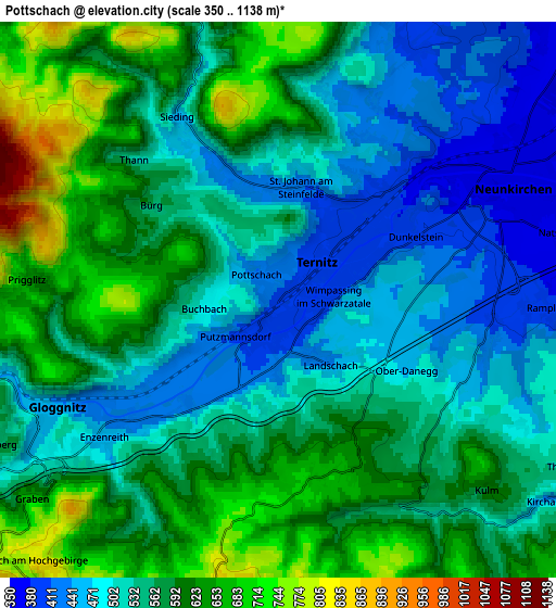
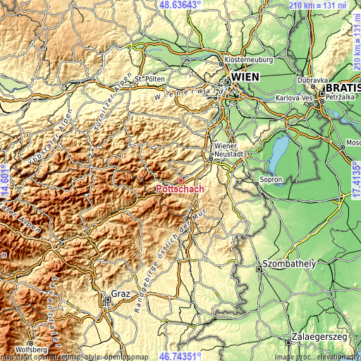
These maps also provides idea of topography and contour of this city, they are displayed at different zoom levels. More info about maps, scale and edge coordinates you can find below images.
| \ | Map #1 | Map #2 | Topo.Map |
| Scale [m] | 375..734 m | 350..1138 m | × |
| Scale [ft] | 1230..2408 ft | 1148..3734 ft | × |
| Average | 474.1 m = 1555 ft | 555.2 m = 1822 ft | × |
| Width | 6.58 km = 4.1 mi | 13.15 km = 8.2 mi | 210.5 km = 130.8 mi |
| Height | 6.58 km = 4.1 mi | 13.15 km = 8.2 mi | 210.5 km = 130.8 mi |
| ↑Max Latitude | 47.728128° | 47.75768° | 48.63643° |
| Latitude at center | 47.69856° | 47.69856° | 47.69856° |
| ↓Min Latitude | 47.668975° | 47.639373° | 46.74351° |
| ← Min Longitude | 15.963305° | 15.919359° | 14.601° |
| Longitude center | 16.00725° | 16.00725° | 16.00725° |
| →Max Longitude | 16.051195° | 16.095141° | 17.4135° |
Nearby cities:
Cities around Pottschach sort by population:
• Neunkirchen elevation 372 m
6.1 km,  65°
65°
• Ternitz 395 m
2.9 km,  48°
48°
• Gloggnitz 448 m
5.8 km,  242°
242°
• Wimpassing im Schwarzatale 394 m
2 km,  75°
75°
• Würflach 401 m
9.4 km,  22°
22°
• Enzenreith 450 m
5.3 km,  230°
230°
• Wartmannstetten 403 m
5.1 km,  96°
96°
• Prigglitz 637 m
6 km,  274°
274°
• Buchbach 488 m
1.7 km,  262°
262°
• Altendorf 644 m
5.4 km,  172°
172°
• Raach am Hochgebirge 771 m
9.1 km,  217°
217°
• Schrattenbach 556 m
9 km,  352°
352°
Multilingual:
 En español:
Pottschach elevación 402 m.
 En France:
Pottschach élévation 402 m.
 Auf Deutsch:
Pottschach höhe über dem Meeresspiegel ist 402 m.

Sources and notes:
- [note 1] Map square and city borders are not equal. Map elevation data is calculated only from area inside that square.
- [src 1] Elevation data from geonames database provided with same terms of usage.
- [src 2] The elevation map of Pottschach is generated using elevation data from NASA's 3 arcsec (90m) resolution SRTM data.
- [src 3] Base (background) map © OpenStreetMap contributors tiles are generated by Geofabrik and OpenTopoMap.
Copyright & License:
This Pottschach Elevation Map is licensed under CC BY-SA. You may reuse any part from this page, if you give a proper credit by linking to this URL:
 More info on terms of use page.