Ternitz elevation
Ternitz (Lower Austria, Politischer Bezirk Neunkirchen), Austria elevation is 395 meters and Ternitz elevation in feet is 1296 ft above sea level [src 1]. Ternitz is a seat of a third-order administrative division (feature code) with elevation that is 114 meters (374 ft) smaller than average city elevation in Austria.
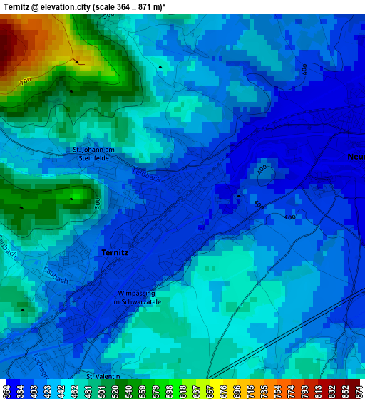
Below is the Elevation map of Ternitz, which displays elevation range with different colors. Scale of the first map is from 364 to 871 m (1194 to 2858 ft) with average elevation of 442 meters (=1450 ft) [note 1]
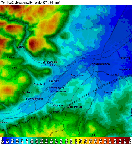
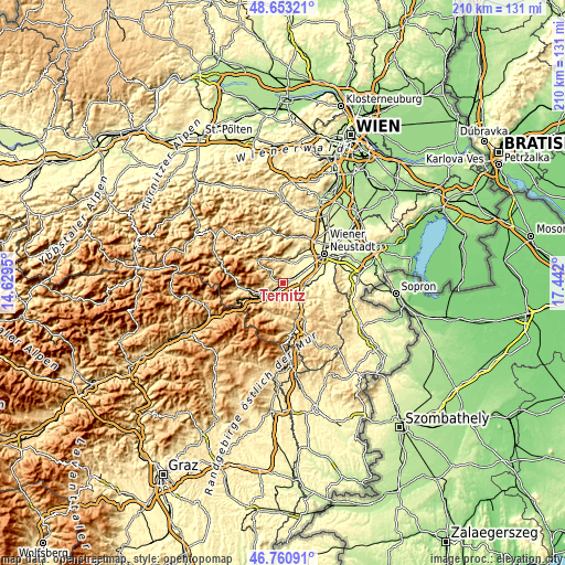
These maps also provides idea of topography and contour of this city, they are displayed at different zoom levels. More info about maps, scale and edge coordinates you can find below images.
| \ | Map #1 | Map #2 | Topo.Map |
| Scale [m] | 364..871 m | 327..941 m | × |
| Scale [ft] | 1194..2858 ft | 1073..3087 ft | × |
| Average | 442 m = 1450 ft | 496.6 m = 1629 ft | × |
| Width | 6.58 km = 4.1 mi | 13.15 km = 8.2 mi | 210.4 km = 130.7 mi |
| Height | 6.57 km = 4.1 mi | 13.15 km = 8.2 mi | 210.4 km = 130.7 mi |
| ↑Max Latitude | 47.745208° | 47.77475° | 48.65321° |
| Latitude at center | 47.71565° | 47.71565° | 47.71565° |
| ↓Min Latitude | 47.686075° | 47.656483° | 46.76091° |
| ← Min Longitude | 15.991805° | 15.947859° | 14.6295° |
| Longitude center | 16.03575° | 16.03575° | 16.03575° |
| →Max Longitude | 16.079695° | 16.123641° | 17.442° |
Nearby cities:
Cities around Ternitz sort by population:
• Neunkirchen elevation 372 m
3.4 km,  80°
80°
• Pottschach 402 m
2.9 km,  228°
228°
• Wimpassing im Schwarzatale 394 m
1.4 km,  187°
187°
• Breitenau 340 m
8.3 km, 76°
• Würflach 401 m
6.9 km,  11°
11°
• Enzenreith 450 m
8.2 km, 229°
• Willendorf am Steinfelde 391 m
8.3 km, 10°
• Wartmannstetten 403 m
3.8 km,  129°
129°
• Prigglitz 637 m
8.2 km,  260°
260°
• Buchbach 488 m
4.4 km,  241°
241°
• Altendorf 644 m
7.4 km, 191°
• Schrattenbach 556 m
7.8 km,  334°
334°
Multilingual:
 En español:
Ternitz elevación 395 m.
 En France:
Ternitz élévation 395 m.


Sources and notes:
- [note 1] Map square and city borders are not equal. Map elevation data is calculated only from area inside that square.
- [src 1] Elevation data from geonames database provided with same terms of usage.
- [src 2] The elevation map of Ternitz is generated using elevation data from NASA's 3 arcsec (90m) resolution SRTM data.
- [src 3] Base (background) map © OpenStreetMap contributors tiles are generated by Geofabrik and OpenTopoMap.
Copyright & License:
This Ternitz Elevation Map is licensed under CC BY-SA. You may reuse any part from this page, if you give a proper credit by linking to this URL:
 More info on terms of use page.