Prambachkirchen elevation
Prambachkirchen (Upper Austria, Politischer Bezirk Eferding), Austria elevation is 374 meters and Prambachkirchen elevation in feet is 1227 ft above sea level [src 1]. Prambachkirchen is a seat of a third-order administrative division (feature code) with elevation that is 135 meters (443 ft) smaller than average city elevation in Austria.
Below is the Elevation map of Prambachkirchen, which displays elevation range with different colors. Scale of the first map is from 298 to 536 m (978 to 1759 ft) with average elevation of 392.1 meters (=1286 ft) [note 1]
These maps also provides idea of topography and contour of this city, they are displayed at different zoom levels. More info about maps, scale and edge coordinates you can find below images.
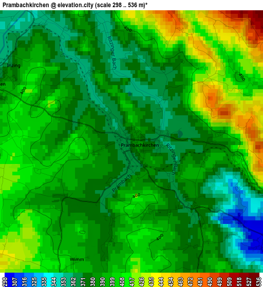
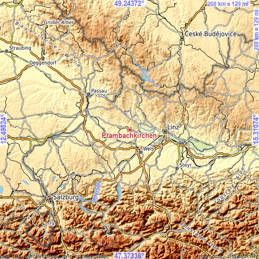
| \ | Map #1 | Topo.Map |
| Scale [m] | 298..536 m | × |
| Scale [ft] | 978..1759 ft | × |
| Average | 392.1 m = 1286 ft | × |
| Width | 6.5 km = 4 mi | 208 km = 129.2 mi |
| Height | 6.5 km = 4 mi | 207.9 km = 129.2 mi |
| ↑Max Latitude | 48.346326° | 49.24372° |
| Latitude at center | 48.31711° | 48.31711° |
| ↓Min Latitude | 48.287878° | 47.37336° |
| ← Min Longitude | 13.860545° | 12.49824° |
| Longitude center | 13.90449° | 13.90449° |
| →Max Longitude | 13.948435° | 15.31074° |
Nearby cities:
Cities around Prambachkirchen sort by population:
• Grieskirchen elevation 334 m
10.7 km,  209°
209°
• Eferding 271 m
8.8 km,  96°
96°
• Bad Schallerbach 309 m
9.7 km,  173°
173°
• Wallern an der Trattnach 300 m
9.9 km,  161°
161°
• Aschach an der Donau 273 m
10.1 km,  58°
58°
• Peuerbach 394 m
10.3 km,  287°
287°
• Waizenkirchen 368 m
3.8 km, 292°
• Hartkirchen 271 m
9 km, 55°
• Feldkirchen an der Donau 266 m
11.3 km,  73°
73°
• Schlüsslberg 322 m
11.2 km,  192°
192°
• Michaelnbach 392 m
6.3 km,  238°
238°
• Pötting 379 m
10.6 km,  249°
249°
Multilingual:
 En español:
Prambachkirchen elevación 374 m.
 En France:
Prambachkirchen élévation 374 m.
 Auf Deutsch:
Prambachkirchen höhe über dem Meeresspiegel ist 374 m.

Sources and notes:
- [note 1] Map square and city borders are not equal. Map elevation data is calculated only from area inside that square.
- [src 1] Elevation data from geonames database provided with same terms of usage.
- [src 2] The elevation map of Prambachkirchen is generated using elevation data from NASA's 3 arcsec (90m) resolution SRTM data.
- [src 3] Base (background) map © OpenStreetMap contributors tiles are generated by Geofabrik and OpenTopoMap.
Copyright & License:
This Prambachkirchen Elevation Map is licensed under CC BY-SA. You may reuse any part from this page, if you give a proper credit by linking to this URL:
 More info on terms of use page.