Purgstall elevation
Purgstall (Lower Austria, Politischer Bezirk Scheibbs), Austria elevation is 297 meters and Purgstall elevation in feet is 974 ft above sea level [src 1]. Purgstall is a seat of a third-order administrative division (feature code) with elevation that is 212 meters (696 ft) smaller than average city elevation in Austria.
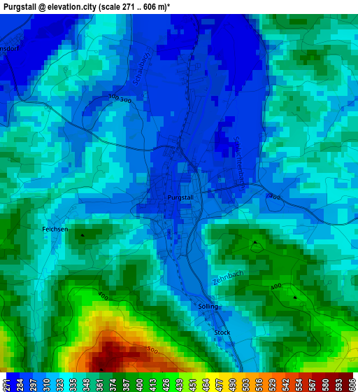
Below is the Elevation map of Purgstall, which displays elevation range with different colors. Scale of the first map is from 271 to 606 m (889 to 1988 ft) with average elevation of 340.4 meters (=1117 ft) [note 1]
These maps also provides idea of topography and contour of this city, they are displayed at different zoom levels. More info about maps, scale and edge coordinates you can find below images.
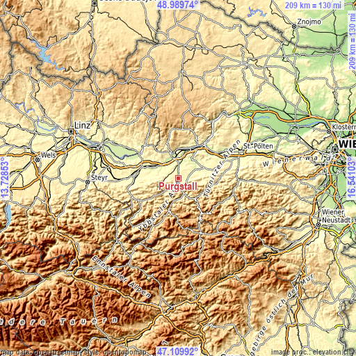
| \ | Map #1 | Topo.Map |
| Scale [m] | 271..606 m | × |
| Scale [ft] | 889..1988 ft | × |
| Average | 340.4 m = 1117 ft | × |
| Width | 6.53 km = 4.1 mi | 209 km = 129.9 mi |
| Height | 6.53 km = 4.1 mi | 209 km = 129.9 mi |
| ↑Max Latitude | 48.087773° | 48.98974° |
| Latitude at center | 48.05841° | 48.05841° |
| ↓Min Latitude | 48.02903° | 47.10992° |
| ← Min Longitude | 15.090835° | 13.72853° |
| Longitude center | 15.13478° | 15.13478° |
| →Max Longitude | 15.178725° | 16.54103° |
Nearby cities:
Cities around Purgstall sort by population:
• Scheibbs elevation 344 m
6.5 km,  157°
157°
• Wieselburg 258 m
8.3 km,  359°
359°
• Bergland 256 m
11.5 km,  19°
19°
• Petzenkirchen 238 m
10 km,  8°
8°
• Neumarkt an der Ybbs 227 m
10.8 km,  328°
328°
• Steinakirchen am Forst 321 m
6.6 km,  280°
280°
• Oberndorf an der Melk 321 m
6.7 km,  84°
84°
• Wang 321 m
8.2 km,  259°
259°
• Wolfpassing 298 m
5.6 km,  292°
292°
• Reinsberg 477 m
9.4 km,  210°
210°
• Sankt Georgen an der Leys 380 m
7.5 km,  113°
113°
• Höfling 327 m
7.3 km,  266°
266°
Multilingual:
 En español:
Purgstall elevación 297 m.
 En France:
Purgstall élévation 297 m.
 Auf Deutsch:
Purgstall höhe über dem Meeresspiegel ist 297 m.

Sources and notes:
- [note 1] Map square and city borders are not equal. Map elevation data is calculated only from area inside that square.
- [src 1] Elevation data from geonames database provided with same terms of usage.
- [src 2] The elevation map of Purgstall is generated using elevation data from NASA's 3 arcsec (90m) resolution SRTM data.
- [src 3] Base (background) map © OpenStreetMap contributors tiles are generated by Geofabrik and OpenTopoMap.
Copyright & License:
This Purgstall Elevation Map is licensed under CC BY-SA. You may reuse any part from this page, if you give a proper credit by linking to this URL:
 More info on terms of use page.