Schweiggers elevation
Schweiggers (Lower Austria, Politischer Bezirk Zwettl), Austria elevation is 638 meters and Schweiggers elevation in feet is 2093 ft above sea level [src 1]. Schweiggers is a seat of a third-order administrative division (feature code) with elevation that is 129 meters (423 ft) bigger than average city elevation in Austria.
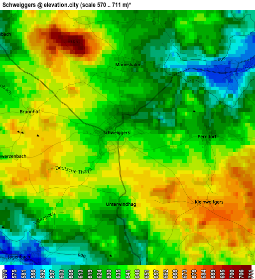
Below is the Elevation map of Schweiggers, which displays elevation range with different colors. Scale of the first map is from 570 to 711 m (1870 to 2333 ft) with average elevation of 636.5 meters (=2088 ft) [note 1]
These maps also provides idea of topography and contour of this city, they are displayed at different zoom levels. More info about maps, scale and edge coordinates you can find below images.
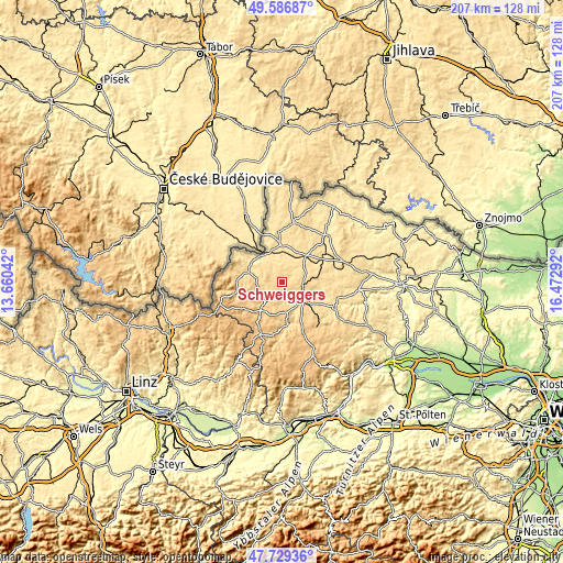
| \ | Map #1 | Topo.Map |
| Scale [m] | 570..711 m | × |
| Scale [ft] | 1870..2333 ft | × |
| Average | 636.5 m = 2088 ft | × |
| Width | 6.45 km = 4 mi | 206.5 km = 128.3 mi |
| Height | 6.45 km = 4 mi | 206.5 km = 128.3 mi |
| ↑Max Latitude | 48.695685° | 49.58687° |
| Latitude at center | 48.66667° | 48.66667° |
| ↓Min Latitude | 48.637638° | 47.72936° |
| ← Min Longitude | 15.022725° | 13.66042° |
| Longitude center | 15.06667° | 15.06667° |
| →Max Longitude | 15.110615° | 16.47292° |
Nearby cities:
Cities around Schweiggers sort by population:
• Gmünd elevation 497 m
12.9 km,  330°
330°
• Zwettl Stadt 537 m
9.9 km,  131°
131°
• Schrems 526 m
13 km,  0°
0°
• Weitra 569 m
14 km,  285°
285°
• Vitis 520 m
13.4 km,  39°
39°
• Groß-Gerungs 677 m
13 km,  217°
217°
• Hoheneich 505 m
12 km,  346°
346°
• Echsenbach 555 m
12.3 km,  63°
63°
• Kirchberg am Walde 577 m
6.7 km,  13°
13°
• Hirschbach 539 m
9.5 km,  26°
26°
• Waldenstein 578 m
7.9 km, 330°
• Rappottenstein 666 m
16.2 km,  176°
176°
Multilingual:
 En español:
Schweiggers elevación 638 m.
 En France:
Schweiggers élévation 638 m.
 Auf Deutsch:
Schweiggers höhe über dem Meeresspiegel ist 638 m.

Sources and notes:
- [note 1] Map square and city borders are not equal. Map elevation data is calculated only from area inside that square.
- [src 1] Elevation data from geonames database provided with same terms of usage.
- [src 2] The elevation map of Schweiggers is generated using elevation data from NASA's 3 arcsec (90m) resolution SRTM data.
- [src 3] Base (background) map © OpenStreetMap contributors tiles are generated by Geofabrik and OpenTopoMap.
Copyright & License:
This Schweiggers Elevation Map is licensed under CC BY-SA. You may reuse any part from this page, if you give a proper credit by linking to this URL:
 More info on terms of use page.