Trumau elevation
Trumau (Lower Austria, Politischer Bezirk Baden), Austria elevation is 201 meters and Trumau elevation in feet is 659 ft above sea level [src 1]. Trumau is a seat of a third-order administrative division (feature code) with elevation that is 308 meters (1010 ft) smaller than average city elevation in Austria.
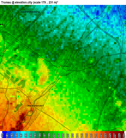
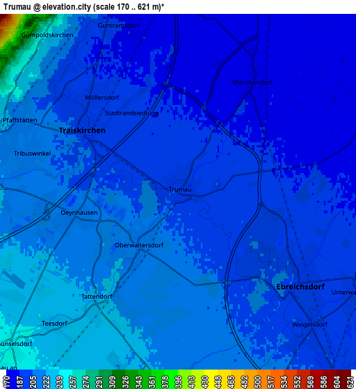
Below is the Elevation map of Trumau, which displays elevation range with different colors. Scale of the first map is from 179 to 231 m (587 to 758 ft) with average elevation of 199.8 meters (=656 ft) [note 1]
These maps also provides idea of topography and contour of this city, they are displayed at different zoom levels. More info about maps, scale and edge coordinates you can find below images.
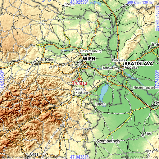
| \ | Map #1 | Map #2 | Topo.Map |
| Scale [m] | 179..231 m | 170..621 m | × |
| Scale [ft] | 587..758 ft | 558..2037 ft | × |
| Average | 199.8 m = 656 ft | 204 m = 669 ft | × |
| Width | 6.54 km = 4.1 mi | 13.08 km = 8.1 mi | 209.3 km = 130.1 mi |
| Height | 6.54 km = 4.1 mi | 13.08 km = 8.1 mi | 209.3 km = 130.1 mi |
| ↑Max Latitude | 48.02288° | 48.052264° | 48.92599° |
| Latitude at center | 47.99348° | 47.99348° | 47.99348° |
| ↓Min Latitude | 47.964063° | 47.934629° | 47.04381° |
| ← Min Longitude | 16.298735° | 16.254789° | 14.93643° |
| Longitude center | 16.34268° | 16.34268° | 16.34268° |
| →Max Longitude | 16.386625° | 16.430571° | 17.74893° |
Nearby cities:
Cities around Trumau sort by population:
• Guntramsdorf elevation 188 m
6.3 km,  340°
340°
• Traiskirchen 204 m
4.4 km,  302°
302°
• Ebreichsdorf 199 m
6.4 km,  131°
131°
• Oberwaltersdorf 212 m
2.5 km,  217°
217°
• Möllersdorf 194 m
4.5 km,  322°
322°
• Tribuswinkel 211 m
5.5 km,  284°
284°
• Münchendorf 183 m
5.4 km,  34°
34°
• Wienersdorf 204 m
4.1 km,  293°
293°
• Weigelsdorf 202 m
6.4 km,  138°
138°
• Teesdorf 234 m
6.5 km, 222°
• Tattendorf 229 m
5.8 km,  213°
213°
• Oeynhausen 214 m
3.9 km,  256°
256°
Multilingual:
 En español:
Trumau elevación 201 m.
 En France:
Trumau élévation 201 m.


Sources and notes:
- [note 1] Map square and city borders are not equal. Map elevation data is calculated only from area inside that square.
- [src 1] Elevation data from geonames database provided with same terms of usage.
- [src 2] The elevation map of Trumau is generated using elevation data from NASA's 3 arcsec (90m) resolution SRTM data.
- [src 3] Base (background) map © OpenStreetMap contributors tiles are generated by Geofabrik and OpenTopoMap.
Copyright & License:
This Trumau Elevation Map is licensed under CC BY-SA. You may reuse any part from this page, if you give a proper credit by linking to this URL:
 More info on terms of use page.