Waidhofen an der Thaya elevation
Waidhofen an der Thaya (Lower Austria, Politischer Bezirk Waidhofen an der Thaya), Austria elevation is 493 meters and Waidhofen an der Thaya elevation in feet is 1617 ft above sea level [src 1]. Waidhofen an der Thaya is a seat of a third-order administrative division (feature code) with elevation that is 16 meters (52 ft) smaller than average city elevation in Austria.
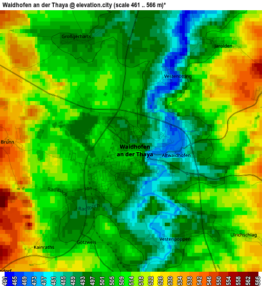
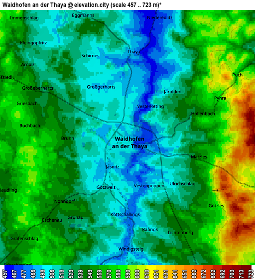
Below is the Elevation map of Waidhofen an der Thaya, which displays elevation range with different colors. Scale of the first map is from 461 to 566 m (1512 to 1857 ft) with average elevation of 507.9 meters (=1666 ft) [note 1]
These maps also provides idea of topography and contour of this city, they are displayed at different zoom levels. More info about maps, scale and edge coordinates you can find below images.
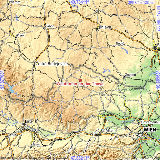
| \ | Map #1 | Map #2 | Topo.Map |
| Scale [m] | 461..566 m | 457..723 m | × |
| Scale [ft] | 1512..1857 ft | 1499..2372 ft | × |
| Average | 507.9 m = 1666 ft | 543.9 m = 1784 ft | × |
| Width | 6.43 km = 4 mi | 12.87 km = 8 mi | 205.9 km = 127.9 mi |
| Height | 6.43 km = 4 mi | 12.87 km = 8 mi | 205.9 km = 127.9 mi |
| ↑Max Latitude | 48.845598° | 48.87451° | 49.73411° |
| Latitude at center | 48.81667° | 48.81667° | 48.81667° |
| ↓Min Latitude | 48.787725° | 48.758763° | 47.88213° |
| ← Min Longitude | 15.239385° | 15.195439° | 13.87708° |
| Longitude center | 15.28333° | 15.28333° | 15.28333° |
| →Max Longitude | 15.327275° | 15.371221° | 16.68958° |
Nearby cities:
Cities around Waidhofen an der Thaya sort by population:
• Heidenreichstein elevation 568 m
13.4 km,  294°
294°
• Groß-Siegharts 527 m
9.3 km,  107°
107°
• Allentsteig 547 m
13.7 km,  166°
166°
• Vitis 520 m
9.7 km,  229°
229°
• Schwarzenau 499 m
8.2 km,  192°
192°
• Echsenbach 555 m
12.1 km,  203°
203°
• Dobersberg 472 m
11.3 km,  14°
14°
• Göpfritz an der Wild 582 m
13.4 km,  139°
139°
• Thaya 486 m
4.3 km, 5°
• Kautzen 521 m
13 km,  345°
345°
• Gastern 504 m
9.8 km,  331°
331°
• Windigsteig 485 m
5.6 km,  180°
180°
Multilingual:
 En español:
Waidhofen an der Thaya elevación 493 m.
 En France:
Waidhofen an der Thaya élévation 493 m.
 Auf Deutsch:
Waidhofen an der Thaya höhe über dem Meeresspiegel ist 493 m.
 На русском:
Вайдхофен-ан-дер-Тайя высота над уровнем моря 493 м
Sources and notes:
- [note 1] Map square and city borders are not equal. Map elevation data is calculated only from area inside that square.
- [src 1] Elevation data from geonames database provided with same terms of usage.
- [src 2] The elevation map of Waidhofen an der Thaya is generated using elevation data from NASA's 3 arcsec (90m) resolution SRTM data.
- [src 3] Base (background) map © OpenStreetMap contributors tiles are generated by Geofabrik and OpenTopoMap.
Copyright & License:
This Waidhofen an der Thaya Elevation Map is licensed under CC BY-SA. You may reuse any part from this page, if you give a proper credit by linking to this URL:
 More info on terms of use page.