Cafayate elevation
Cafayate (Salta), Argentina elevation is 1625 meters and Cafayate elevation in feet is 5331 ft above sea level [src 1]. Cafayate is a populated place (feature code) with elevation that is 1275 meters (4183 ft) bigger than average city elevation in Argentina.
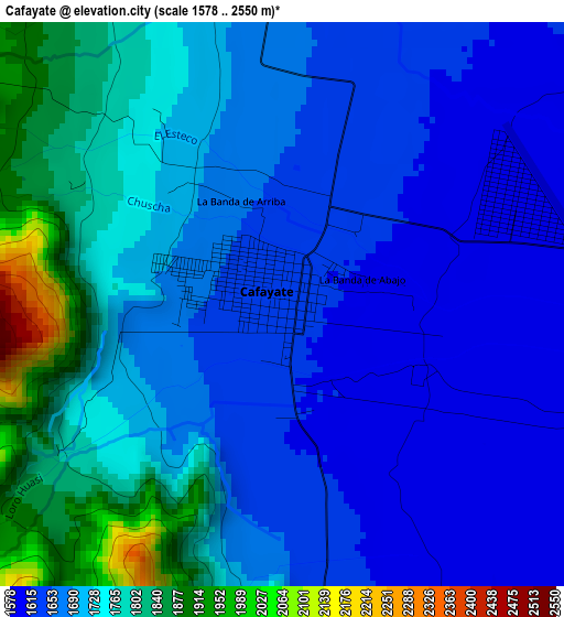
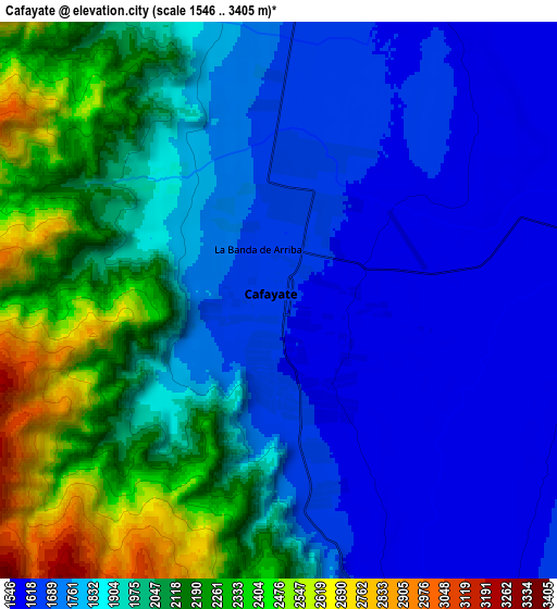
Below is the Elevation map of Cafayate, which displays elevation range with different colors. Scale of the first map is from 1578 to 2550 m (5177 to 8366 ft) with average elevation of 1704.9 meters (=5594 ft) [note 1]
These maps also provides idea of topography and contour of this city, they are displayed at different zoom levels. More info about maps, scale and edge coordinates you can find below images.
| \ | Map #1 | Map #2 | Topo.Map |
| Scale [m] | 1578..2550 m | 1546..3405 m | × |
| Scale [ft] | 5177..8366 ft | 5072..11171 ft | × |
| Average | 1704.9 m = 5594 ft | 1916.4 m = 6287 ft | × |
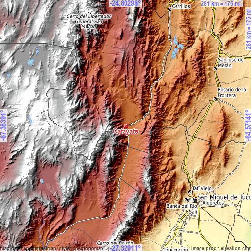
| Width | 8.78 km = 5.5 mi | 17.56 km = 10.9 mi | 280.9 km = 174.5 mi |
| Height | 8.78 km = 5.5 mi | 17.56 km = 10.9 mi | 280.9 km = 174.5 mi |
| ↑Max Latitude | -26.03338° | -25.993887° | -24.80298° |
| Latitude at center | -26.07286° | -26.07286° | -26.07286° |
| ↓Min Latitude | -26.112327° | -26.15178° | -27.32911° |
| ← Min Longitude | -66.021605° | -66.065551° | -67.38391° |
| Longitude center | -65.97766° | -65.97766° | -65.97766° |
| →Max Longitude | -65.933715° | -65.889769° | -64.57141° |
Nearby cities:
Cities around Cafayate sort by population:
• Yerba Buena elevation 515 m
105.7 km,  141°
141°
• Tafí Viejo 629 m
102.4 km, 135°
• Trancas 780 m
71.7 km,  104°
104°
• Tafí del Valle 2000 m
90.7 km,  162°
162°
• Cachí 2355 m
107.6 km,  349°
349°
• Rosario de la Frontera 787 m
105.2 km,  73°
73°
• La Candelaria 1042 m
92.9 km,  93°
93°
• La Viña 1193 m
79 km,  31°
31°
• Guachipas 1096 m
77.3 km,  37°
37°
• Molinos 2042 m
77.2 km,  335°
335°
• Santa María 1885 m
69.6 km,  185°
185°
• San Carlos 1630 m
21.3 km,  13°
13°
Multilingual:
 En español:
Cafayate elevación 1625 m.
 En France:
Cafayate élévation 1625 m.
 Auf Deutsch:
Cafayate höhe über dem Meeresspiegel ist 1625 m.

Sources and notes:
- [note 1] Map square and city borders are not equal. Map elevation data is calculated only from area inside that square.
- [src 1] Elevation data from geonames database provided with same terms of usage.
- [src 2] The elevation map of Cafayate is generated using elevation data from NASA's 3 arcsec (90m) resolution SRTM data.
- [src 3] Base (background) map © OpenStreetMap contributors tiles are generated by Geofabrik and OpenTopoMap.
Copyright & License:
This Cafayate Elevation Map is licensed under CC BY-SA. You may reuse any part from this page, if you give a proper credit by linking to this URL:
 More info on terms of use page.