El Quebrachal elevation
El Quebrachal (Salta, Departamento de Anta), Argentina elevation is 355 meters and El Quebrachal elevation in feet is 1165 ft above sea level [src 1]. El Quebrachal is a populated place (feature code) with elevation that is 5 meters (16 ft) bigger than average city elevation in Argentina.
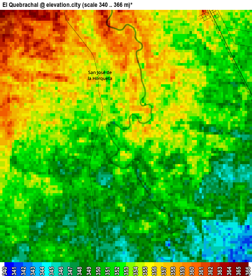
Below is the Elevation map of El Quebrachal, which displays elevation range with different colors. Scale of the first map is from 340 to 366 m (1115 to 1201 ft) with average elevation of 352.2 meters (=1156 ft) [note 1]
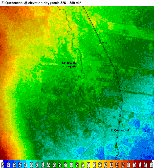
These maps also provides idea of topography and contour of this city, they are displayed at different zoom levels. More info about maps, scale and edge coordinates you can find below images.
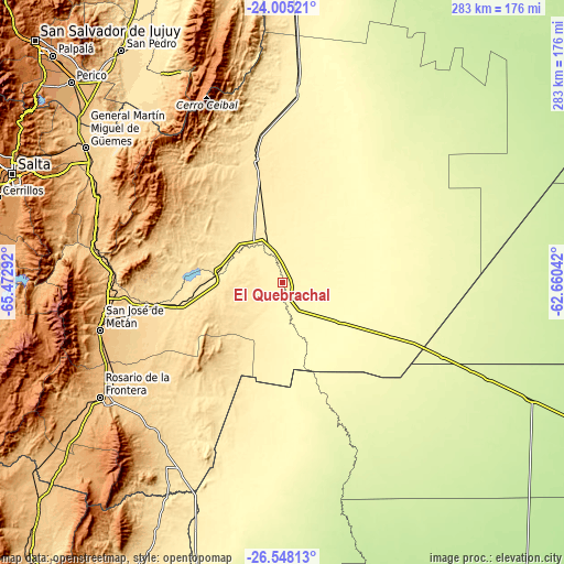
| \ | Map #1 | Map #2 | Topo.Map |
| Scale [m] | 340..366 m | 328..389 m | × |
| Scale [ft] | 1115..1201 ft | 1076..1276 ft | × |
| Average | 352.2 m = 1156 ft | 353.1 m = 1158 ft | × |
| Width | 8.84 km = 5.5 mi | 17.67 km = 11 mi | 282.7 km = 175.7 mi |
| Height | 8.84 km = 5.5 mi | 17.67 km = 11 mi | 282.8 km = 175.7 mi |
| ↑Max Latitude | -25.243588° | -25.203833° | -24.00521° |
| Latitude at center | -25.28333° | -25.28333° | -25.28333° |
| ↓Min Latitude | -25.323059° | -25.362775° | -26.54813° |
| ← Min Longitude | -64.110615° | -64.154561° | -65.47292° |
| Longitude center | -64.06667° | -64.06667° | -64.06667° |
| →Max Longitude | -64.022725° | -63.978779° | -62.66042° |
Nearby cities:
Cities around El Quebrachal sort by population:
• Joaquín V. González elevation 362 m
19.8 km,  342°
342°
• Las Lajitas 440 m
63.1 km,  348°
348°
• Apolinario Saravia 361 m
94.8 km,  4°
4°
• Taco Pozo 261 m
88.4 km,  114°
114°
• El Galpón 527 m
59.9 km,  259°
259°
• Santa Clara 573 m
123.9 km,  330°
330°
• Monte Quemado 224 m
137 km,  115°
115°
• La Candelaria 1042 m
136 km,  226°
226°
• General Martín Miguel de Güemes 742 m
120.1 km,  304°
304°
• Rosario de la Frontera 787 m
107.2 km,  237°
237°
• Nueva Esperanza 324 m
103.3 km,  189°
189°
• Metán 860 m
94.2 km, 255°
Multilingual:
 En español:
El Quebrachal elevación 355 m.
 En France:
El Quebrachal élévation 355 m.
 Auf Deutsch:
El Quebrachal höhe über dem Meeresspiegel ist 355 m.

Sources and notes:
- [note 1] Map square and city borders are not equal. Map elevation data is calculated only from area inside that square.
- [src 1] Elevation data from geonames database provided with same terms of usage.
- [src 2] The elevation map of El Quebrachal is generated using elevation data from NASA's 3 arcsec (90m) resolution SRTM data.
- [src 3] Base (background) map © OpenStreetMap contributors tiles are generated by Geofabrik and OpenTopoMap.
Copyright & License:
This El Quebrachal Elevation Map is licensed under CC BY-SA. You may reuse any part from this page, if you give a proper credit by linking to this URL:
 More info on terms of use page.