Las Perdices elevation
Las Perdices (Cordoba, Departamento de Tercero Arriba), Argentina elevation is 253 meters and Las Perdices elevation in feet is 830 ft above sea level [src 1]. Las Perdices is a populated place (feature code) with elevation that is 97 meters (318 ft) smaller than average city elevation in Argentina.
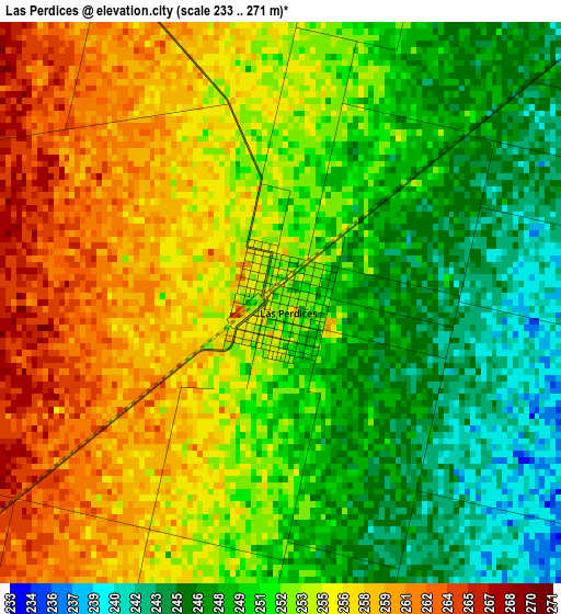
Below is the Elevation map of Las Perdices, which displays elevation range with different colors. Scale of the first map is from 233 to 271 m (764 to 889 ft) with average elevation of 252.6 meters (=829 ft) [note 1]
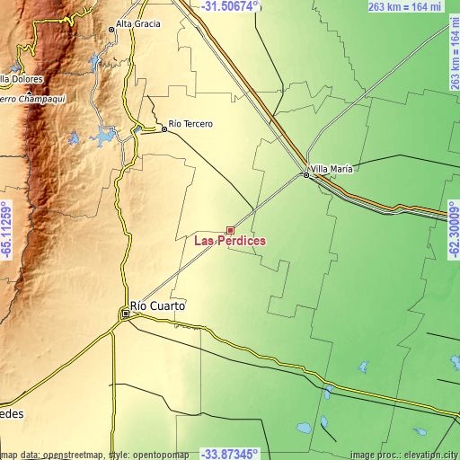
These maps also provides idea of topography and contour of this city, they are displayed at different zoom levels. More info about maps, scale and edge coordinates you can find below images.
| \ | Map #1 | Map #2 | Topo.Map |
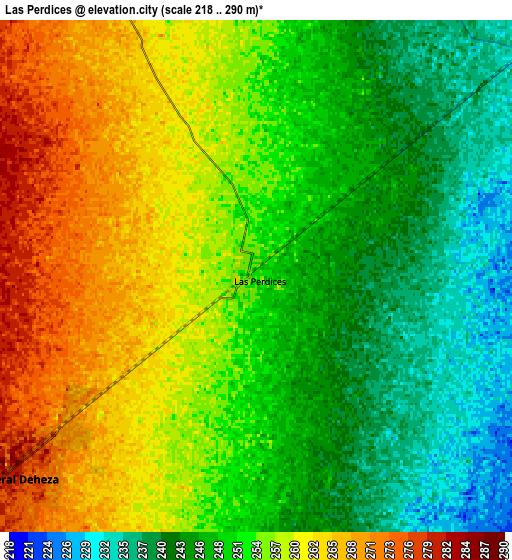
| Scale [m] | 233..271 m | 218..290 m | × |
| Scale [ft] | 764..889 ft | 715..951 ft | × |
| Average | 252.6 m = 829 ft | 252.7 m = 829 ft | × |
| Width | 8.22 km = 5.1 mi | 16.45 km = 10.2 mi | 263.2 km = 163.5 mi |
| Height | 8.22 km = 5.1 mi | 16.45 km = 10.2 mi | 263.2 km = 163.5 mi |
| ↑Max Latitude | -32.660951° | -32.623947° | -31.50674° |
| Latitude at center | -32.69794° | -32.69794° | -32.69794° |
| ↓Min Latitude | -32.734914° | -32.771872° | -33.87345° |
| ← Min Longitude | -63.750285° | -63.794231° | -65.11259° |
| Longitude center | -63.70634° | -63.70634° | -63.70634° |
| →Max Longitude | -63.662395° | -63.618449° | -62.30009° |
Nearby cities:
Cities around Las Perdices sort by population:
• Villa María elevation 202 m
54.3 km,  53°
53°
• Villa Nueva 204 m
52.1 km,  55°
55°
• Hernando 279 m
30.3 km,  355°
355°
• General Cabrera 298 m
20.1 km,  230°
230°
• Ucacha 197 m
41.6 km,  153°
153°
• Etruria 163 m
50.7 km,  122°
122°
• Arroyo Cabral 223 m
36.7 km, 51°
• Ticino 204 m
25.3 km,  88°
88°
• Carnerillo 322 m
38 km, 230°
• Dalmacio Vélez Sársfield 235 m
15.3 km, 50°
• Pasco 187 m
34.5 km,  99°
99°
• Charras 350 m
48.2 km,  221°
221°
Multilingual:
 En español:
Las Perdices elevación 253 m.
 En France:
Las Perdices élévation 253 m.
 Auf Deutsch:
Las Perdices höhe über dem Meeresspiegel ist 253 m.

Sources and notes:
- [note 1] Map square and city borders are not equal. Map elevation data is calculated only from area inside that square.
- [src 1] Elevation data from geonames database provided with same terms of usage.
- [src 2] The elevation map of Las Perdices is generated using elevation data from NASA's 3 arcsec (90m) resolution SRTM data.
- [src 3] Base (background) map © OpenStreetMap contributors tiles are generated by Geofabrik and OpenTopoMap.
Copyright & License:
This Las Perdices Elevation Map is licensed under CC BY-SA. You may reuse any part from this page, if you give a proper credit by linking to this URL:
 More info on terms of use page.