Oliva elevation
Oliva (Cordoba, Departamento de Tercero Arriba), Argentina elevation is 267 meters and Oliva elevation in feet is 876 ft above sea level [src 1]. Oliva is a seat of a second-order administrative division (feature code) with elevation that is 83 meters (272 ft) smaller than average city elevation in Argentina.
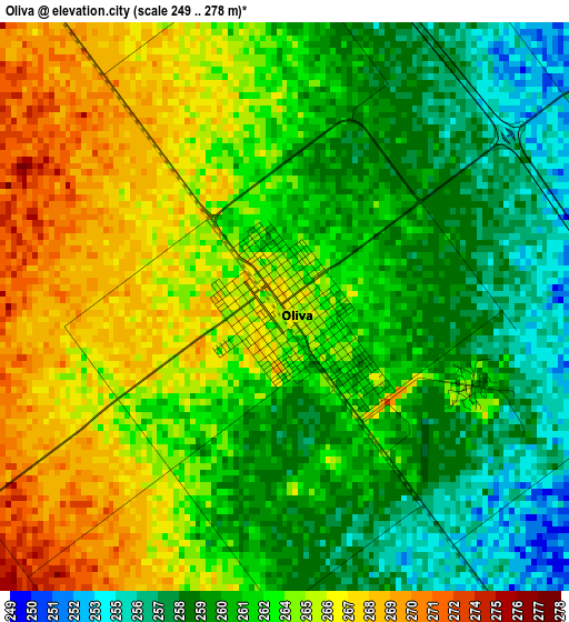
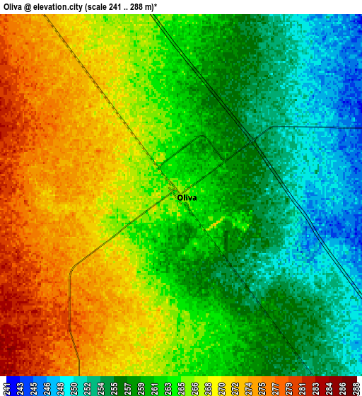
Below is the Elevation map of Oliva, which displays elevation range with different colors. Scale of the first map is from 249 to 278 m (817 to 912 ft) with average elevation of 262.5 meters (=861 ft) [note 1]
These maps also provides idea of topography and contour of this city, they are displayed at different zoom levels. More info about maps, scale and edge coordinates you can find below images.
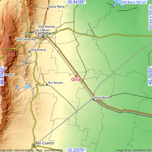
| \ | Map #1 | Map #2 | Topo.Map |
| Scale [m] | 249..278 m | 241..288 m | × |
| Scale [ft] | 817..912 ft | 791..945 ft | × |
| Average | 262.5 m = 861 ft | 263.1 m = 863 ft | × |
| Width | 8.28 km = 5.1 mi | 16.57 km = 10.3 mi | 265.1 km = 164.7 mi |
| Height | 8.28 km = 5.1 mi | 16.57 km = 10.3 mi | 265.1 km = 164.7 mi |
| ↑Max Latitude | -32.004322° | -31.967048° | -30.84185° |
| Latitude at center | -32.04158° | -32.04158° | -32.04158° |
| ↓Min Latitude | -32.078823° | -32.116051° | -33.22579° |
| ← Min Longitude | -63.613725° | -63.657671° | -64.97603° |
| Longitude center | -63.56978° | -63.56978° | -63.56978° |
| →Max Longitude | -63.525835° | -63.481889° | -62.16353° |
Nearby cities:
Cities around Oliva sort by population:
• Oncativo elevation 283 m
17.7 km,  323°
323°
• Pilar 334 m
49.8 km, 324°
• Hernando 279 m
45.5 km,  199°
199°
• Laguna Larga 308 m
36.7 km, 323°
• Tancacha 354 m
44.7 km,  239°
239°
• James Craik 246 m
16.5 km,  143°
143°
• Tío Pujio 226 m
34 km, 143°
• La Playosa 175 m
51.2 km,  97°
97°
• Villa Ascasubi 337 m
33.2 km,  245°
245°
• Las Junturas 238 m
26 km,  25°
25°
• Carrilobo 185 m
46.6 km,  66°
66°
• Costa Sacate 308 m
47.3 km,  337°
337°
Multilingual:
 En español:
Oliva elevación 267 m.
 En France:
Oliva élévation 267 m.


Sources and notes:
- [note 1] Map square and city borders are not equal. Map elevation data is calculated only from area inside that square.
- [src 1] Elevation data from geonames database provided with same terms of usage.
- [src 2] The elevation map of Oliva is generated using elevation data from NASA's 3 arcsec (90m) resolution SRTM data.
- [src 3] Base (background) map © OpenStreetMap contributors tiles are generated by Geofabrik and OpenTopoMap.
Copyright & License:
This Oliva Elevation Map is licensed under CC BY-SA. You may reuse any part from this page, if you give a proper credit by linking to this URL:
 More info on terms of use page.