Tancacha elevation
Tancacha (Cordoba, Departamento de Tercero Arriba), Argentina elevation is 354 meters and Tancacha elevation in feet is 1161 ft above sea level [src 1]. Tancacha is a populated place (feature code) with elevation that is 4 meters (13 ft) bigger than average city elevation in Argentina.
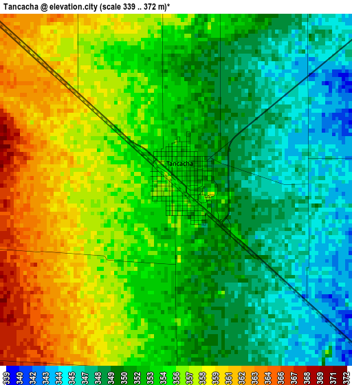
Below is the Elevation map of Tancacha, which displays elevation range with different colors. Scale of the first map is from 339 to 372 m (1112 to 1220 ft) with average elevation of 353.3 meters (=1159 ft) [note 1]
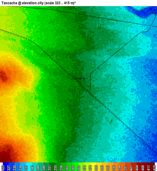
These maps also provides idea of topography and contour of this city, they are displayed at different zoom levels. More info about maps, scale and edge coordinates you can find below images.
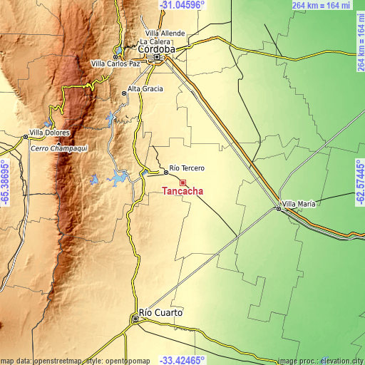
| \ | Map #1 | Map #2 | Topo.Map |
| Scale [m] | 339..372 m | 323..415 m | × |
| Scale [ft] | 1112..1220 ft | 1060..1362 ft | × |
| Average | 353.3 m = 1159 ft | 355.2 m = 1165 ft | × |
| Width | 8.27 km = 5.1 mi | 16.53 km = 10.3 mi | 264.5 km = 164.4 mi |
| Height | 8.27 km = 5.1 mi | 16.53 km = 10.3 mi | 264.5 km = 164.4 mi |
| ↑Max Latitude | -32.205914° | -32.168722° | -31.04596° |
| Latitude at center | -32.24309° | -32.24309° | -32.24309° |
| ↓Min Latitude | -32.280251° | -32.317397° | -33.42465° |
| ← Min Longitude | -64.024645° | -64.068591° | -65.38695° |
| Longitude center | -63.9807° | -63.9807° | -63.9807° |
| →Max Longitude | -63.936755° | -63.892809° | -62.57445° |
Nearby cities:
Cities around Tancacha sort by population:
• Río Tercero elevation 387 m
14.8 km,  301°
301°
• Embalse 561 m
41.7 km,  279°
279°
• Oncativo 283 m
46.2 km,  37°
37°
• Oliva 267 m
44.7 km,  59°
59°
• Almafuerte 430 m
26.5 km, 282°
• Hernando 279 m
30.9 km,  131°
131°
• Berrotarán 631 m
44.8 km,  238°
238°
• Villa del Dique 546 m
45.3 km, 279°
• Los Cóndores 542 m
29.2 km,  252°
252°
• Villa Ascasubi 337 m
12.2 km, 43°
• Villa Rumipal 546 m
47.4 km, 277°
• Corralito 473 m
31.4 km,  320°
320°
Multilingual:
 En español:
Tancacha elevación 354 m.
 En France:
Tancacha élévation 354 m.
 Auf Deutsch:
Tancacha höhe über dem Meeresspiegel ist 354 m.

Sources and notes:
- [note 1] Map square and city borders are not equal. Map elevation data is calculated only from area inside that square.
- [src 1] Elevation data from geonames database provided with same terms of usage.
- [src 2] The elevation map of Tancacha is generated using elevation data from NASA's 3 arcsec (90m) resolution SRTM data.
- [src 3] Base (background) map © OpenStreetMap contributors tiles are generated by Geofabrik and OpenTopoMap.
Copyright & License:
This Tancacha Elevation Map is licensed under CC BY-SA. You may reuse any part from this page, if you give a proper credit by linking to this URL:
 More info on terms of use page.