Simoca elevation
Simoca (Tucuman, Departamento de Simoca), Argentina elevation is 325 meters and Simoca elevation in feet is 1066 ft above sea level [src 1]. Simoca is a seat of a second-order administrative division (feature code) with elevation that is 25 meters (82 ft) smaller than average city elevation in Argentina.
Below is the Elevation map of Simoca, which displays elevation range with different colors. Scale of the first map is from 313 to 339 m (1027 to 1112 ft) with average elevation of 324.7 meters (=1065 ft) [note 1]
These maps also provides idea of topography and contour of this city, they are displayed at different zoom levels. More info about maps, scale and edge coordinates you can find below images.
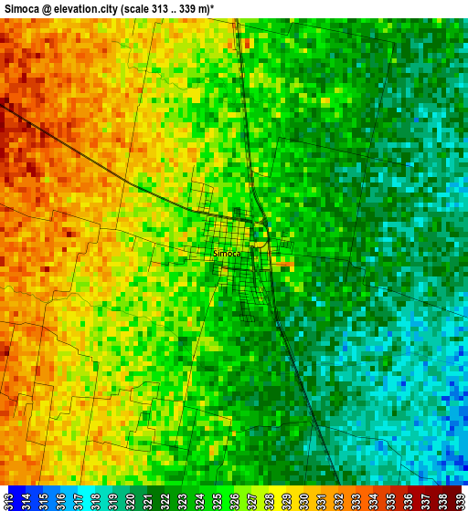
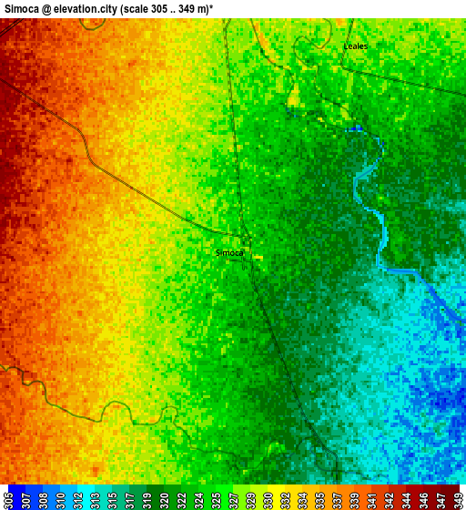
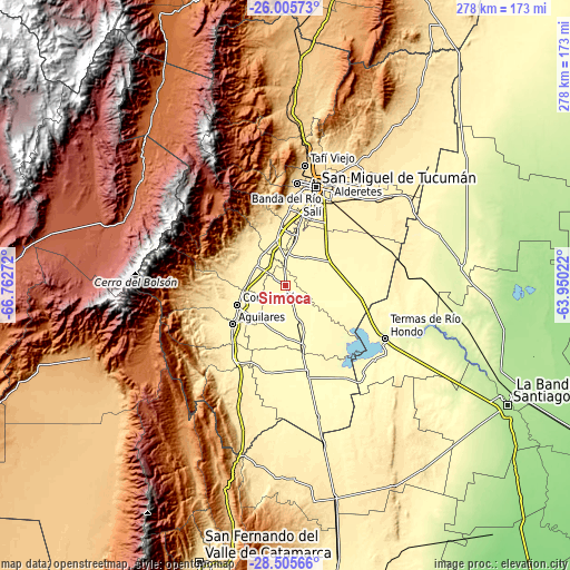
| \ | Map #1 | Map #2 | Topo.Map |
| Scale [m] | 313..339 m | 305..349 m | × |
| Scale [ft] | 1027..1112 ft | 1001..1145 ft | × |
| Average | 324.7 m = 1065 ft | 326.6 m = 1072 ft | × |
| Width | 8.69 km = 5.4 mi | 17.37 km = 10.8 mi | 278 km = 172.7 mi |
| Height | 8.69 km = 5.4 mi | 17.37 km = 10.8 mi | 278 km = 172.7 mi |
| ↑Max Latitude | -27.223649° | -27.184565° | -26.00573° |
| Latitude at center | -27.26272° | -27.26272° | -27.26272° |
| ↓Min Latitude | -27.301777° | -27.34082° | -28.50566° |
| ← Min Longitude | -65.400415° | -65.444361° | -66.76272° |
| Longitude center | -65.35647° | -65.35647° | -65.35647° |
| →Max Longitude | -65.312525° | -65.268579° | -63.95022° |
Nearby cities:
Cities around Simoca sort by population:
• San Miguel de Tucumán elevation 452 m
50.5 km,  15°
15°
• Yerba Buena 515 m
49.8 km,  4°
4°
• Alderetes 454 m
54.3 km, 24°
• Aguilares 375 m
31.8 km,  233°
233°
• Famaillá 368 m
23.7 km,  348°
348°
• Termas de Río Hondo 260 m
55.4 km,  117°
117°
• Monteros 360 m
17.6 km,  307°
307°
• Bella Vista 366 m
26 km,  11°
11°
• Graneros 326 m
43.7 km,  190°
190°
• Banda del Río Salí 431 m
51.3 km, 21°
• San Isidro de Lules 418 m
37.3 km, 2°
• Concepción 374 m
25.3 km,  249°
249°
Multilingual:
 En español:
Simoca elevación 325 m.
 En France:
Simoca élévation 325 m.


Sources and notes:
- [note 1] Map square and city borders are not equal. Map elevation data is calculated only from area inside that square.
- [src 1] Elevation data from geonames database provided with same terms of usage.
- [src 2] The elevation map of Simoca is generated using elevation data from NASA's 3 arcsec (90m) resolution SRTM data.
- [src 3] Base (background) map © OpenStreetMap contributors tiles are generated by Geofabrik and OpenTopoMap.
Copyright & License:
This Simoca Elevation Map is licensed under CC BY-SA. You may reuse any part from this page, if you give a proper credit by linking to this URL:
 More info on terms of use page.