Sumampa elevation
Sumampa (Santiago del Estero, Departamento de Quebrachos), Argentina elevation is 243 meters and Sumampa elevation in feet is 797 ft above sea level [src 1]. Sumampa is a seat of a second-order administrative division (feature code) with elevation that is 107 meters (351 ft) smaller than average city elevation in Argentina.
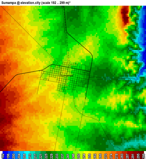
Below is the Elevation map of Sumampa, which displays elevation range with different colors. Scale of the first map is from 192 to 299 m (630 to 981 ft) with average elevation of 248.7 meters (=816 ft) [note 1]
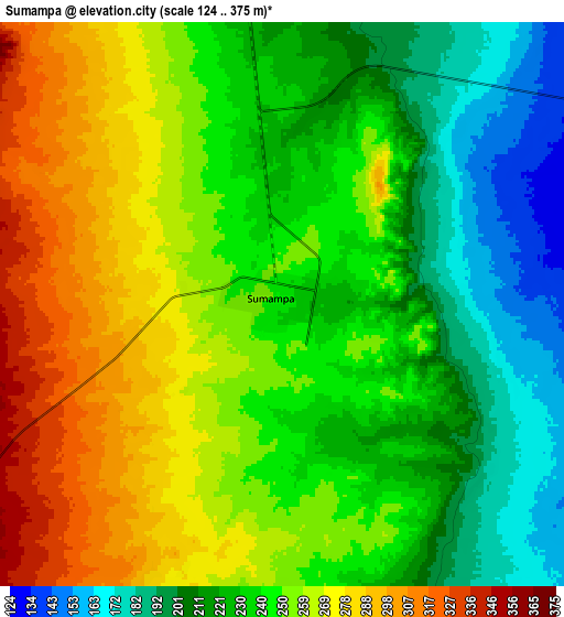
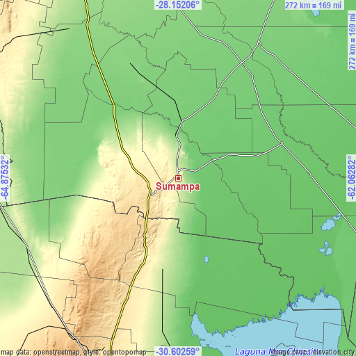
These maps also provides idea of topography and contour of this city, they are displayed at different zoom levels. More info about maps, scale and edge coordinates you can find below images.
| \ | Map #1 | Map #2 | Topo.Map |
| Scale [m] | 192..299 m | 124..375 m | × |
| Scale [ft] | 630..981 ft | 407..1230 ft | × |
| Average | 248.7 m = 816 ft | 243.6 m = 799 ft | × |
| Width | 8.52 km = 5.3 mi | 17.03 km = 10.6 mi | 272.5 km = 169.3 mi |
| Height | 8.52 km = 5.3 mi | 17.03 km = 10.6 mi | 272.5 km = 169.3 mi |
| ↑Max Latitude | -29.346401° | -29.308088° | -28.15206° |
| Latitude at center | -29.3847° | -29.3847° | -29.3847° |
| ↓Min Latitude | -29.422984° | -29.461254° | -30.60259° |
| ← Min Longitude | -63.513015° | -63.556961° | -64.87532° |
| Longitude center | -63.46907° | -63.46907° | -63.46907° |
| →Max Longitude | -63.425125° | -63.381179° | -62.06282° |
Nearby cities:
Cities around Sumampa sort by population:
• Añatuya elevation 111 m
119.9 km,  30°
30°
• Villa Ojo de Agua 531 m
25.3 km,  239°
239°
• Villa General Mitre 90 m
83.6 km,  71°
71°
• San José de la Dormida 468 m
117.3 km,  203°
203°
• Villa Atamisqui 124 m
104.4 km,  341°
341°
• Colonia Dora 107 m
100.8 km, 30°
• San Francisco del Chañar 681 m
64.2 km,  225°
225°
• Sebastián Elcano 211 m
87.2 km,  187°
187°
• Los Telares 107 m
44.5 km,  2°
2°
• Herrera 111 m
107.8 km,  21°
21°
• Villa Unión 87 m
66 km,  92°
92°
• Villa de María 347 m
62.5 km, 203°
Multilingual:
 En español:
Sumampa elevación 243 m.
 En France:
Sumampa élévation 243 m.


Sources and notes:
- [note 1] Map square and city borders are not equal. Map elevation data is calculated only from area inside that square.
- [src 1] Elevation data from geonames database provided with same terms of usage.
- [src 2] The elevation map of Sumampa is generated using elevation data from NASA's 3 arcsec (90m) resolution SRTM data.
- [src 3] Base (background) map © OpenStreetMap contributors tiles are generated by Geofabrik and OpenTopoMap.
Copyright & License:
This Sumampa Elevation Map is licensed under CC BY-SA. You may reuse any part from this page, if you give a proper credit by linking to this URL:
 More info on terms of use page.